
MyTopo
Classic USGS Fort Hall Idaho 7.5'x7.5' Topo Map
Couldn't load pickup availability
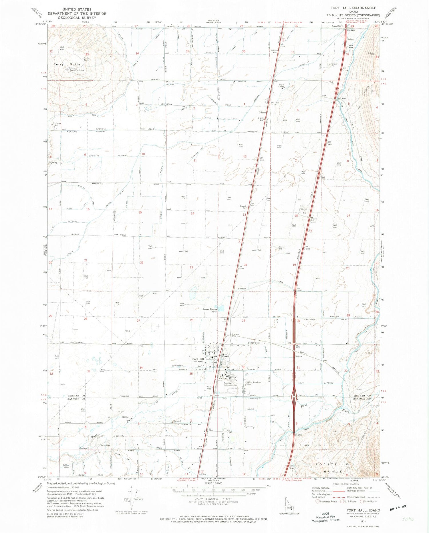
Historical USGS topographic quad map of Fort Hall in the state of Idaho. Map scale may vary for some years, but is generally around 1:24,000. Print size is approximately 24" x 27"
This quadrangle is in the following counties: Bannock, Bingham.
The map contains contour lines, roads, rivers, towns, and lakes. Printed on high-quality waterproof paper with UV fade-resistant inks, and shipped rolled.
Contains the following named places: Agency Lateral, Bell Lateral, Buffalo Lodge, Calico Lateral, Eagle Lodge, Early Lateral, Echo Lateral, Edge Lateral, Egg Lateral, Eldridge Lateral, Elite Lateral, Enders Lateral, Engdahl Lateral, English Lateral, Evans Lateral, Express Lateral, Ferry Butte, Fort Hall, Fort Hall Census Designated Place, Fort Hall Elementary School, Fort Hall Fire and Emergency Medical Services District, Fort Hall Indian Agency, Fort Hall Main Canal, Fred Lateral, Fremont Lateral, Gibson, Gibson Canal, Golden Lateral, Good Shepherd Cemetery, Hay Lateral, Jones Lateral, Lindian Lateral, Marlow Lateral, Nadine Lateral, Nazarre Lateral, Neon Lateral, Neptune Lateral, New Lateral, Newell Lateral, Nola Lateral, Nora Lateral, Palm Lateral, Parker Lateral, Pine Lateral, Plum Lateral, Pole Lateral, Ponzo Lateral, Poplar Lateral, Ross Fork Wasteway, School Lateral, Teak Lateral, Town Lateral, Townsend Lateral, Township Lateral, Trego Lateral, Turner Lateral, ZIP Code: 83203


