MyTopo
Classic USGS Fort Irwin California 7.5'x7.5' Topo Map
Couldn't load pickup availability
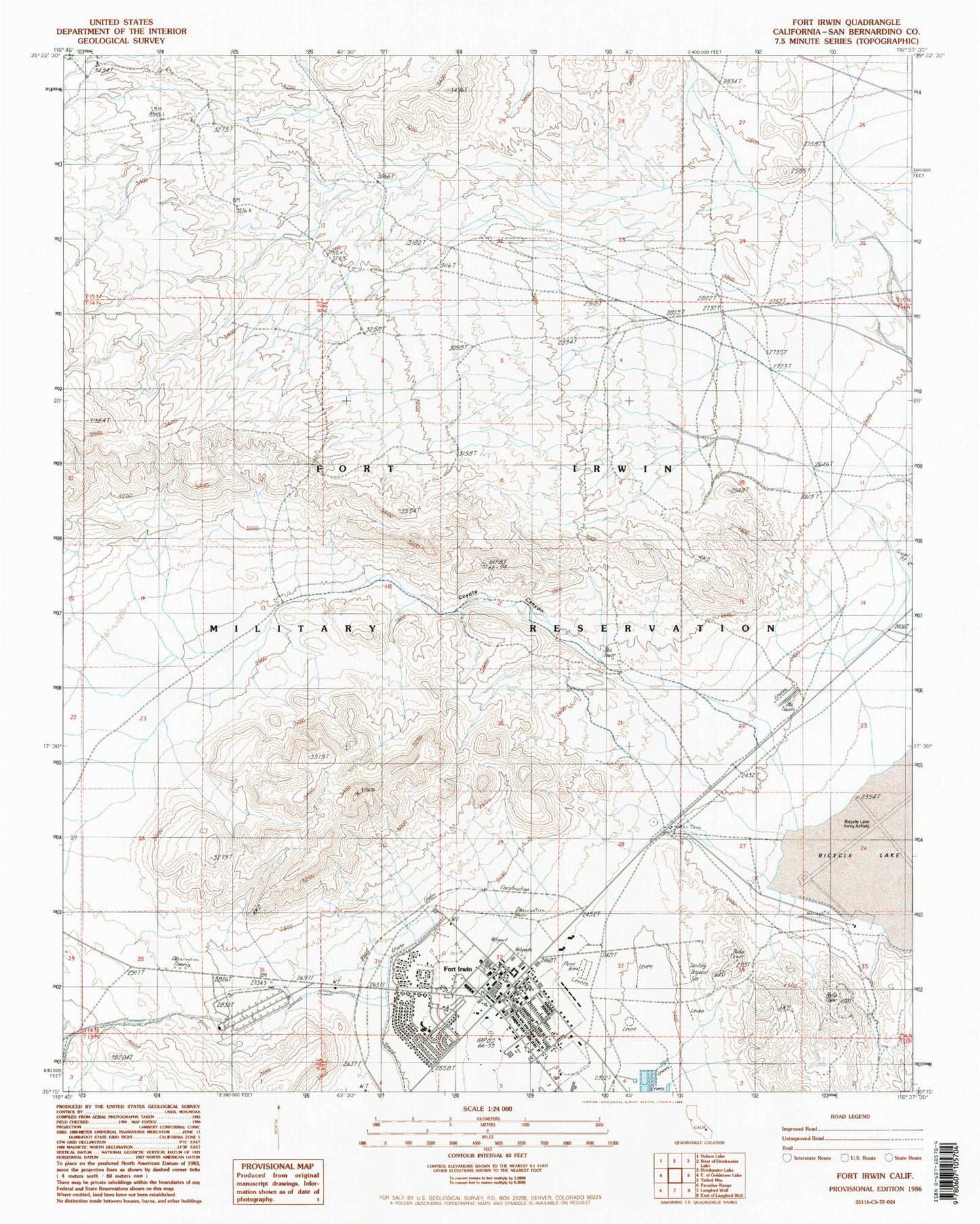
Historical USGS topographic quad map of Fort Irwin in the state of California. Typical map scale is 1:24,000, but may vary for certain years, if available. Print size: 24" x 27"
This quadrangle is in the following counties: San Bernardino.
The map contains contour lines, roads, rivers, towns, and lakes. Printed on high-quality waterproof paper with UV fade-resistant inks, and shipped rolled.
Contains the following named places: Bicycle Lake, Bicycle Lake Army Airfield, Coyote Canyon, Fort Irwin, Fort Irwin Elementary School, Fort Irwin Middle School, Fort Irwin Post Library, Jackass Park, Weed Army Community Hospital, Weed Army Community Hospital Medical Library, Fort Irwin Fire Department Station 412, Fort Irwin Fire Department Station 411, Fort Irwin Post Office