MyTopo
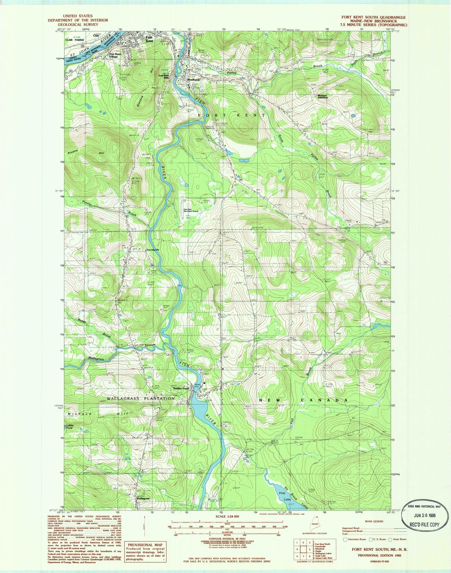
Classic USGS Fort Kent South Maine 7.5'x7.5' Topo Map
Couldn't load pickup availability
Historical USGS topographic quad map of Fort Kent South in the state of Maine. Typical map scale is 1:24,000, but may vary for certain years, if available. Print size: 24" x 27"
This quadrangle is in the following counties: Aroostook.
The map contains contour lines, roads, rivers, towns, and lakes. Printed on high-quality waterproof paper with UV fade-resistant inks, and shipped rolled.
Contains the following named places: Baxter School, Bradburys, Buggy Brook, Coolidge School, Dumond School, Fall Brook, First Lake, Fish River Falls, Fort Kent Mills, Fort Kent Pit, Fort Kent Village, Harding School, Labby, Lincoln School, Michaud Siding, Michaud Hill, Michigan School, North Branch Perley Brook, North Perley Brook School, Perley Brook, Pinette Brook, Pinette Hill, Roosevelt School, Saint Euzebe School, Saint George School, Saint Johns School, Shakespere School, Soldier Pond, South Perley Brook, Stevens Hill, Wallagrass, Wallagrass Stream, Washington School, Wilson School, Wilson School, Michigan Settlement, Plourde Mill, WLVC-AM (Fort Kent), Town of Fort Kent, Town of New Canada, Acadian Archives, Christ Congregational Church, Fort Kent Community High School, Fort Kent Elementary School, Fort Kent Mills Post Office, Fort Kent Municipal Airport (historical), Fort Kent Post Office (historical), International Bridge, Saint Josephs Church, Soldier Pond Post Office, Wallagrass Elementary School, Christ Church Congregational Cemetery, Saint Josephs the Helper Cemetery, Saint Josephs Cemetery, Fort Kent Police Department, Valley Rivers Middle School, Wallagrass Post Office, Fort Kent Post Office