MyTopo
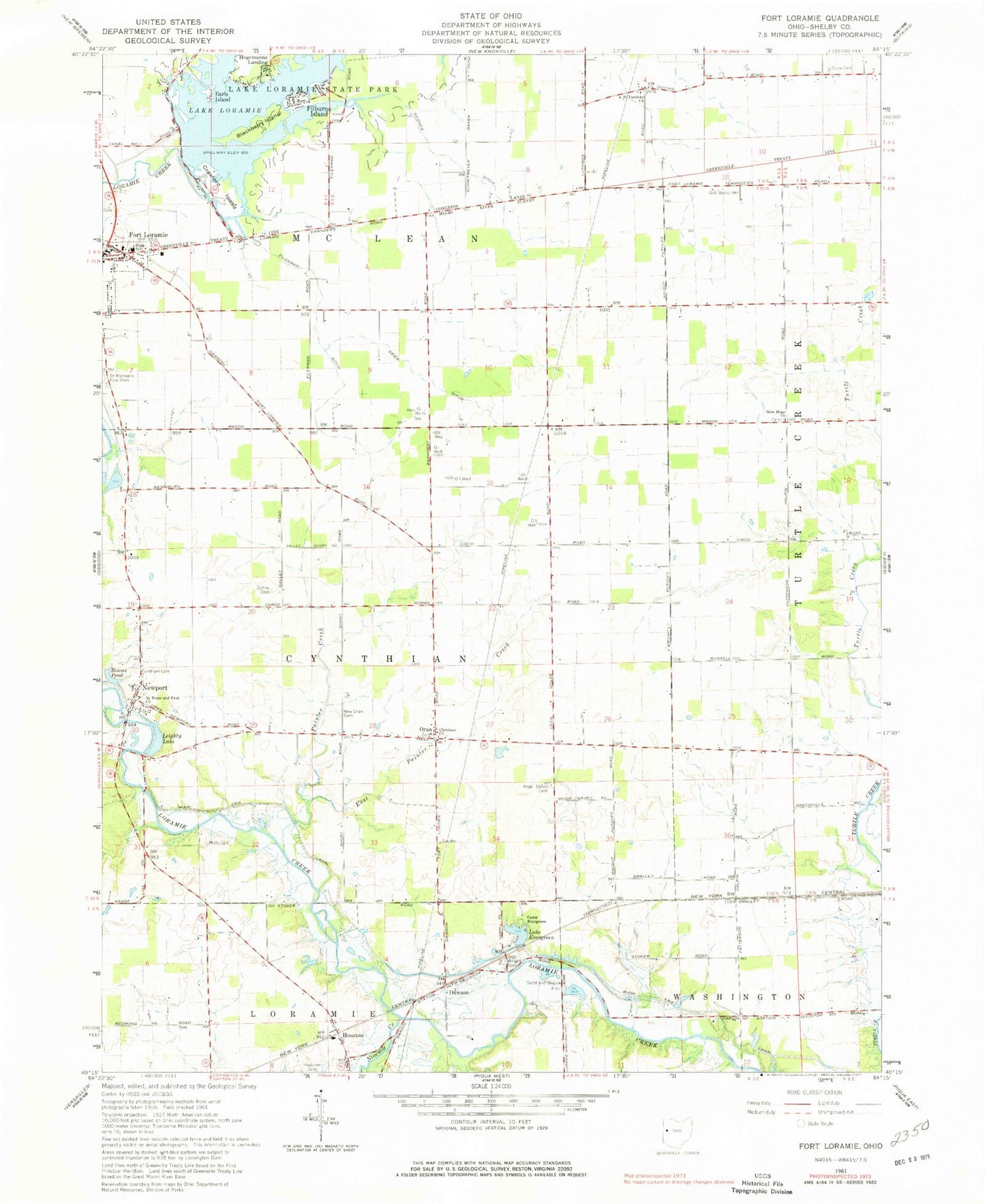
Classic USGS Fort Loramie Ohio 7.5'x7.5' Topo Map
Couldn't load pickup availability
Historical USGS topographic quad map of Fort Loramie in the state of Ohio. Map scale may vary for some years, but is generally around 1:24,000. Print size is approximately 24" x 27"
This quadrangle is in the following counties: Shelby.
The map contains contour lines, roads, rivers, towns, and lakes. Printed on high-quality waterproof paper with UV fade-resistant inks, and shipped rolled.
Contains the following named places: Angel Street Cemetery, Big Run School, Blackberry Island, Bunker Hill School, Camp Evergreen, Crawford Island, Cuba Cemetery, Cynthian Cemetery, Dawson, Dawson Post Office, Earls Island, East Painter Creek, Eilerman Ditch, Ernst Swine Farm, Filburns Island, Forest School, Fort Loramie, Fort Loramie Fire Department, Fort Loramie High School, Fort Loramie Post Office, Fort Loramie Rescue Squad, Furrow Cemetery, Gaier Ditch, Galley Cemetery, Hegemanns Landing, Hopewell School, Houston, Houston Post Office, Lake Evergreen, Lake Loramie, Lake Loramie Dam, Lake Loramie State Park, Leighty Lake, Mills Cemetery, Mills School, New Hope Cemetery, New Hope Church, New Oran Cemetery, Newport, Newport Census Designated Place, Ninemile Creek, Old Saint Michaels Cemetery, Oran, Oran Christian Cemetery, Oran Christian Church, Oran Post Office, Painter Creek, Reams Pond, Saint Michael Cemetery, Saint Michaels Catholic Church, Saint Michaels New Cemetery, Saint Patrick, Saint Patrick Cemetery, Saint Patricks Church, Saint Patricks Post Office, Saint Peter and Paul Church, Saint Peter and Saint Paul Cemetery, Shorts School, Spirk Mobile Home Park, Township of Cynthian, Township of McLean, Union School, Uno, Uno Post Office, Village of Fort Loramie, Webner Ditch, Wright Cemetery