MyTopo
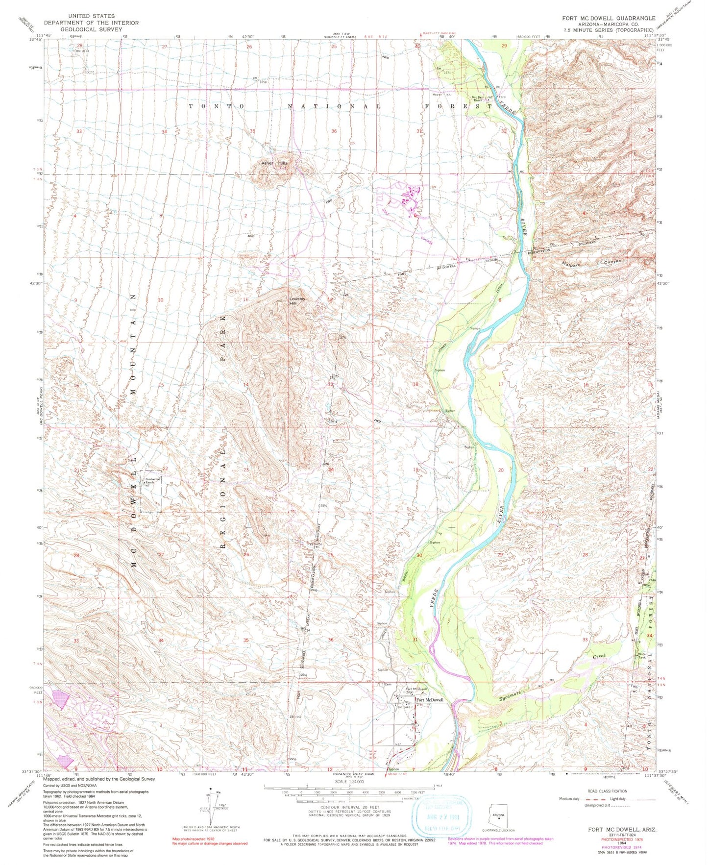
Classic USGS Fort McDowell Arizona 7.5'x7.5' Topo Map
Couldn't load pickup availability
Historical USGS topographic quad map of Fort McDowell in the state of Arizona. Map scale may vary for some years, but is generally around 1:24,000. Print size is approximately 24" x 27"
This quadrangle is in the following counties: Maricopa.
The map contains contour lines, roads, rivers, towns, and lakes. Printed on high-quality waterproof paper with UV fade-resistant inks, and shipped rolled.
Contains the following named places: Asher Hills, Box Bar Campground, Box Bar Ranch, Fort McDowell, Fort McDowell Indian Church, Fort McDowell Indian Community - Wassaja Memorial Health Center, Fort McDowell Yavapai Nation Reservation, Fort McDowell Yavapai Nation Tribal Library, Fountain Hills Dam Number Six, Fountain Hills Dam Number Thirty Six, Fountain Hills Middle School, Jones Ditch, Lousley Hill, Malpais Canyon, McDowell Mountain Regional Park, Pemberton Ranch, Rio Verde, Rio Verde Census Designated Place, Rio Verde Community Church, Rio Verde Country Club Golf Course, Rio Verde Estate, Rio Verde Estates, Rio Verde Memorial Gardens, Rio Verde Post Office - CPU, Sycamore Creek, The Fountains United Methodist Church, Tonto Verde Golf Club, Vista Verde Golf Course