MyTopo
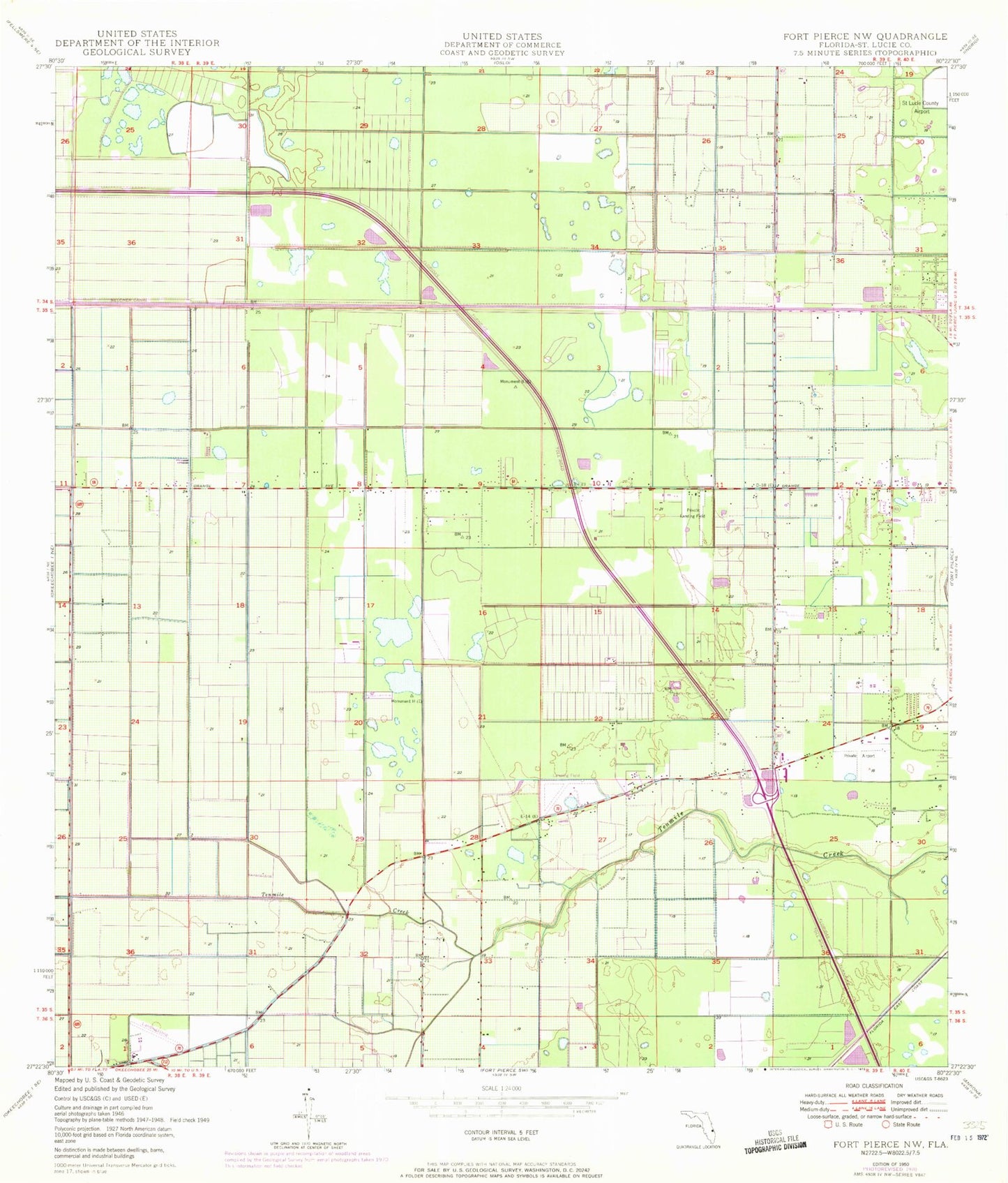
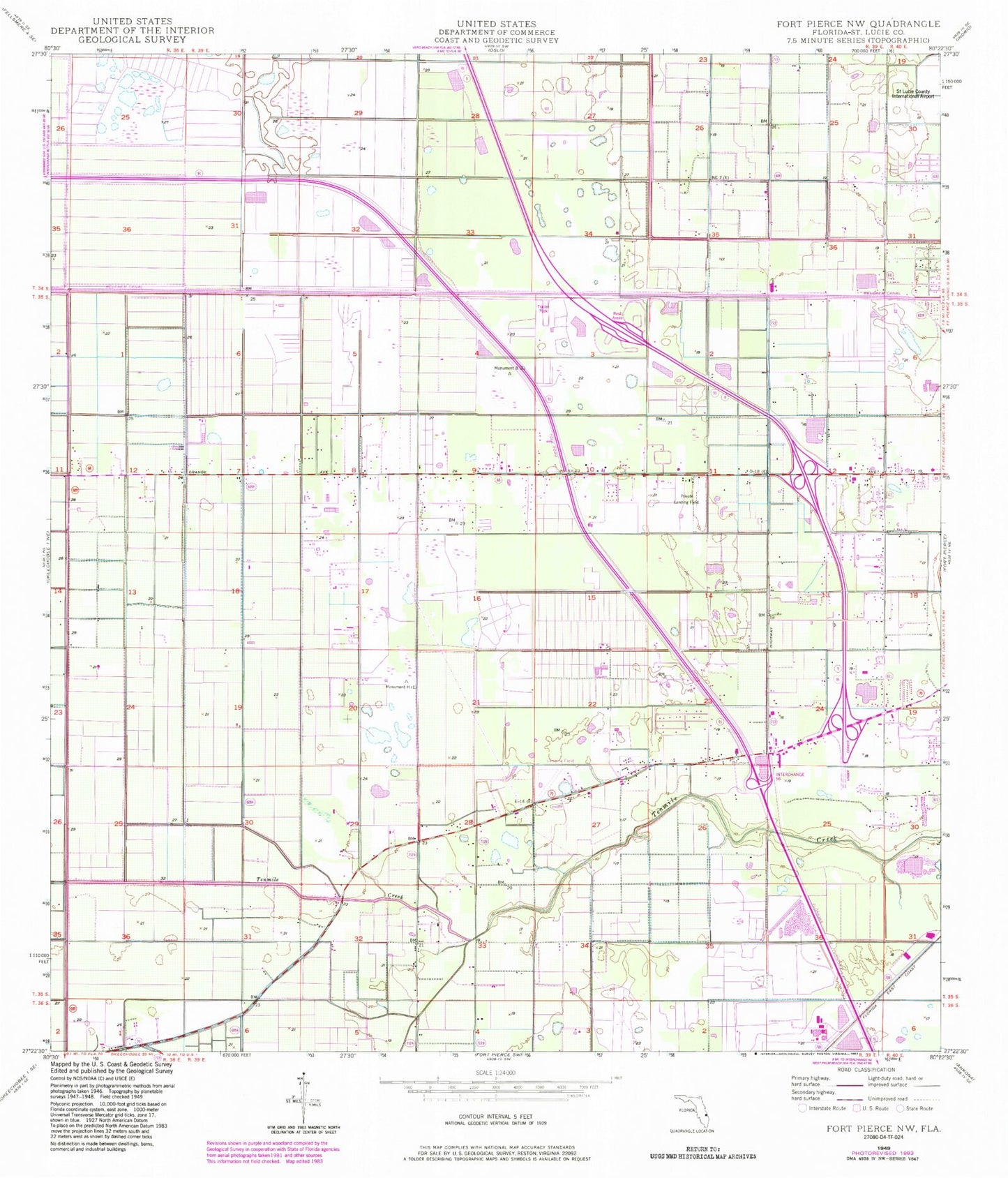
Classic USGS Fort Pierce NW Florida 7.5'x7.5' Topo Map
Couldn't load pickup availability
Historical USGS topographic quad map of Fort Pierce NW in the state of Florida. Map scale may vary for some years, but is generally around 1:24,000. Print size is approximately 24" x 27"
This quadrangle is in the following counties: St. Lucie.
The map contains contour lines, roads, rivers, towns, and lakes. Printed on high-quality waterproof paper with UV fade-resistant inks, and shipped rolled.
Contains the following named places: Baggett Airport, Belcher Canal, Clayton Howard Pond, Florida Club at Martin County, Fort Pierce Post Office, Fort Pierce Reservation, Fort Pierce Westwood High School, Golden Ponds Mobile Home Park, Orange Avenue Baptist Church, Saint Lucie County, Saint Lucie County Fire District Station 11, Saint Lucie County Jail, Seminole Police Department - Fort Pierce, Sunrise Shopping Center, Williams Hawgwild Airport, World on Fire Revivals, ZIP Code: 34981