
MyTopo
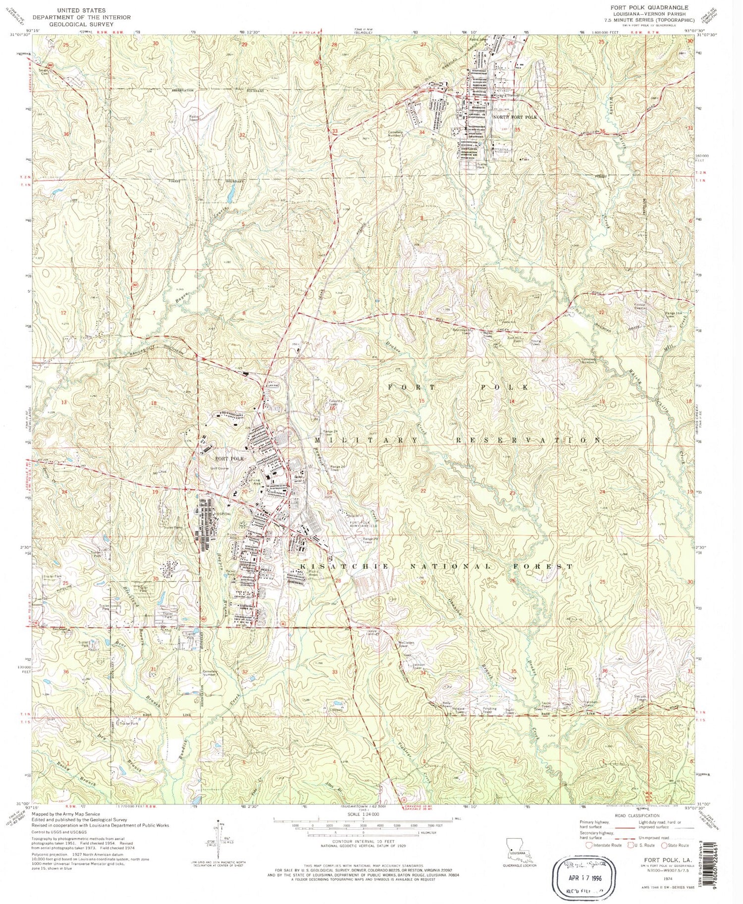
Classic USGS Fort Polk Louisiana 7.5'x7.5' Topo Map
Couldn't load pickup availability
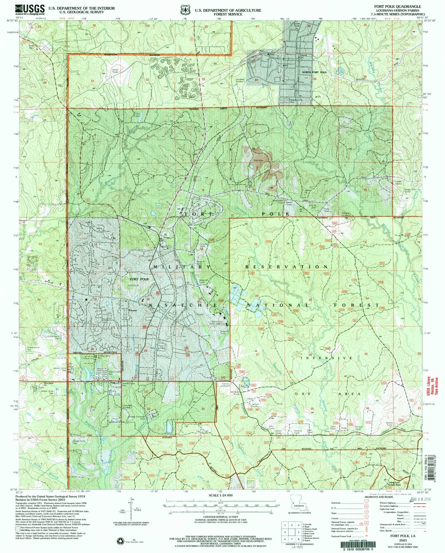
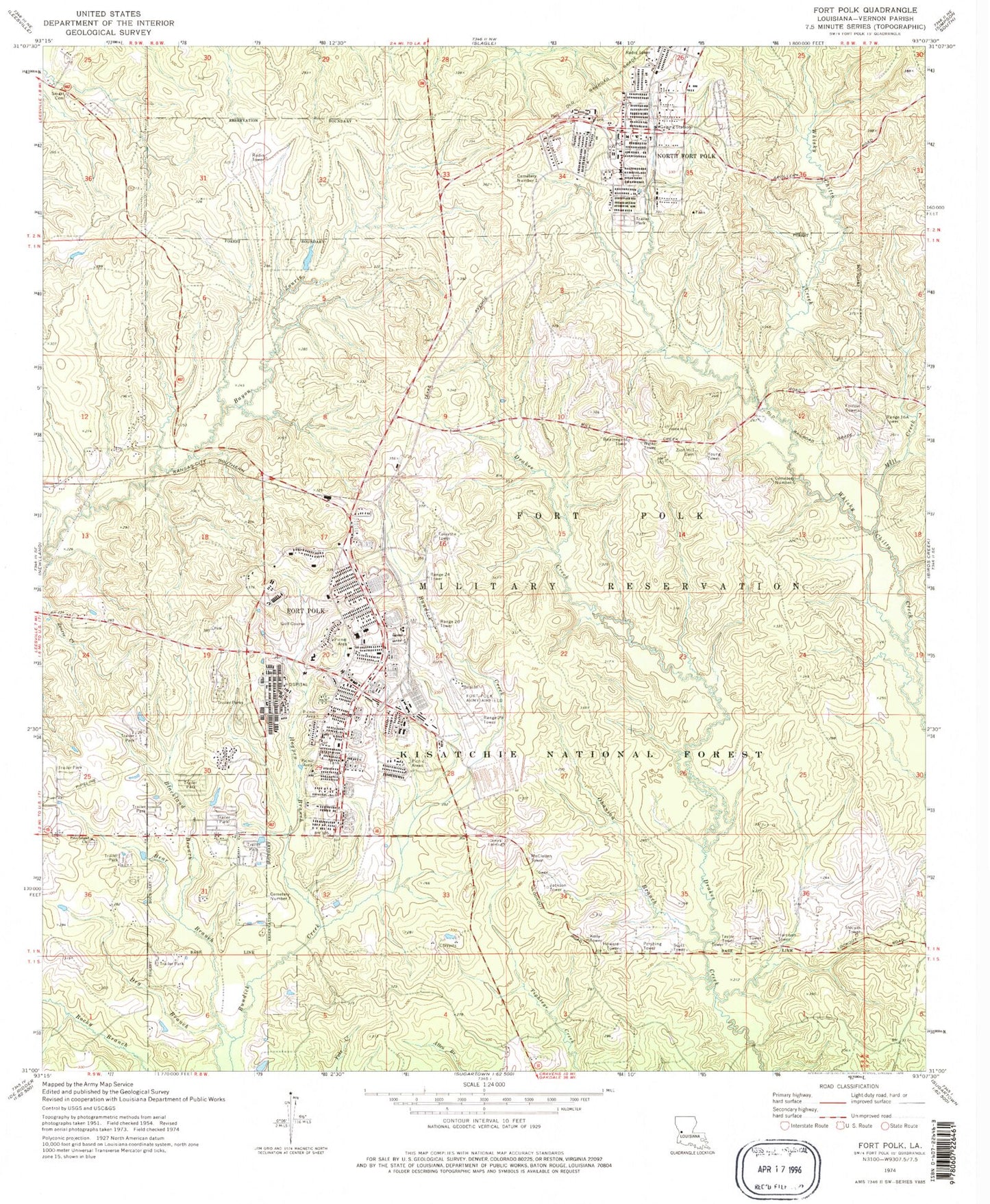
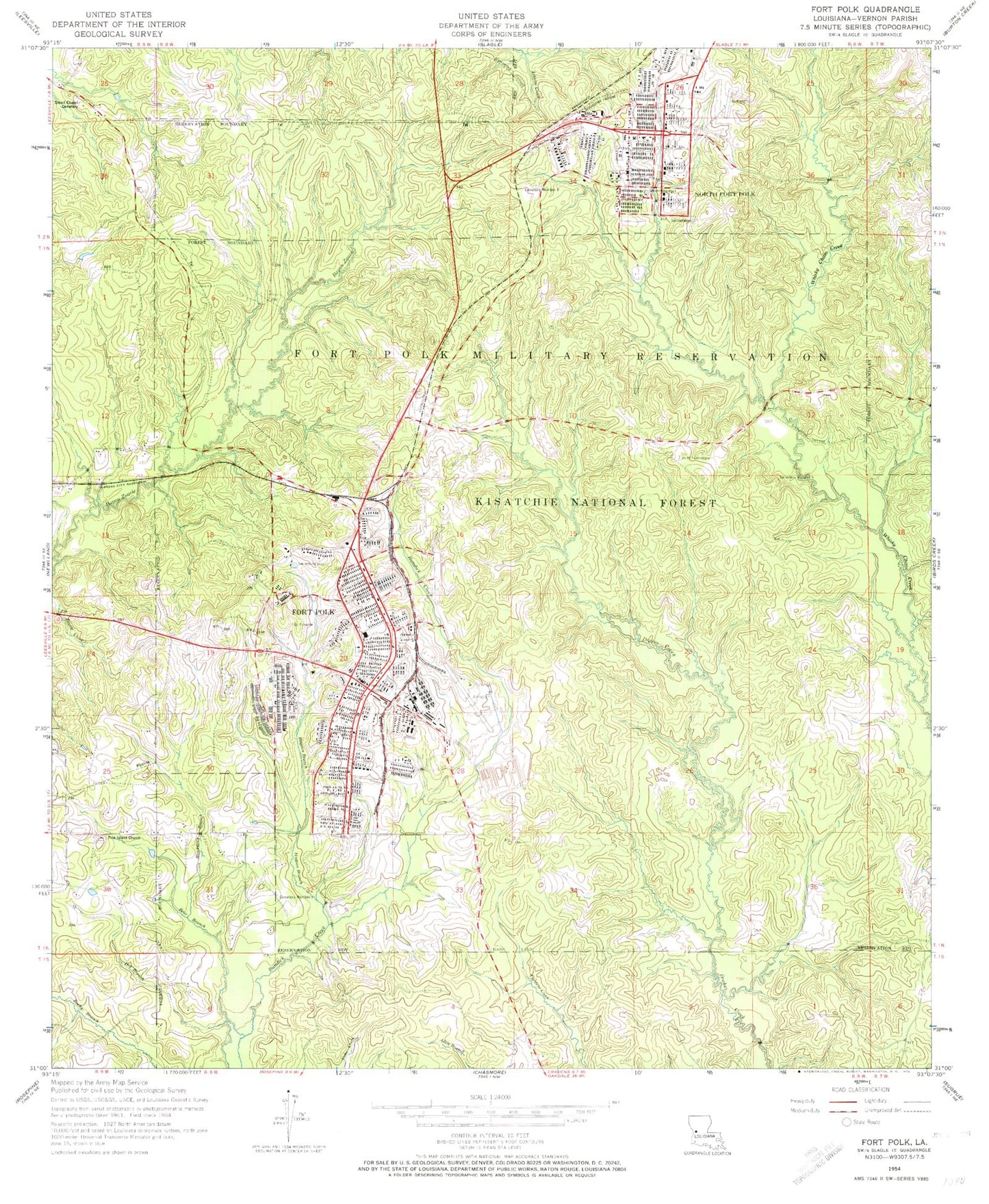
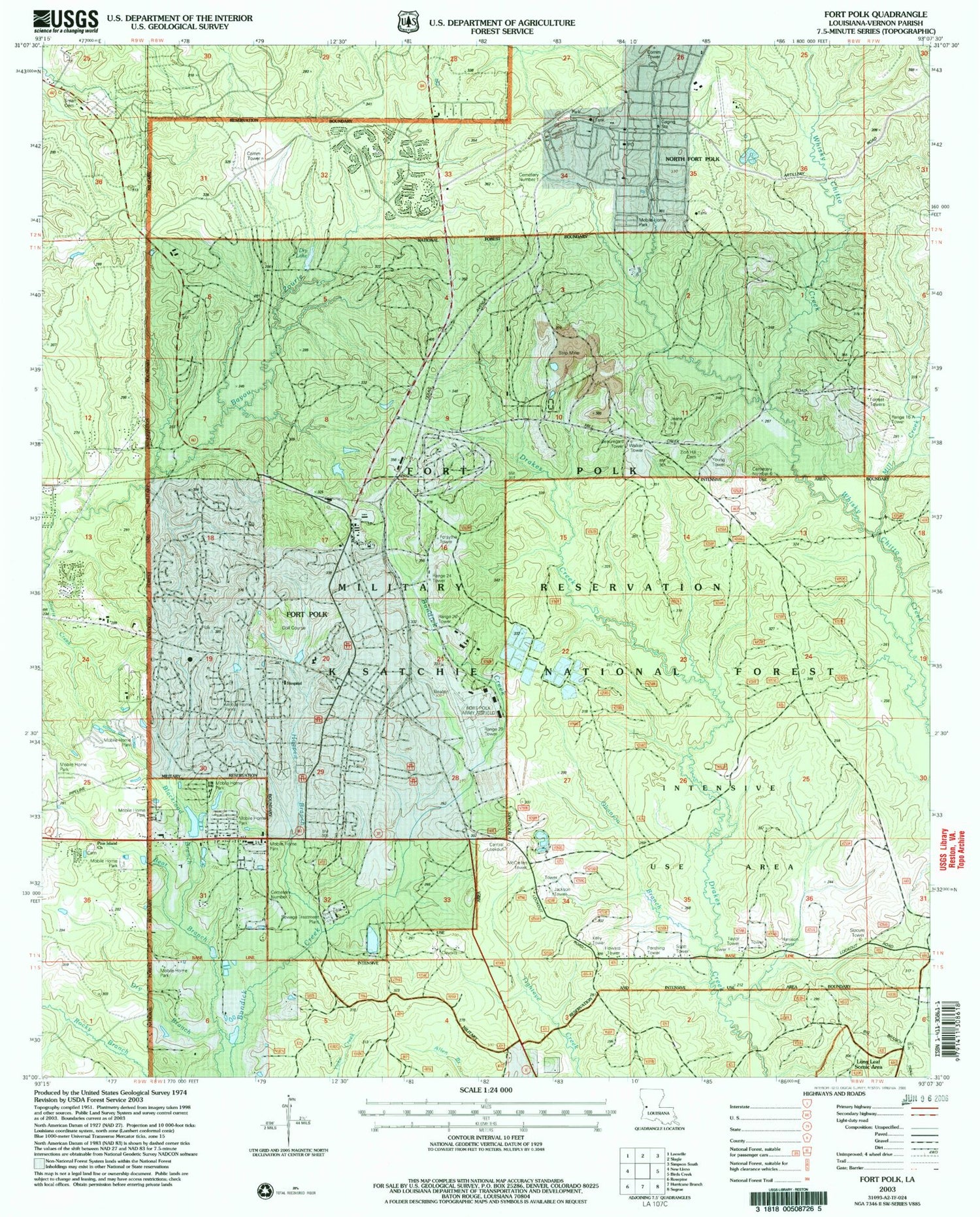
Historical USGS topographic quad map of Fort Polk in the state of Louisiana. Typical map scale is 1:24,000, but may vary for certain years, if available. Print size: 24" x 27"
This quadrangle is in the following counties: Vernon.
The map contains contour lines, roads, rivers, towns, and lakes. Printed on high-quality waterproof paper with UV fade-resistant inks, and shipped rolled.
Contains the following named places: Ward Four, Bear Branch, Beauregard Tower, Blackland Branch, Burns Cemetery, Davis Cemetery, Phillips - Sarver Cemetery, Dry Branch, Forrest Towers, Forsythe Tower, Harrison Tower, Hogpen Branch, Howard Tower, Jackson Tower, Kelly Tower, McClellen Tower, Mill Creek, Obanion Branch, Pershing Tower, Pine Island Church, Range 16A Tower, Range 24 Tower, Range 26 Tower, Range 29 Tower, Scott Tower, Slocum Tower, Taylor Tower, Walker Tower, Young Tower, Zion Hill Cemetery, Central Lookout, Fort Polk, Pry Lake, Bayne - Jones Army Community Hospital, Chesser Dental Clinic, Cummins Gym, Fort Polk Library, Fort Polk Military Museum, La Louisiane Recreation Center, Polk Elementary School, Sandy Hill, North Fort Polk, Smart Chapel Cemetery, Vernon Parish, Fort Polk Post Office, KCIJ-FM (North Fort Polk), Parish Governing Authority District 4, Fort Polk North Census Designated Place, Fort Polk South Census Designated Place, South Polk Elementary School, North Polk Elementary School, Sandy Hill Volunteer Fire Department Station 7, Polk Army Airfield, Central Louisiana Veterans Cemetery, Self Forward Landing Strip, Ward Four, Bear Branch, Beauregard Tower, Blackland Branch, Burns Cemetery, Davis Cemetery, Phillips - Sarver Cemetery, Dry Branch, Forrest Towers, Forsythe Tower, Harrison Tower, Hogpen Branch, Howard Tower, Jackson Tower, Kelly Tower, McClellen Tower, Mill Creek, Obanion Branch, Pershing Tower, Pine Island Church, Range 16A Tower, Range 24 Tower, Range 26 Tower, Range 29 Tower, Scott Tower, Slocum Tower, Taylor Tower, Walker Tower, Young Tower, Zion Hill Cemetery, Central Lookout, Fort Polk, Pry Lake, Bayne - Jones Army Community Hospital, Chesser Dental Clinic, Cummins Gym, Fort Polk Library, Fort Polk Military Museum, La Louisiane Recreation Center, Polk Elementary School, Sandy Hill, North Fort Polk, Smart Chapel Cemetery, Vernon Parish, Fort Polk Post Office, KCIJ-FM (North Fort Polk), Parish Governing Authority District 4, Fort Polk North Census Designated Place, Fort Polk South Census Designated Place, South Polk Elementary School, North Polk Elementary School, Sandy Hill Volunteer Fire Department Station 7, Polk Army Airfield, Central Louisiana Veterans Cemetery, Self Forward Landing Strip