MyTopo
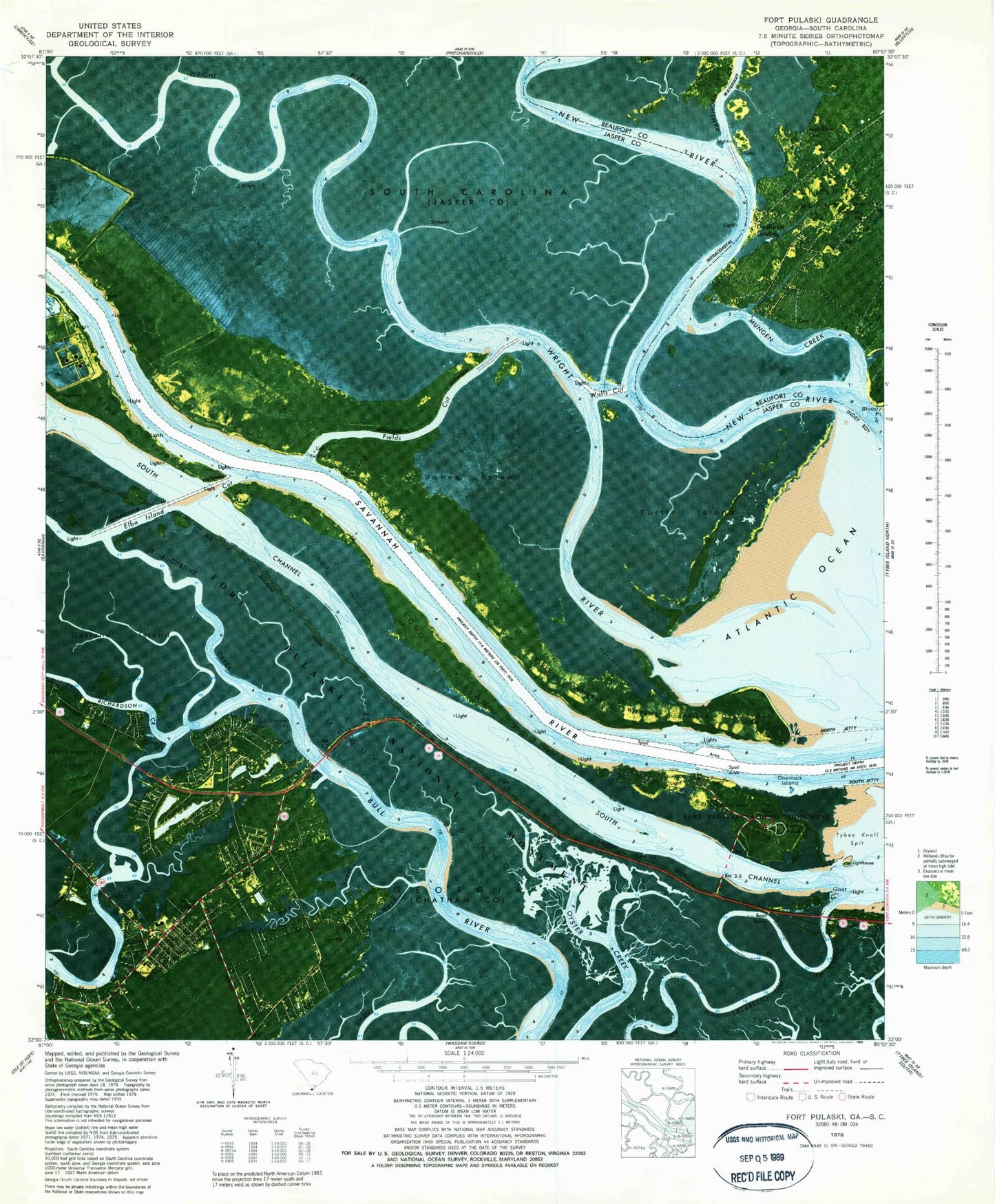
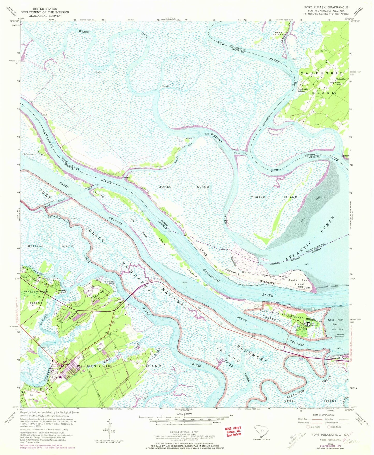
Classic USGS Fort Pulaski Georgia 7.5'x7.5' Topo Map
Couldn't load pickup availability
Historical USGS topographic quad map of Fort Pulaski in the states of Georgia, South Carolina. Map scale may vary for some years, but is generally around 1:24,000. Print size is approximately 24" x 27"
This quadrangle is in the following counties: Beaufort, Chatham, Jasper.
The map contains contour lines, roads, rivers, towns, and lakes. Printed on high-quality waterproof paper with UV fade-resistant inks, and shipped rolled.
Contains the following named places: Battery Horace Hambright, Battery Point, Betz Creek, Bird Island, Bloody Point, Bradley Flat, Camoos Creek, Cockspur Island, Cockspur Island Lighthouse, Cooks Cut, Daufuskie Landing, Daufuskie School, Daymark Island, Elba Island Cut, Fields Cut, Fort Pulaski National Monument, Goat Point, Golden Isles, Grace Church of the Islands, Harbor Creek, Hog Island, Hog Marsh, Hogans Marina, Horseshoe Shoal, Howard Elementary School, Islands Community Church, Islands First Baptist Church, Jones Island, Lazaretto Creek, Lee Shore Marina, LI Crossing, LI Crossing Range, Live Oak Public Library System Islands Branch, Long Island, Lower Flats Range, Lutheran Church of the Redeemer, Mary Field Cemetery, Mary Field School, McQueens Island, Mud Creek, Mungen Creek, Pine Island, Ramshorn Creek, River Oaks, Saint Andrews School, Saint Augustine Creek, Saint Francis of the Islands Church, Saint Peter the Apostle Catholic Church, Saint Peter the Apostle School, Screvens Point, Shad River, South Channel Savannah River, Southside Fire Department - Islands Division Station 4, Southside Fire Department Station 8, Spence Grayson Bridge, Talahi Island, Talahi Island Census Designated Place, The Islands Mall Shopping Center, Turner Creek, Turtle Island, Tybee National Wildlife Refuge, Union Church, Walls Cut, Wilmington Island, Wilmington Island Census Designated Place, Wilmington Island Church, Wilmington Island Golf Club, Wilmington Island Methodist Church, Wilmington Island Post Office, Wilmington Island Presbyterian Church, Woodridge Estates, Wright River, ZIP Code: 31410