MyTopo
Classic USGS Fort Rock Ranch Arizona 7.5'x7.5' Topo Map
Regular price
$16.95
Regular price
Sale price
$16.95
Unit price
per
Couldn't load pickup availability
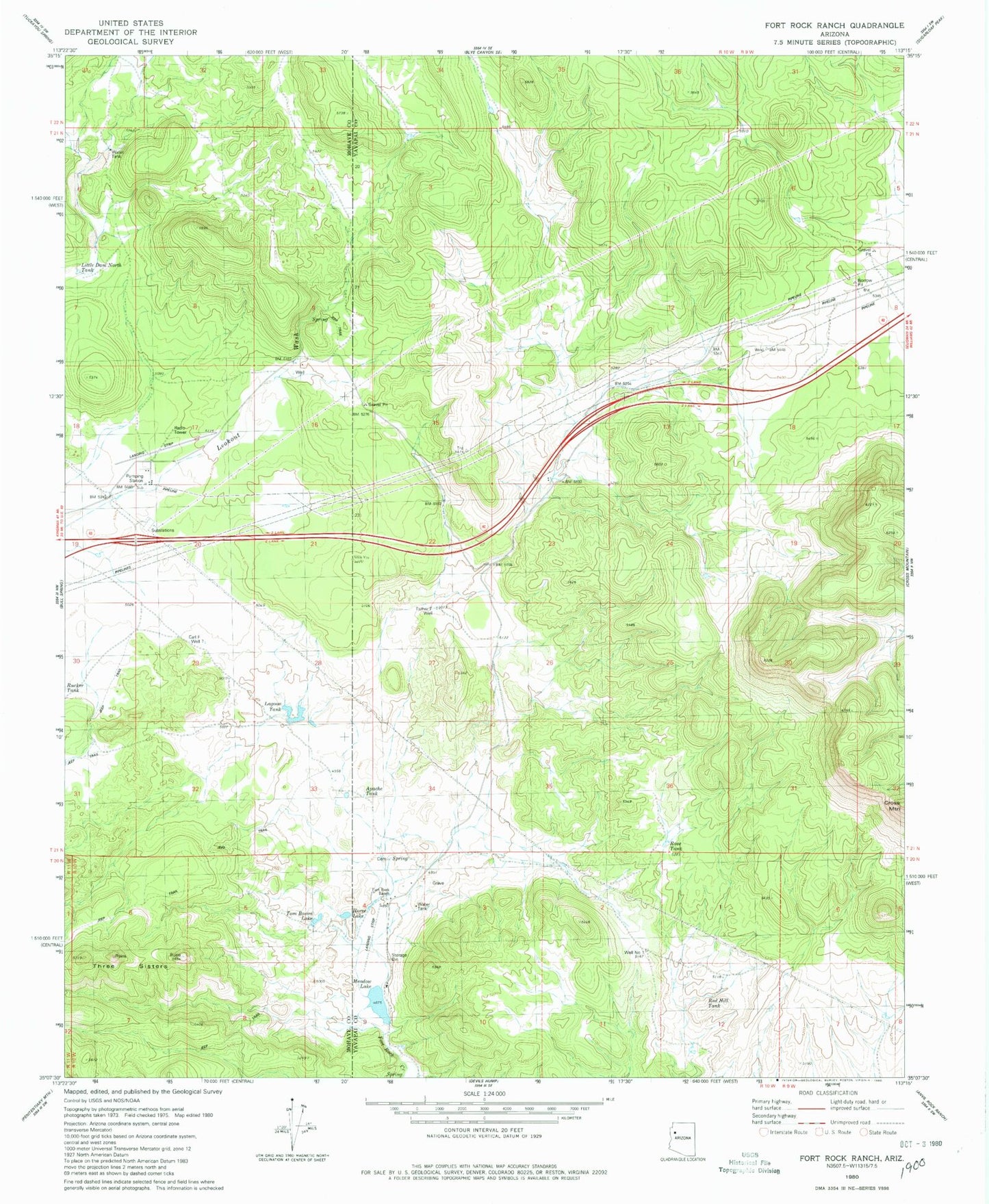
Historical USGS topographic quad map of Fort Rock Ranch in the state of Arizona. Map scale may vary for some years, but is generally around 1:24,000. Print size is approximately 24" x 27"
This quadrangle is in the following counties: Mohave, Yavapai.
The map contains contour lines, roads, rivers, towns, and lakes. Printed on high-quality waterproof paper with UV fade-resistant inks, and shipped rolled.
Contains the following named places: Apache Tank, Carl F Well, Dunton Ranch Airport, Esther F Well, Fort Rock Ranch, Horse Lake, Lagoon Tank, Little Dam North Tank, Meadow Lake, Red Hill Tank, Rose Tank, Three Sisters, Tom Bacon Lake, Well Number One