MyTopo
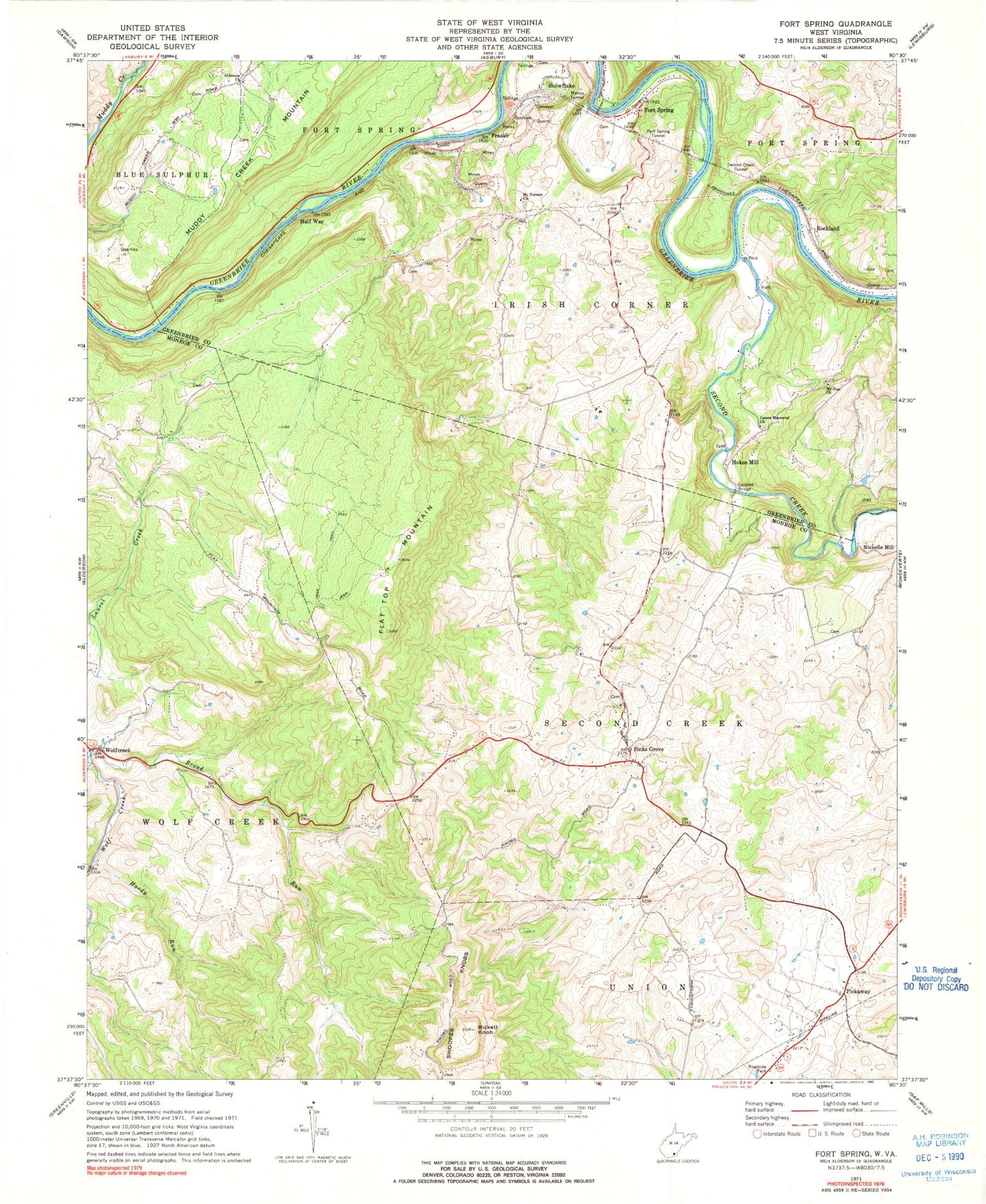
Classic USGS Fort Spring West Virginia 7.5'x7.5' Topo Map
Couldn't load pickup availability
Historical USGS topographic quad map of Fort Spring in the state of West Virginia. Typical map scale is 1:24,000, but may vary for certain years, if available. Print size: 24" x 27"
This quadrangle is in the following counties: Greenbrier, Monroe.
The map contains contour lines, roads, rivers, towns, and lakes. Printed on high-quality waterproof paper with UV fade-resistant inks, and shipped rolled.
Contains the following named places: Alderson Church, Bickett Knob, Broad Run, Flat Top Mountain, Fort Spring, Fort Spring Tunnel, Hardy Run, James Memorial Church, Manns Tunnel, Mount Vernon United Methodist Church, Mount Zion Church, Pickaway, Second Creek Tunnel, Sinks Grove, Swoopes Knobs, Frazier, Half Way, Second Creek, Hokes Mill, Nickells Mill, Rockland, Snowflake, Wolfcreek, Cherry Row School (historical), First Baptist Church, Mount Vernon School (historical), Perry School (historical), Hokes Mill Covered Bridge, Stephens Ferry (historical), Chestnut Grove School (historical), Ewing School (historical), Lady Hall School (historical), Patent School (historical), Spider Den School (historical), Sugar Tree School (historical), John Kirby Spring, Miller Spring, Rockland Spring, Harry Campbell Spring, Broad Run Baptist Church, Pickaway Methodist Church, Sinks Grove Baptist Church, Fort Spring Post Office, Sinks Grove Post Office, Wolfcreek Post Office, WKCJ-FM (Lewisburg), Scott Hollow, Lincoln Cemetery, Mount Vernon United Methodist Church Cemetery