MyTopo
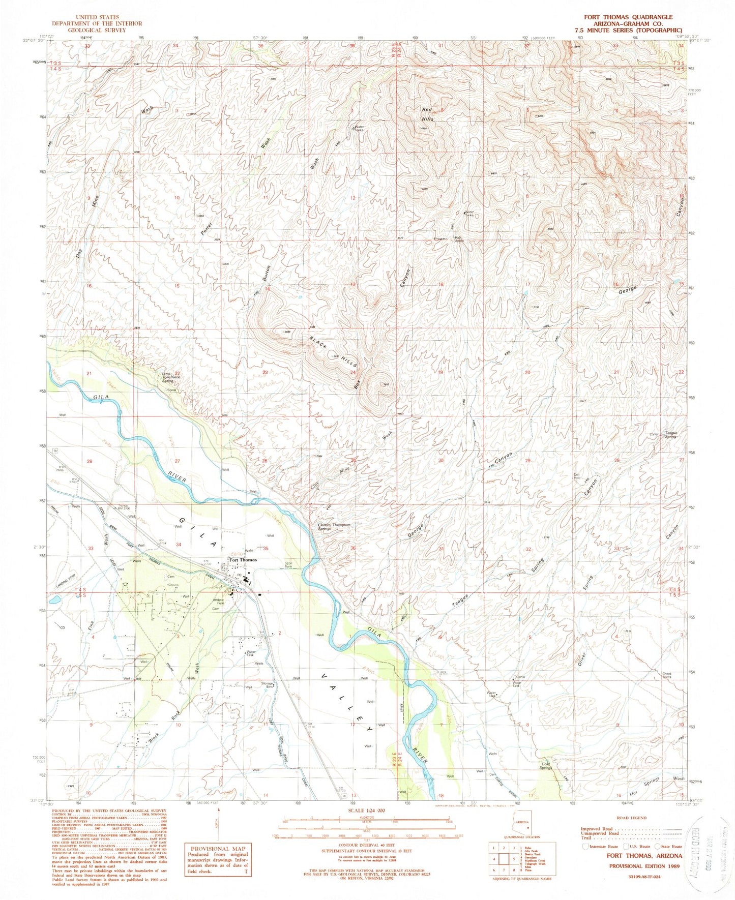
Classic USGS Fort Thomas Arizona 7.5'x7.5' Topo Map
Couldn't load pickup availability
Historical USGS topographic quad map of Fort Thomas in the state of Arizona. Map scale may vary for some years, but is generally around 1:24,000. Print size is approximately 24" x 27"
This quadrangle is in the following counties: Graham.
The map contains contour lines, roads, rivers, towns, and lakes. Printed on high-quality waterproof paper with UV fade-resistant inks, and shipped rolled.
Contains the following named places: Beauty Springs, Black Hills, Black Hills Arch, Black Rock Wash, Box Canyon, Burton Wash, Camp Tank, Charley Thompson Springs, Clay Mine Wash, Cold Springs, Colvin-Jones Canal, Day Mine Wash, Fine Wash, Fort Thomas, Fort Thomas Canal, Fort Thomas Cemetery, Fort Thomas Census Designated Place, Fort Thomas Elementary School, Fort Thomas High School, Fort Thomas Post Office, George Canyon, McEuen Cemetery, Midway Retention Dam, Old Fort Thomas Cemetery, Oliver Spring Canyon, Red Hills, Regeneration Airport, Teague Spring, Teague Spring Canyon, Tom Niece Spring