MyTopo
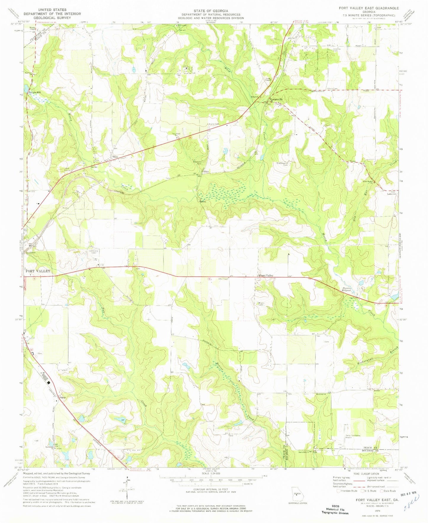
Classic USGS Fort Valley East Georgia 7.5'x7.5' Topo Map
Couldn't load pickup availability
Historical USGS topographic quad map of Fort Valley East in the state of Georgia. Map scale may vary for some years, but is generally around 1:24,000. Print size is approximately 24" x 27"
This quadrangle is in the following counties: Crawford, Houston, Peach.
The map contains contour lines, roads, rivers, towns, and lakes. Printed on high-quality waterproof paper with UV fade-resistant inks, and shipped rolled.
Contains the following named places: Albaugh, Allen Chapel, Bethel Church, Bethel Church Cemetery, Big Dog - Cameron Field, Biss, Bryn Mawr, Byron Division, Church of Christ, Cleveland Dam, Cleveland Lake, Cliett Cemetery, Davis Hill Church, Davis Hill School, Diamond Cemetery, Dry Run Creek, Edgewood, Fagan, Fairview Church, Fort Valley Division, Full Gospel Lighthouse Church, Housers Millpond, Lisenby Cemetery, Little Bethel Church, Lizzie Chapel, Macedonia Church, Miami Cemetery, Miami Valley, Miami Valley Farm Airport, Mount Pleasant Church, Mule Creek, New Faith Church, Oak Grove, Ohio, Peach County, Peach County Fire Department Station 1, Peach County Fire Department Station 2, Peach County Fire Department Station 5, Perry-Houston County Airport, Pineola Farms, Powersville, Powersville Church, Saint John Church, Scattergood Cemetery, Smith Field, South Peach Industrial Park, Taylors Mill, The Medical Center of Peach County, Wesley Chapel, Wesley Chapel Cemetery, Whipple Dam, Whipple Lake, WKXK-FM (Fort Valley), WQBZ-FM (Fort Valley)