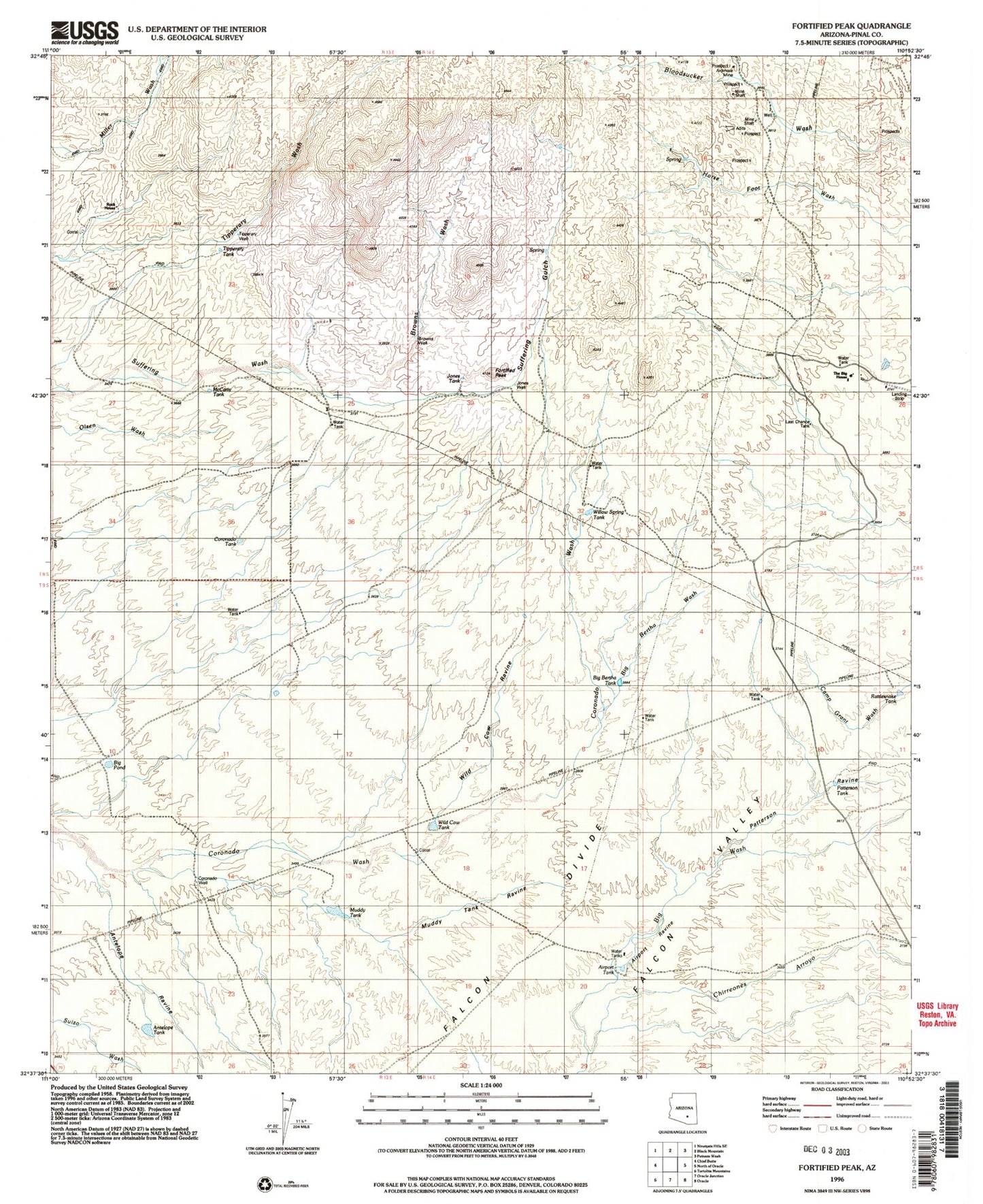
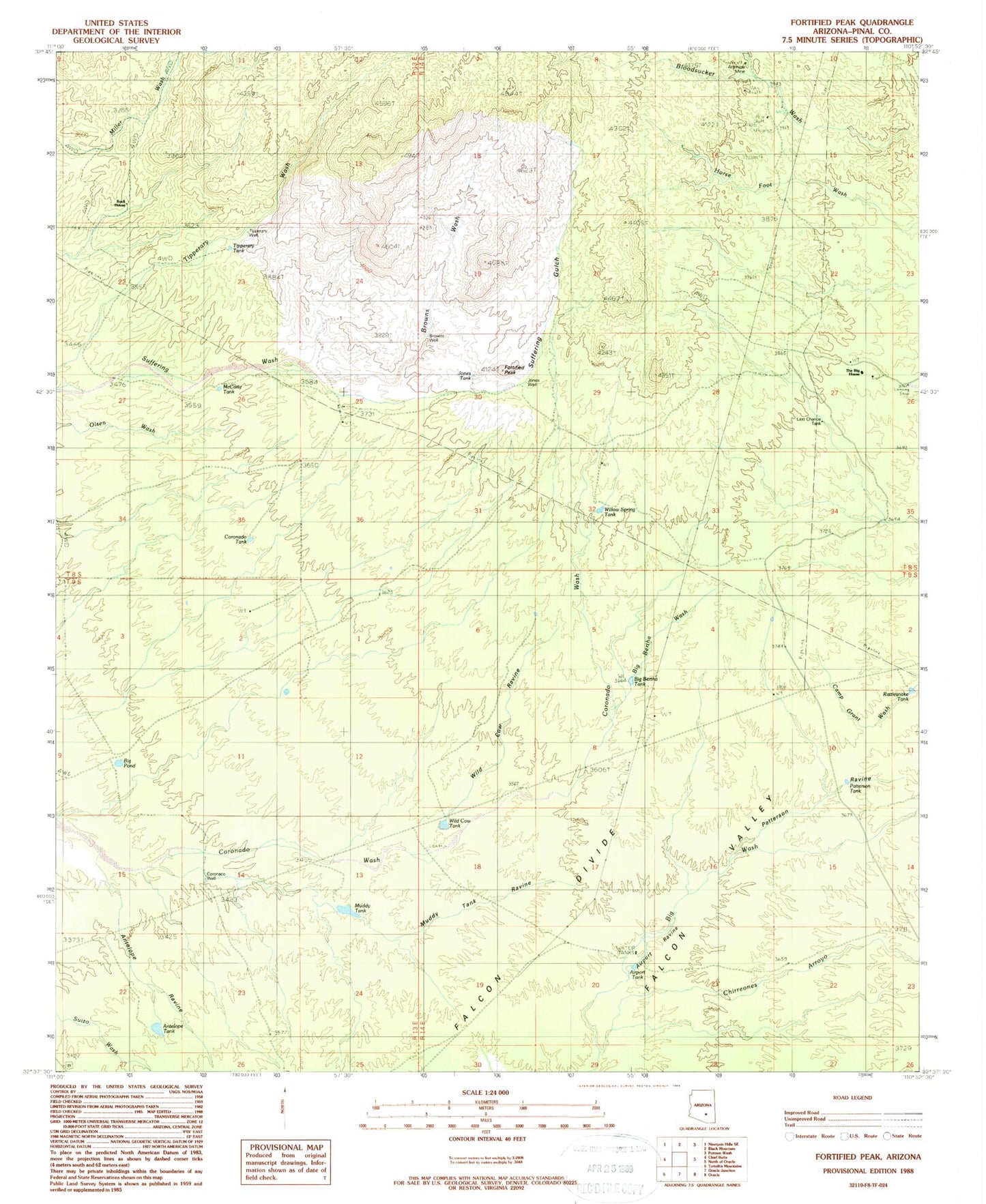
MyTopo
Classic USGS Fortified Peak Arizona 7.5'x7.5' Topo Map
Couldn't load pickup availability
Historical USGS topographic quad map of Fortified Peak in the state of Arizona. Map scale may vary for some years, but is generally around 1:24,000. Print size is approximately 24" x 27"
This quadrangle is in the following counties: Pinal.
The map contains contour lines, roads, rivers, towns, and lakes. Printed on high-quality waterproof paper with UV fade-resistant inks, and shipped rolled.
Contains the following named places: Airport Ravine, Airport Tank, Antelope Ravine, Antelope Tank, Ardmore Mine, Big Bertha Tank, Big Bertha Wash, Big Pond, Browns Wash, Browns Well, Chirreones Arroyo, Coronado Tank, Coronado Well, Fortified Peak, Horse Foot Ranch, Hot Boy Mine, James Well, Jones Tank, Jones Well, Last Chance Tank, McCarty Tank, Muddy Tank, Muddy Tank Ravine, Patterson Ravine, Patterson Tank, Rattlesnake Tank, Rock House, Suffering Gulch, Sunnyside Ranch, The Big House, Tipperary Tank, Tipperary Well, Wild Cow Ravine, Wild Cow Tank, Willow Spring Tank