MyTopo
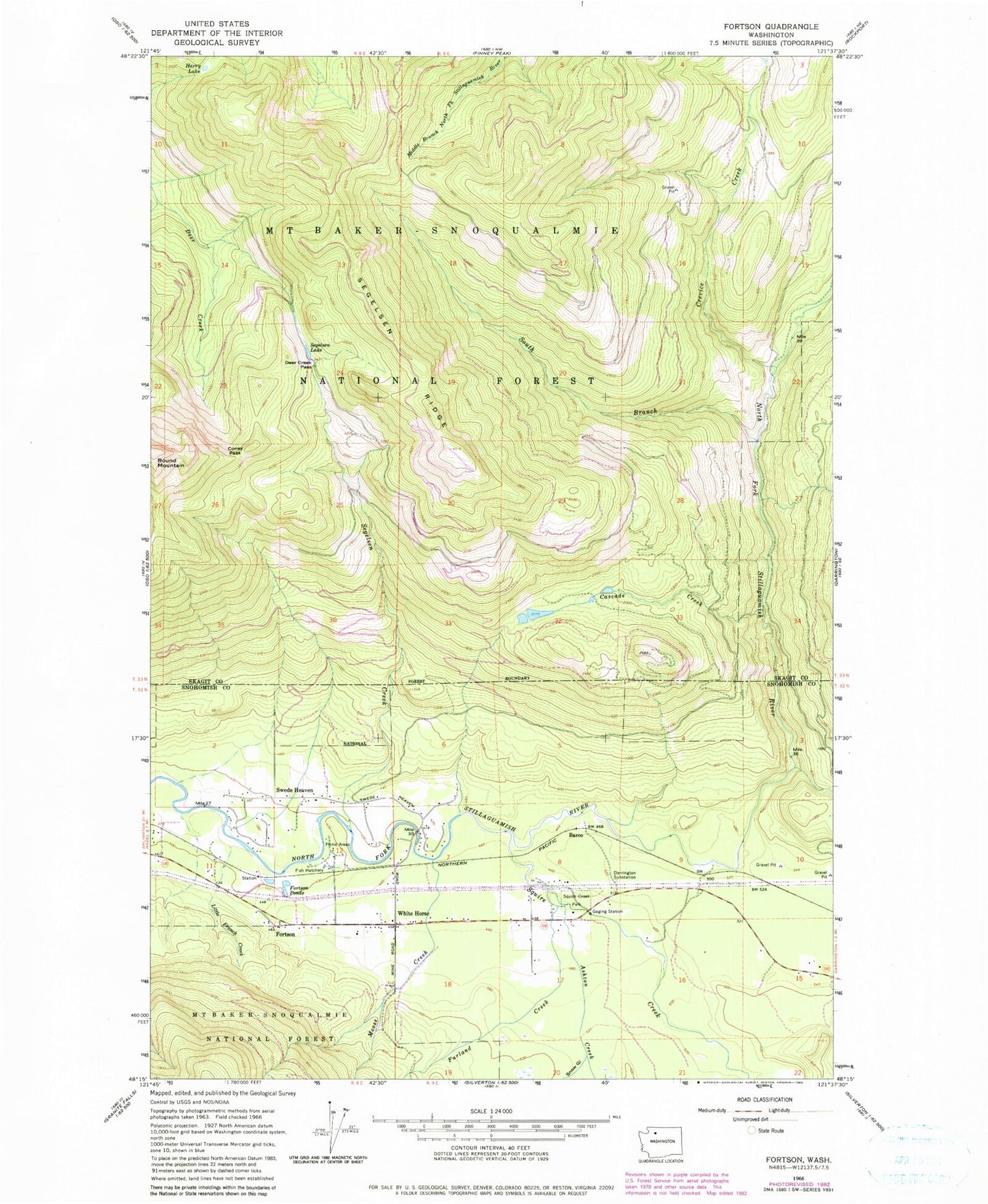
Classic USGS Fortson Washington 7.5'x7.5' Topo Map
Couldn't load pickup availability
Historical USGS topographic quad map of Fortson in the state of Washington. Map scale may vary for some years, but is generally around 1:24,000. Print size is approximately 24" x 27"
This quadrangle is in the following counties: Skagit, Snohomish.
The map contains contour lines, roads, rivers, towns, and lakes. Printed on high-quality waterproof paper with UV fade-resistant inks, and shipped rolled.
Contains the following named places: Allen Pit, Ashton Creek, Barco, Cascade Creek, Coney Pass, Crevice Creek, Darrington Substation, Deer Creek Pass, Fortson, Fortson Mill Pond, Fortson Mill Pond Dam, Fortson Ponds, Furland Creek, Harry Lake, Kingdom Hall of Jehovah's Witnesses, Little French Creek, Moose Creek, Segelsen Creek, Segelsen Lake, Segelsen Ridge, Snohomish County Fire District 24 Station 38, Snow Gulch, South Branch North Fork Stillaguamish River, Squire Creek, Squire Creek Park, Swede Heaven, Swede Heaven Census Designated Place, White Horse