MyTopo
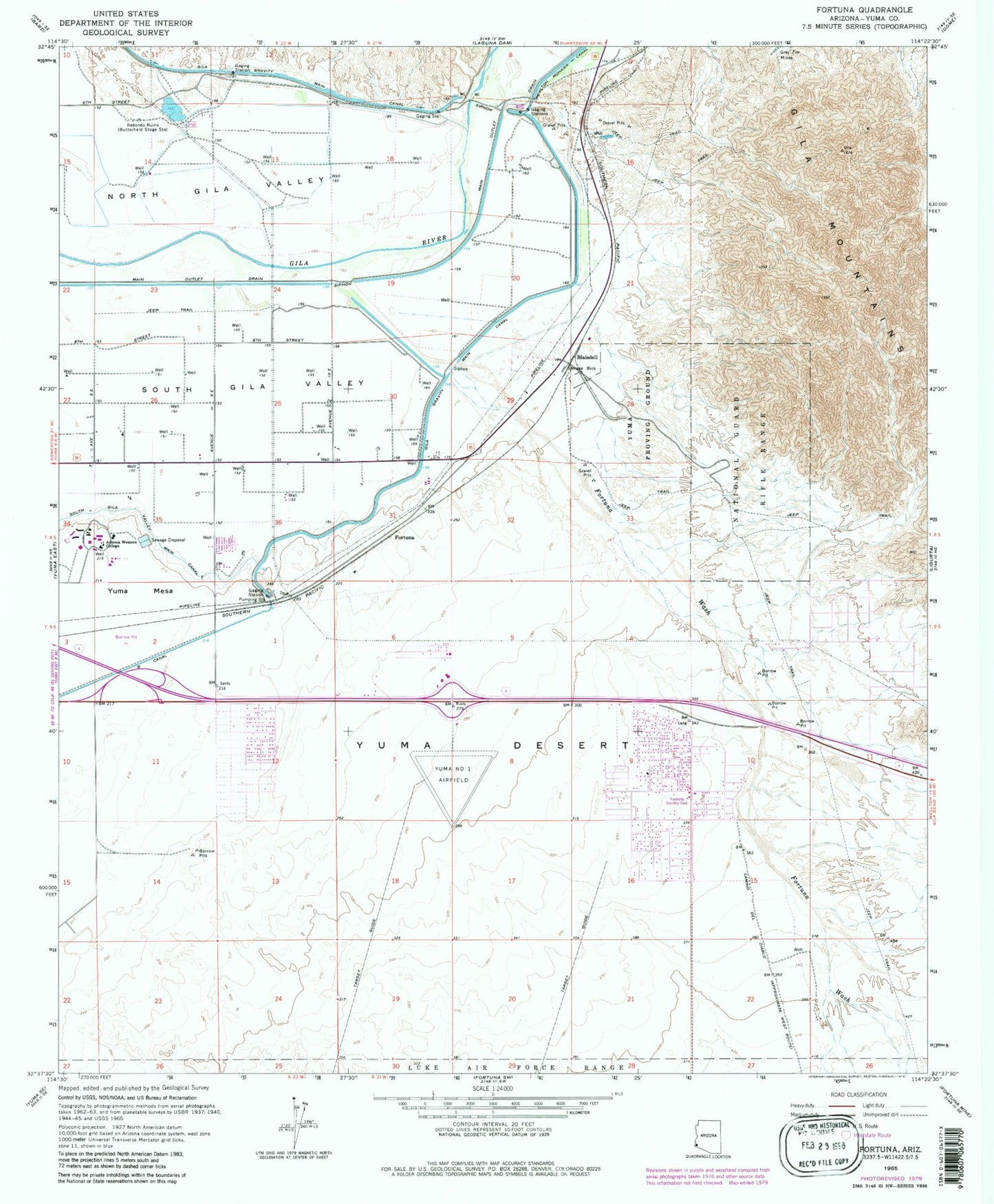
Classic USGS Fortuna Arizona 7.5'x7.5' Topo Map
Couldn't load pickup availability
Historical USGS topographic quad map of Fortuna in the state of Arizona. Map scale may vary for some years, but is generally around 1:24,000. Print size is approximately 24" x 27"
This quadrangle is in the following counties: Yuma.
The map contains contour lines, roads, rivers, towns, and lakes. Printed on high-quality waterproof paper with UV fade-resistant inks, and shipped rolled.
Contains the following named places: Arizona Western College Main Campus, Blaisdell, Blalack, Blue Sky Recreational Vehicle Park, Bonita Mesa Recreational Vehicle Resort, Buckshot Census Designated Place, Cactus Gardens Recreational Vehicle Resort, Caravan Oasis Recreational Vehicle Park, Castle Dome Middle School, Country Breeze Mobile Home Park, Faith Horizon Baptist Church, Foothills Assembly of God, Foothills Church of Christ, Foothills Country Club, Foothills Golf Courses, Foothills Southern Baptist Church, Fortuna, Fortuna Delrey Golf Course, Fortuna Foothills, Fortuna Foothills Census Designated Place, Fortuna Wash, Gila Mountain United Methodist Church, Gloria de Cristo Lutheran Church, Grey Fox Mines, Imperial Well, KAWC-AM (Yuma), KAWC-FM (Yuma), KWAC-AM (Yuma), La Barrancas Golf Course, Las Quintas Oasis Recreational Vehicle Resort, Main Outlet Drain, Mary A Otondo Elementary School, Mesa Del Sol Golf Club, Northern Arizona University Yuma Campus, Rancho Rialto Mobile Home Park, Ron Watson Middle School, Rural / Metro Fire Department Station 10, Rural / Metro Fire Department Station 2, Shangri - La Mobile Home Park, Shepherd of the Hills Lutheran Church, Sunrise Elementary School, Victory Community Church, Yuma County Sheriff's Office Foothills District, Yuma Foothills Post Office, Yuma Number One Airfield, ZIP Code: 85367