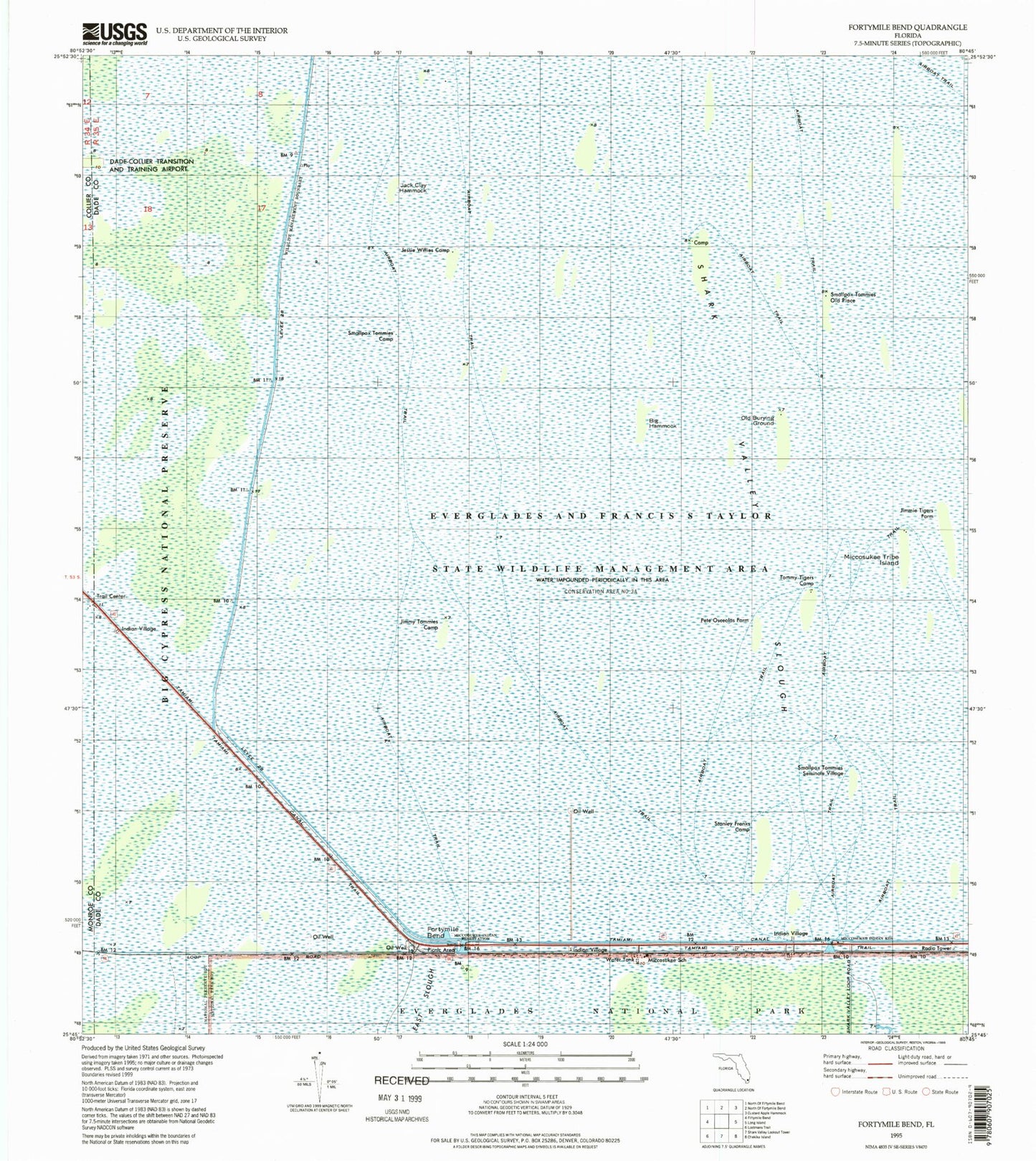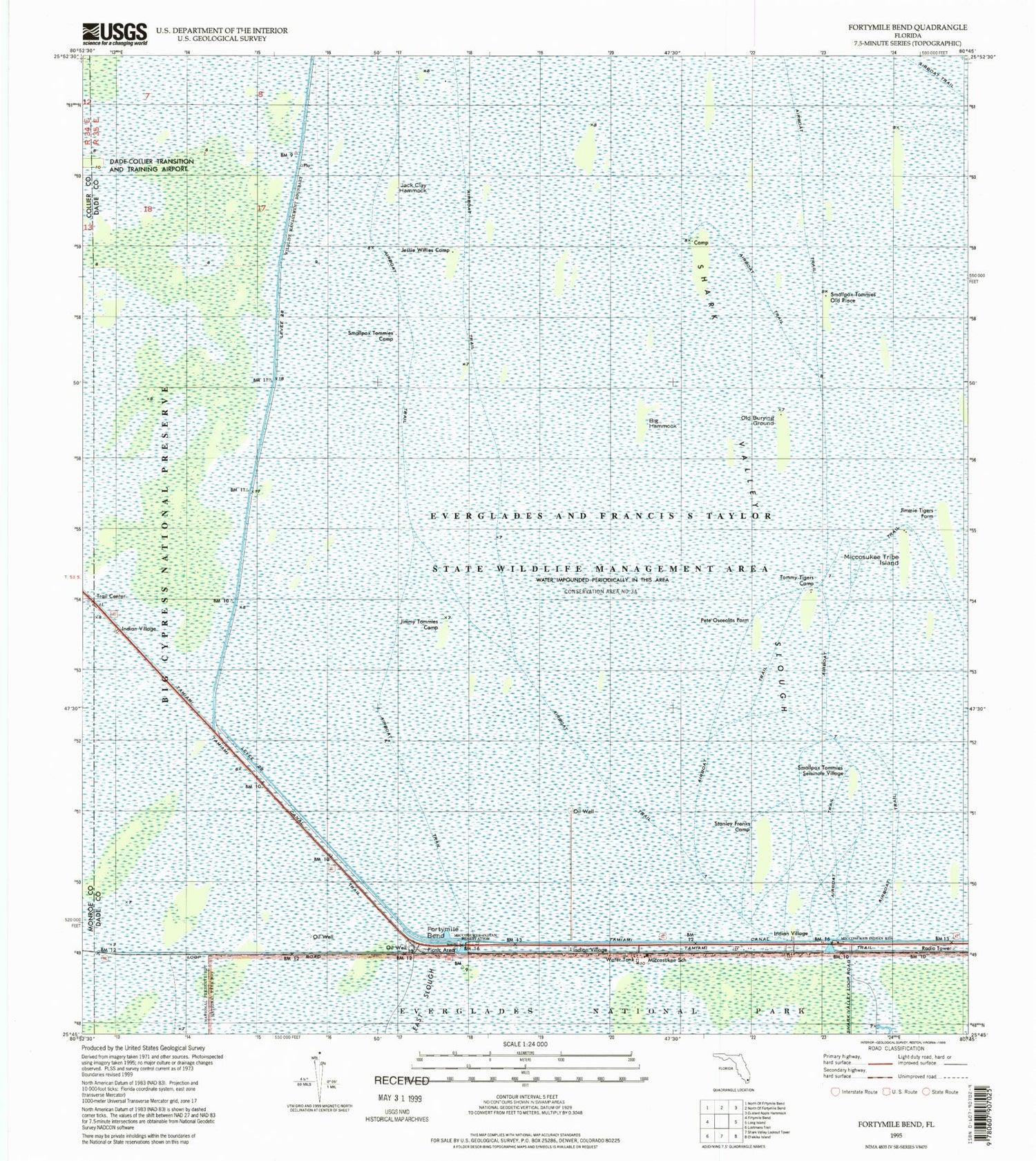
MyTopo
Classic USGS Fortymile Bend Florida 7.5'x7.5' Topo Map
Couldn't load pickup availability
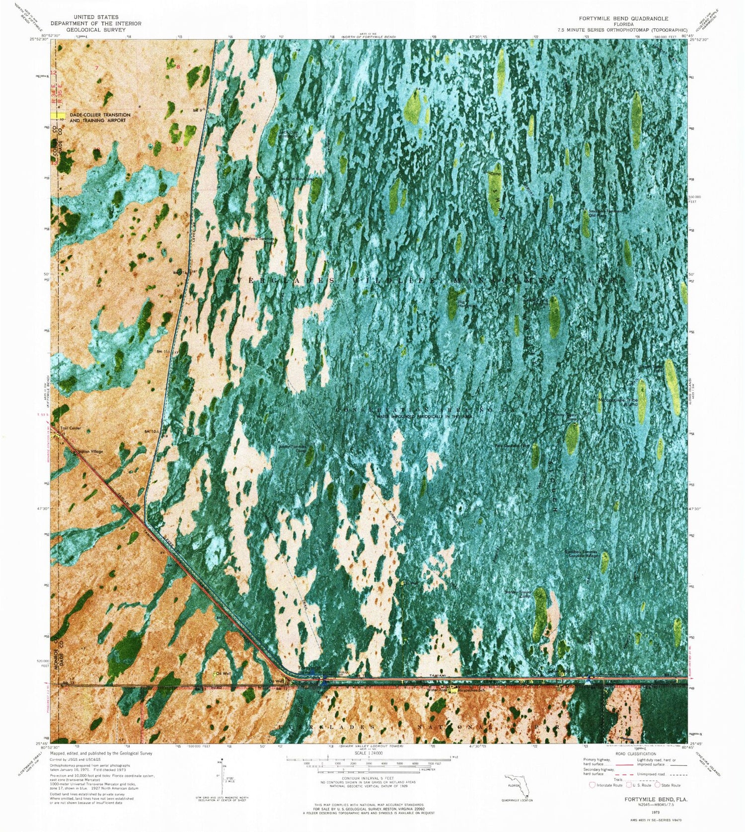
Historical USGS topographic quad map of Fortymile Bend in the state of Florida. Map scale may vary for some years, but is generally around 1:24,000. Print size is approximately 24" x 27"
This quadrangle is in the following counties: Collier, Miami-Dade, Monroe.
The map contains contour lines, roads, rivers, towns, and lakes. Printed on high-quality waterproof paper with UV fade-resistant inks, and shipped rolled.
Contains the following named places: Big Hammock, Biscayne Shopping Center, Breezeswept Center, Fortymile Bend, Jack Clay Hammock, Jessie Willies Camp, Jimmie Tigers Farm, Jimmy Tommies Camp, Ladow Yeshiva School, Levee 28, Miccosukee Indian Reservation, Miccosukee Police Department, Miccosukee School, Miccosukee Tribe Headquarters, Miccosukee Tribe Island, Pete Osceolas Farm, Pete Osceolas Seminole Village, Rabbi Alexander S Gross Hebrew Academy, Smallpox Tommies Camp, Smallpox Tommies Old Place, Smallpox Tommies Seminole Village, Stanley Franks Camp, Tamiami Canal Number C-4, Tamiami Trail, Temple Menorah School, Tommy Tigers Camp