
MyTopo
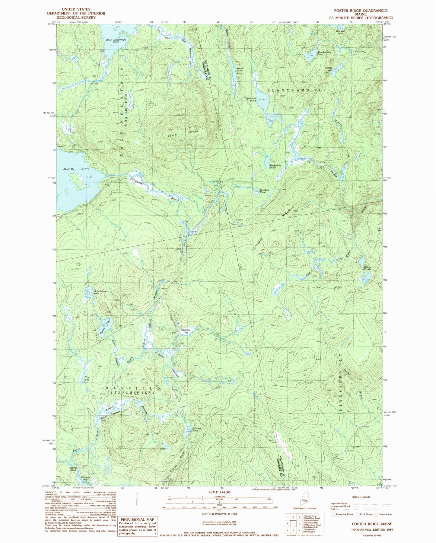
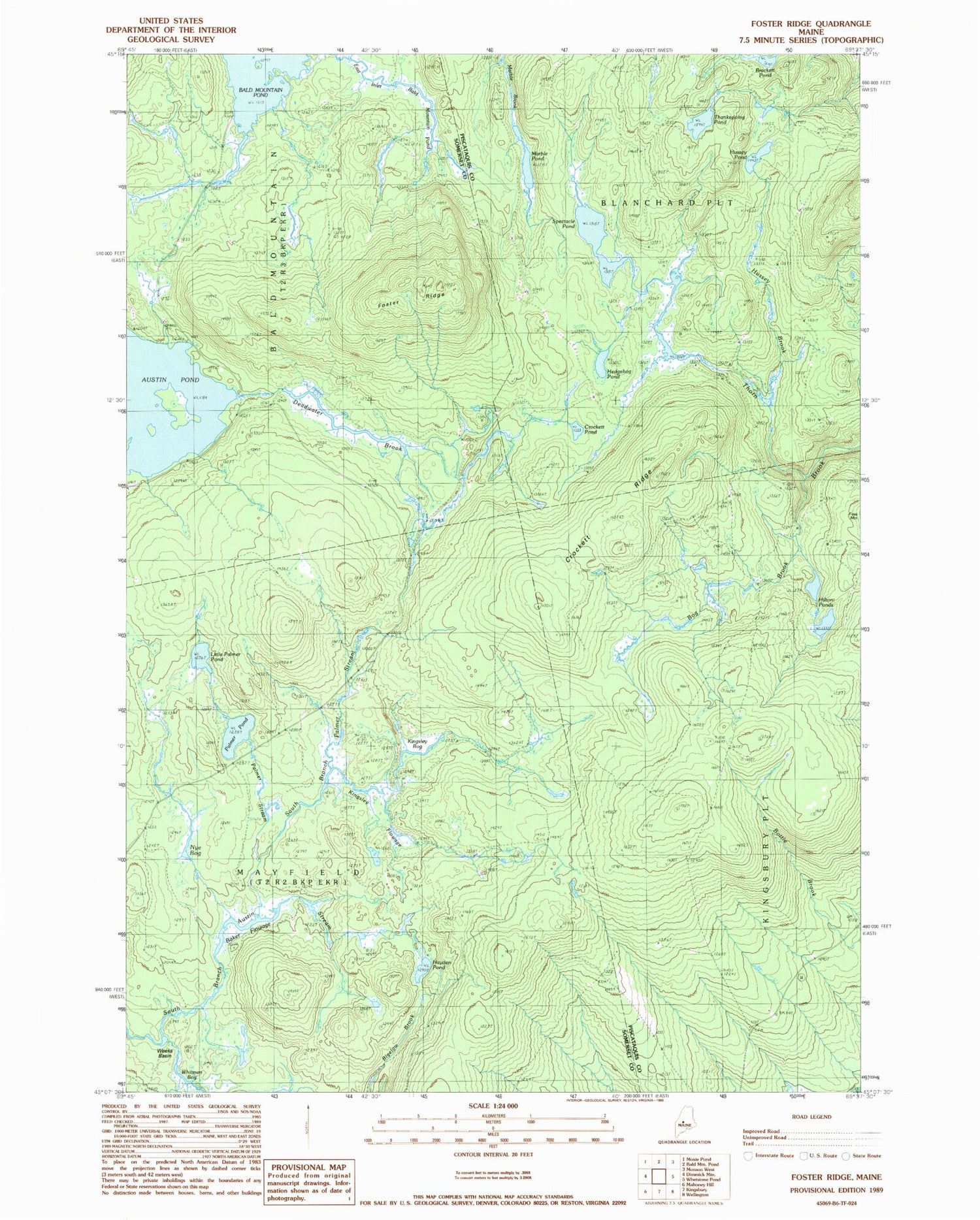
Classic USGS Foster Ridge Maine 7.5'x7.5' Topo Map
Couldn't load pickup availability
Historical USGS topographic quad map of Foster Ridge in the state of Maine. Map scale may vary for some years, but is generally around 1:24,000. Print size is approximately 24" x 27"
This quadrangle is in the following counties: Piscataquis, Somerset.
The map contains contour lines, roads, rivers, towns, and lakes. Printed on high-quality waterproof paper with UV fade-resistant inks, and shipped rolled.
Contains the following named places: Austin Pond, Baker Flowage, Bog Brook, Brackett Pond, Crockett Pond, Crockett Ridge, Deadwater Brook, Foster Ridge, Hayden Pond, Hedgehog Pond, Hilton Cemetery, Hilton Ponds, Hussey Brook, Hussey Pond, Kingsley Bog, Kingsley Flowage, Little Palmer Pond, Marble Pond, Nye Bog, Palmer Pond, Palmer Stream, South Branch Palmer Stream, Spectacle Pond, Thanksgiving Pond, Titcomb Cemetery, Township of Blanchard, Township of Mayfield, Weeks Basin, Whitman Bog