MyTopo
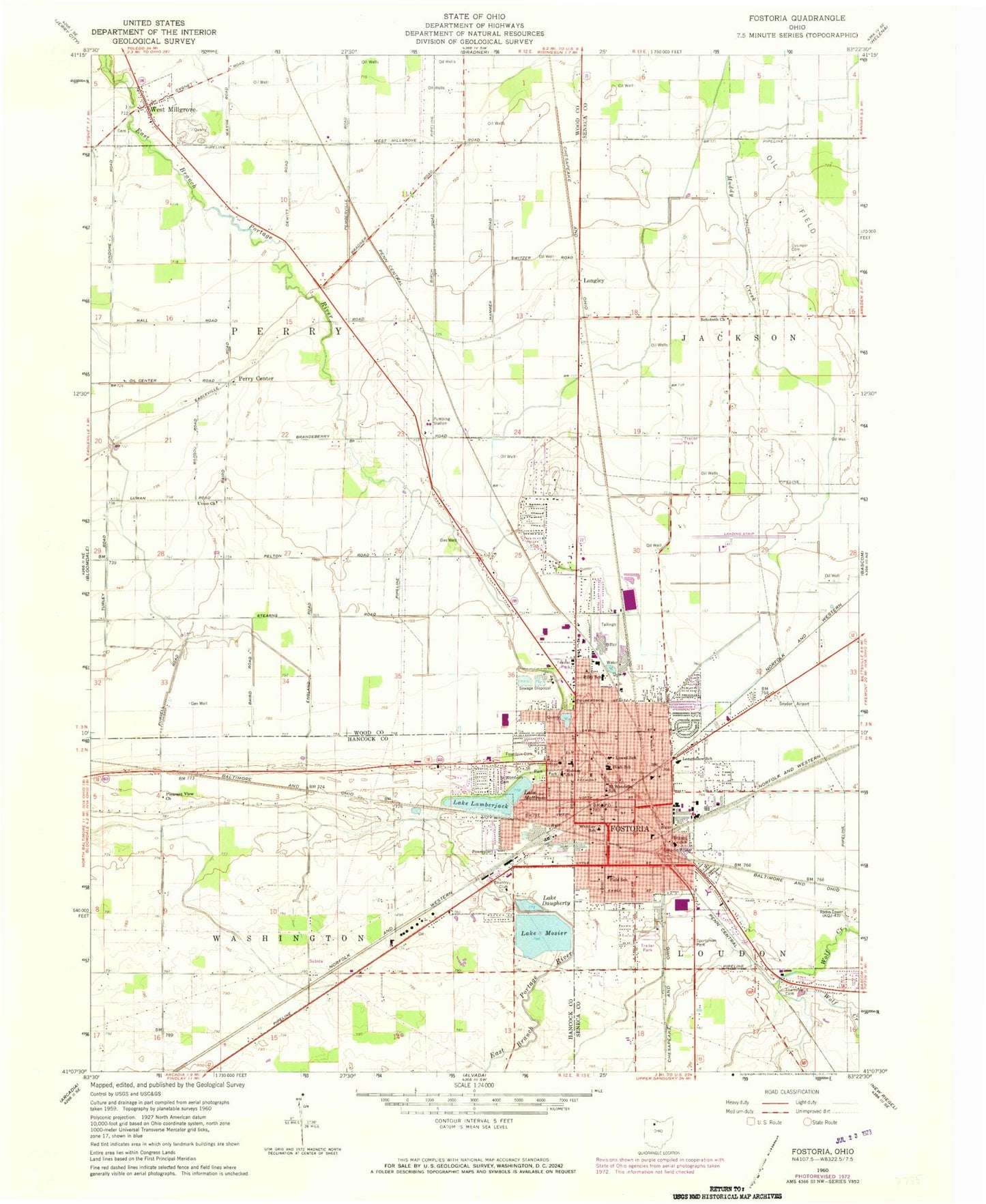
Classic USGS Fostoria Ohio 7.5'x7.5' Topo Map
Couldn't load pickup availability
Historical USGS topographic quad map of Fostoria in the state of Ohio. Map scale may vary for some years, but is generally around 1:24,000. Print size is approximately 24" x 27"
This quadrangle is in the following counties: Hancock, Seneca, Wood.
The map contains contour lines, roads, rivers, towns, and lakes. Printed on high-quality waterproof paper with UV fade-resistant inks, and shipped rolled.
Contains the following named places: Autolite Heliport, Bethel Baptist Church, Bethel Evangelical Lutheran Church, Bryant School, Caldwells Addition, Church of God, Church of the Nazarene, City of Fostoria, Daugherty Lake, Dysinger Cemetery, Emerson Junior High School, Faith Tabernacle Pentecostal Church of God, Field Elementary School, First Baptist Church, First Church of Christ, First Church of Christ Scientist, First Church of the Brethren, First Methodist Church, First Presbyterian Church, First United Church of Christ, Flechtner Heights, Fostoria, Fostoria Area Historical Museum, Fostoria Church of the Brethren, Fostoria City Hospital Heliport, Fostoria Country Club, Fostoria Fire Department, Fostoria High School, Fostoria Metropolitan Airport, Fostoria Mobile Estates, Fostoria Municipal Building, Fostoria Police Department, Fostoria Post Office, Fostoria Sewage Disposal Plant, Fostoria Water Treatment Plant, Fountain Cemetery, Foursquare Gospel Tabernacle, Glass Heritage Gallery, High Street United Methodist Church, Holmes Elementary School, Hope Lutheran Church, House of Prayer, Kaubisch Memorial Public Library, Lake Daugherty Upground Reservoir Dam, Lake Lamberjack Upground Reservoir Dam, Lake Mosier Upground Reservoir Dam, Lake Mottram Upground Reservoir Dam, Lamberjack Lake, Longfellow Elementary School, Longley, Loudon Township Cemetery, Lowell Elementary School, Madison Addition, Mosier Lake, Mottram Lake, Norris Station, North Pointe Place Mobile Home Park, Nyes Mobile Home Park, Pelton Mobile Home Park, Pentecostal Church of God, Perry Center, Perry Center Cemetery, Pilgrim Holiness Church, Pleasant View Church, Portage Park, ProMedica Fostoria Community Hospital, Rehoboth, Rehoboth Church, Revival Center, Riley Elementary School, Saint John the Divine Church, Saint Wendelin Cemetery, Saint Wendelin High School, Saint Wendelin School, Saint Wendelins Roman Catholic Church, Sportsman Park, Stearns Crest, Township of Perry, Trinity Episcopal Church, Union Church, Village of West Millgrove, West Millgrove, West Millgrove Cemetery, West Millgrove Fire Department, West Millgrove Post Office, Westgate Village Park, Whittier School, Williams Mobile Home Park, ZIP Codes: 43467, 44830