MyTopo
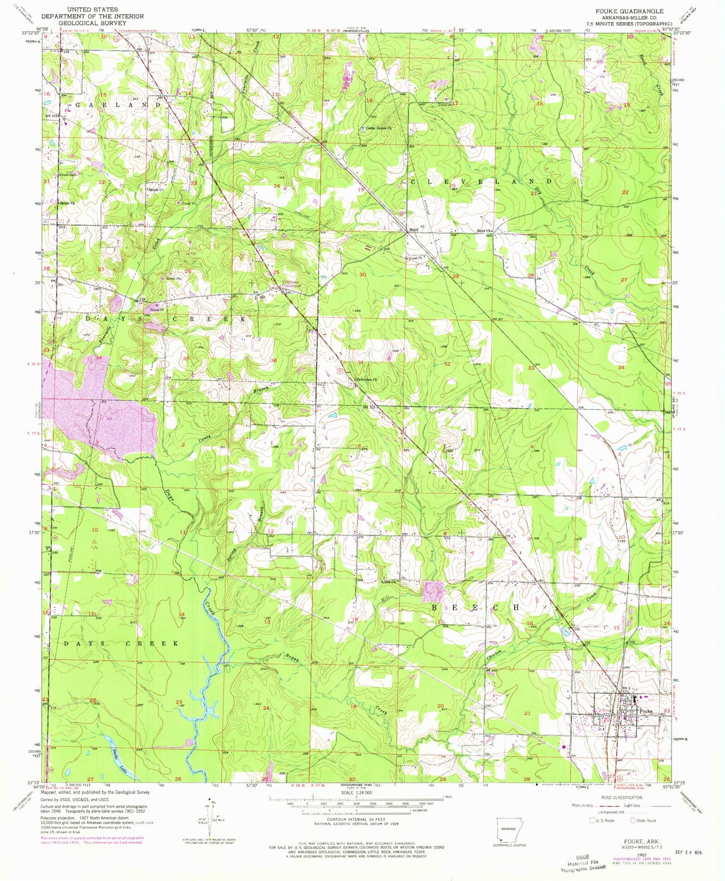
Classic USGS Fouke Arkansas 7.5'x7.5' Topo Map
Couldn't load pickup availability
Historical USGS topographic quad map of Fouke in the state of Arkansas. Typical map scale is 1:24,000, but may vary for certain years, if available. Print size: 24" x 27"
This quadrangle is in the following counties: Miller.
The map contains contour lines, roads, rivers, towns, and lakes. Printed on high-quality waterproof paper with UV fade-resistant inks, and shipped rolled.
Contains the following named places: Boggy Creek, Boyd Church, Cedar Grove Church, Chicken Creek, Gibson Cemetery, Little Church, Mill Creek, Salem Church, Salem Church, Spring Branch, Boyd, Fouke, Fouke Elementary School, Fouke High School, Roberts (historical), Sylverino, Township of Days Creek, Miller County, Snake Lake, Caney Branch, Ferguson Crossroads, Fourmile Creek, Sylverino Church, Paradise Lake Dam, Paradise Lake, Davis Lake Dam, Davis Lake, Davis Lake Dam Number Two, Davis Lake Number Two, Robinson Estate Lower Lake Dam, Lower Lake, Robinson Estate Upper Lake Dam, Upper Lake, Paulette Smith Middle School, Fouke City Fire Department, Fouke Police Department, City of Fouke, Fouke Post Office