MyTopo
Classic USGS Fountain City Indiana 7.5'x7.5' Topo Map
Couldn't load pickup availability
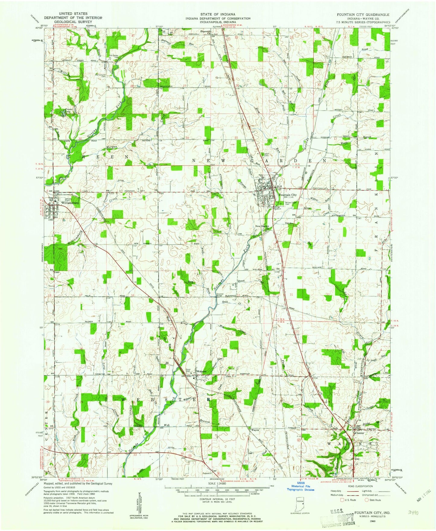
Historical USGS topographic quad map of Fountain City in the state of Indiana. Map scale may vary for some years, but is generally around 1:24,000. Print size is approximately 24" x 27"
This quadrangle is in the following counties: Wayne.
The map contains contour lines, roads, rivers, towns, and lakes. Printed on high-quality waterproof paper with UV fade-resistant inks, and shipped rolled.
Contains the following named places: Berg Brook, Bridge Brook, Cain Ditch, Center Friends Cemetery, Chester, Chester Creek, Dover Cemetery, Dover Run, Fellow Brook, Fountain City, Fountain City - New Garden Township Fire Department, Fountain City Police Department, Fountain City Post Office, Fountain Creek, Fruit Branch, Garden Run, Grove Creek, High Brook, Hinshaw Ditch, Hopewell Church, Hopewell Run, Knoll Run, Knollenberg Ditch, Land Drain, Levi Coffin House, Line Brook, Long Creek, Morgan Creek, Nail Creek, New Garden Church, Newport Cemetery, Odd Run, Old Concord Cemetery, Olive Hill Post Office, Pole Creek, Quack Creek, Quill Creek, Reel Run, Silver Brook, Single Creek, Slow Run, Small Run, Spike Brook, Tie Run, Town Creek, Town of Fountain City, Township of New Garden, Township of Webster, Tree Brook, Vernon Brook, Wayne, Web Branch, Web Creek, Webster, Webster Creek, Webster Post Office, Webster Volunteer Fire Department, Well Brook, WHON-AM (Centerville), William Creek, Williamsburg, Williamsburg Elementary School, Williamsburg Post Office, Williamsburg Volunteer Fire Department, Willow Grove Cemetery, Willow Run, Woods Branch, WQLK-FM (Richmond), Young Stadium, Youngs Brook, ZIP Code: 47341