MyTopo
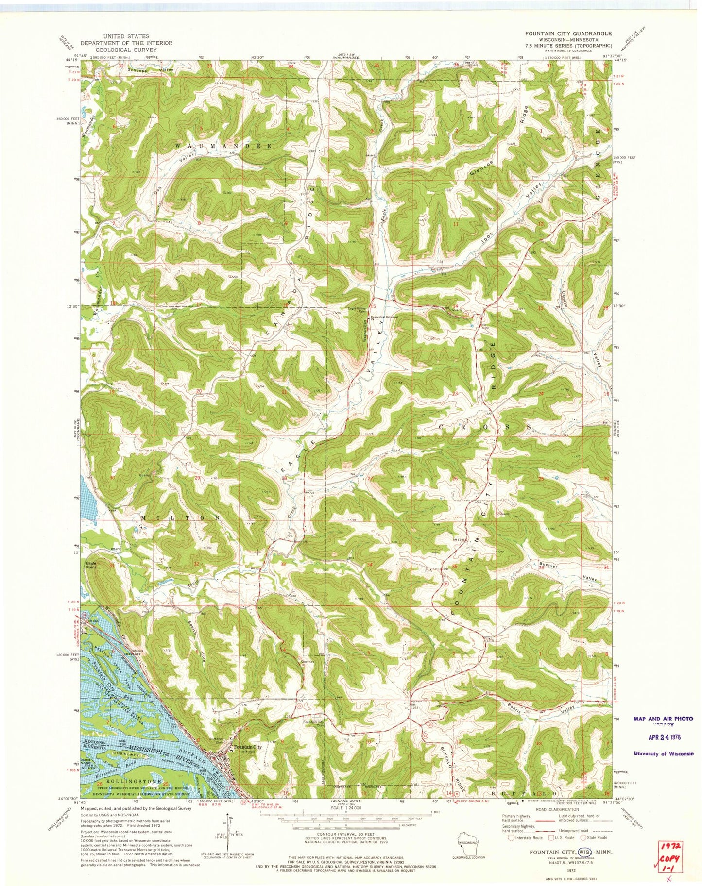
Classic USGS Fountain City Wisconsin 7.5'x7.5' Topo Map
Couldn't load pickup availability
Historical USGS topographic quad map of Fountain City in the states of Wisconsin, Minnesota. Map scale may vary for some years, but is generally around 1:24,000. Print size is approximately 24" x 27"
This quadrangle is in the following counties: Buffalo, Winona.
The map contains contour lines, roads, rivers, towns, and lakes. Printed on high-quality waterproof paper with UV fade-resistant inks, and shipped rolled.
Contains the following named places: Canada Ridge, Cross School, Eagle Point, Eagle Valley, Eagle Valley Cemetery, Evangelical Reformed Church, Fairview School, Fountain City, Fountain City Bay, Fountain City Cemetery, Fountain City Fire Department, Fountain City Post Office, Fountain City Ridge, Fountain Police Department, Glencoe Ridge, Horseshoe Bend, Joos Valley, Merrick State Park, Oak Valley, Owl Head, Saint Marys Cemetery, Schoepp Valley, Schoepps Creek, Speith Hole, Town of Cross, Upper Mississippi Wild Life and Fish Refuge, Wagners Cliff, Waumandee Creek, ZIP Code: 54629