MyTopo
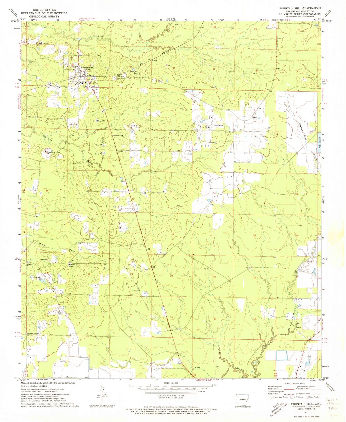
Classic USGS Fountain Hill Arkansas 7.5'x7.5' Topo Map
Couldn't load pickup availability
Historical USGS topographic quad map of Fountain Hill in the state of Arkansas. Map scale may vary for some years, but is generally around 1:24,000. Print size is approximately 24" x 27"
This quadrangle is in the following counties: Ashley.
The map contains contour lines, roads, rivers, towns, and lakes. Printed on high-quality waterproof paper with UV fade-resistant inks, and shipped rolled.
Contains the following named places: First Baptist Church of Fountain Hill, Flat Creek Cemetery, Flat Creek Church, Fountain Hill, Fountain Hill Elementary School, Fountain Hill Fire Department, Fountain Hill High School, Fountain Hill Police Department, Fountain Hill Post Office, Fountain Prairie, Judson Cemetery, Judson Missionary Baptist Church, Kirkpatrick Cemetery, Norris Hill Cemetery, Roark, Shiloh Church, Shiloh Lake, Shiloh Lake Dam, Spring Hill Cemetery, Town of Fountain Hill, Township of White