MyTopo
Classic USGS Fountain Lake Arkansas 7.5'x7.5' Topo Map
Couldn't load pickup availability
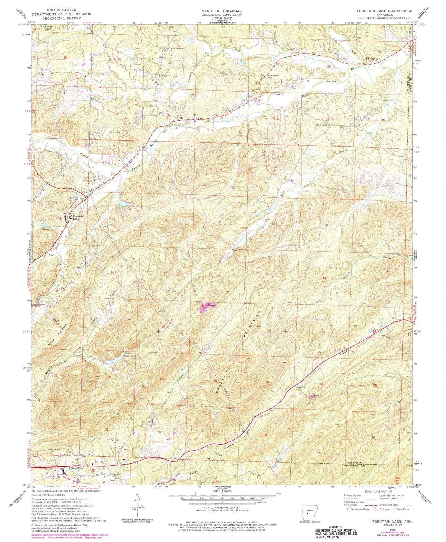
Historical USGS topographic quad map of Fountain Lake in the state of Arkansas. Map scale may vary for some years, but is generally around 1:24,000. Print size is approximately 24" x 27"
This quadrangle is in the following counties: Garland, Hot Spring, Saline.
The map contains contour lines, roads, rivers, towns, and lakes. Printed on high-quality waterproof paper with UV fade-resistant inks, and shipped rolled.
Contains the following named places: Benoit Airfield, Beth Jacob Cemetery, Cedar Creek, Center Hill Church, Cutter - Morning Star Elementary School, Cutter - Morning Star High School, Dripping Springs, Fountain Lake, Fountain Lake Charter High School, Fountain Lake Dam, Fountain Lake Elementary School, Fountain Lake Fire Department Station 1, Grapevine Mountain, Gulpha, High Point, Lockett Creek, McClendon Cemetery, Medlock Cemetery, Mill Creek, Mill Creek Baptist Church, Morning Star, Morning Star Church, Morning Star Fire Department Station 1, Nooner Lake, Nooner Lake Dam, Oak Hill Church, O'Mahoney Pond, O'Mahoney Pond Dam, Peaceful Valley Church, Rockdale Church, South Fork Bridge, Town of Fountain Lake, Township of Whittington, Whittington, ZIP Code: 71901