MyTopo
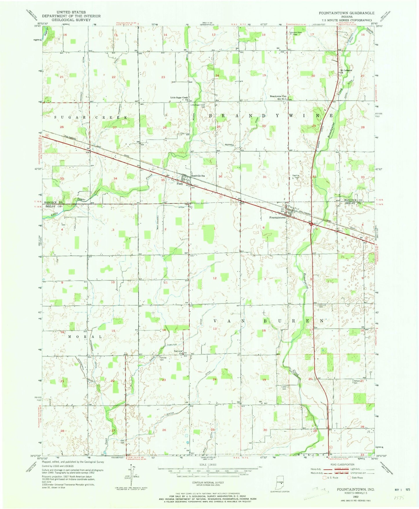
Classic USGS Fountaintown Indiana 7.5'x7.5' Topo Map
Couldn't load pickup availability
Historical USGS topographic quad map of Fountaintown in the state of Indiana. Map scale may vary for some years, but is generally around 1:24,000. Print size is approximately 24" x 27"
This quadrangle is in the following counties: Hancock, Shelby.
The map contains contour lines, roads, rivers, towns, and lakes. Printed on high-quality waterproof paper with UV fade-resistant inks, and shipped rolled.
Contains the following named places: Andis Ditch, Ashcraft Ditch, Brandywine Elementary School, Brown Ditch, Carrollton, Concord Cemetery, Duckworth Ditch, Fairview Cemetery, Fairview Church, Farm Strip, Fisher Cemetery, Fountaintown, Fountaintown Community Volunteer Fire Department, Fountaintown Post Office, Gorton Memorial Church, Hamilton Ditch, Lisher Cemetery, Little Sugar Creek Cemetery, Little Sugar Creek Church, MacDougall Ditch, Manlove Park, Maxwell Ditch, Mc Neil Field Airport, Moral Post Office, Mount Lebanon Church, Osgood Field, Pelham Cemetery, Powers Ditch, Reedville Station, Sexton Ditch, Snodgrass Ditch, Stucker Fork Structure Number 15, Thompson Ditch, Township of Brandywine, Township of Van Buren, Wilson Ditch, ZIP Code: 46130