MyTopo
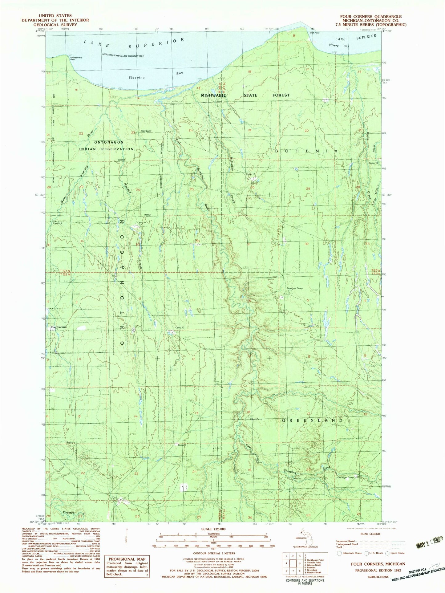
Classic USGS Four Corners Michigan 7.5'x7.5' Topo Map
Regular price
$16.95
Regular price
Sale price
$16.95
Unit price
per
Couldn't load pickup availability
Historical USGS topographic quad map of Four Corners in the state of Michigan. Map scale may vary for some years, but is generally around 1:24,000. Print size is approximately 24" x 27"
This quadrangle is in the following counties: Ontonagon.
The map contains contour lines, roads, rivers, towns, and lakes. Printed on high-quality waterproof paper with UV fade-resistant inks, and shipped rolled.
Contains the following named places: Black Creek, Camp 12, Camp 13, Camp 14, Camp 16, Camp 17, Camp 18, Camp 8, Camp 9, East Sleeping River, Four Corners, Fourteen Mile Point, Hilger Camp, Holland Creek, McCarthy Creek, Old Hilger Camp, Ontonagon Reservation, Penegors Camp, Sleeping Bay, West Sleeping River