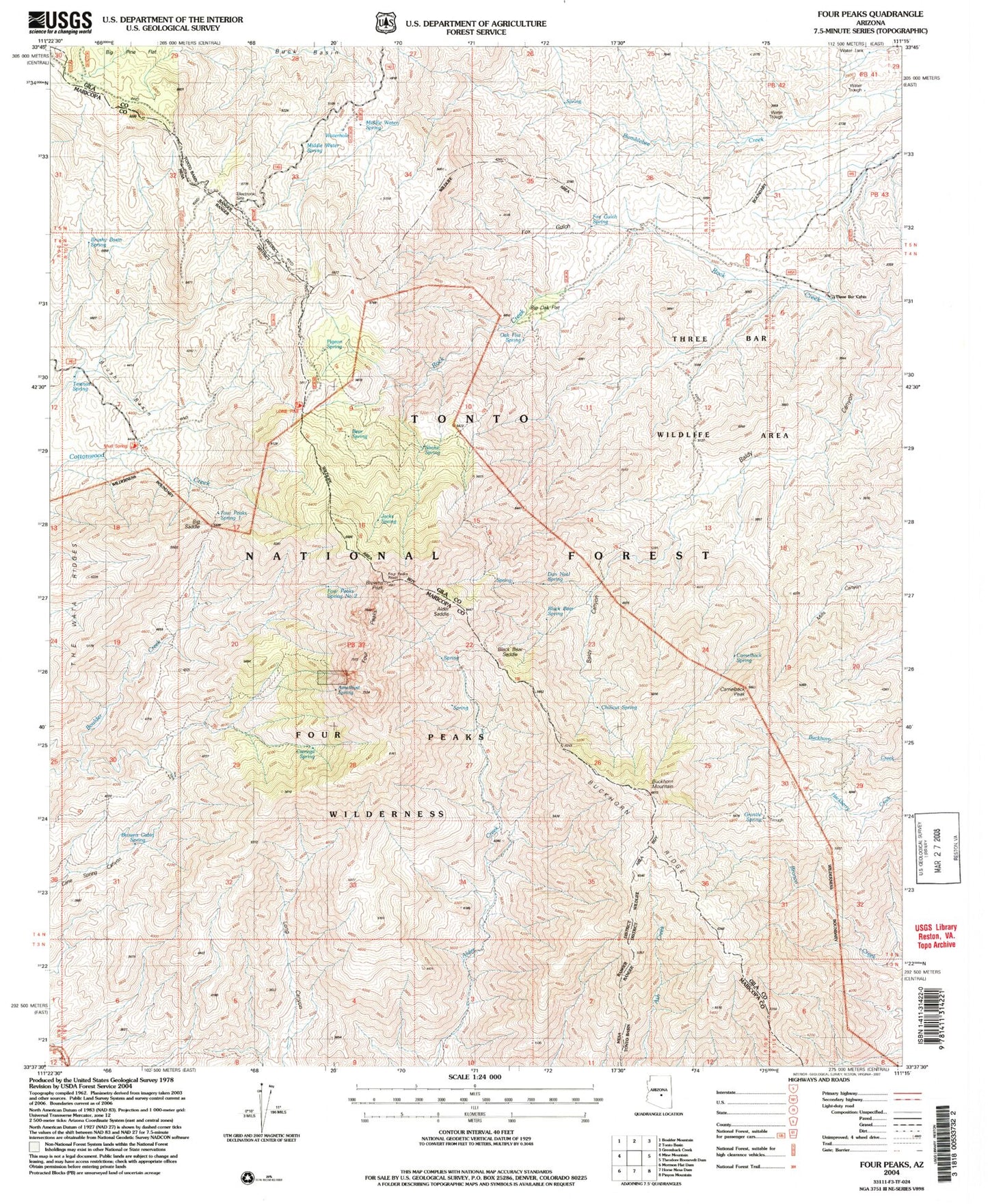
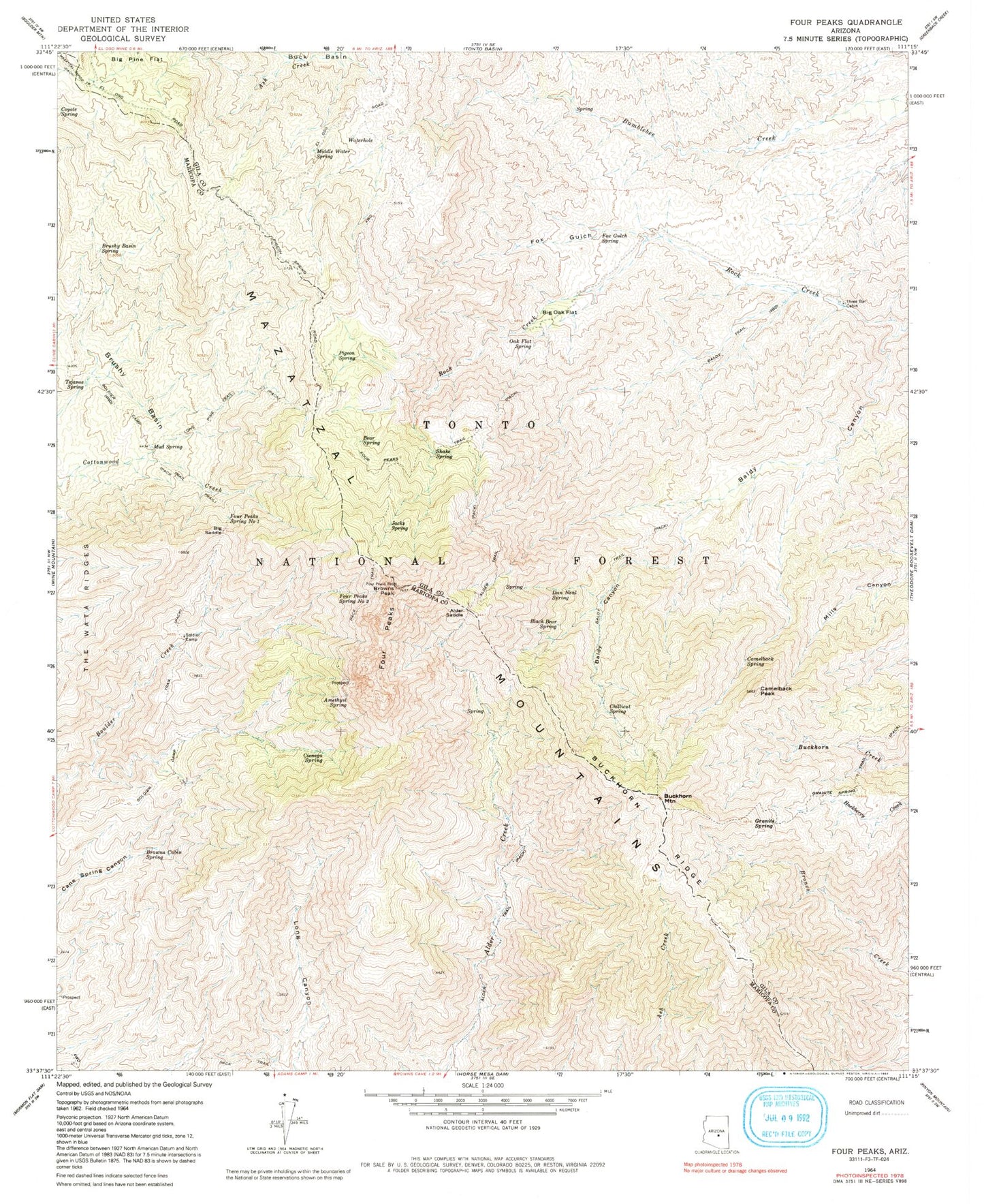
MyTopo
Classic USGS Four Peaks Arizona 7.5'x7.5' Topo Map
Couldn't load pickup availability
Historical USGS topographic quad map of Four Peaks in the state of Arizona. Typical map scale is 1:24,000, but may vary for certain years, if available. Print size: 24" x 27"
This quadrangle is in the following counties: Gila, Maricopa.
The map contains contour lines, roads, rivers, towns, and lakes. Printed on high-quality waterproof paper with UV fade-resistant inks, and shipped rolled.
Contains the following named places: Alder Saddle, Alder Trail, Amethyst Spring, Baldy Canyon, Baldy Trail, Baldy Trail, Bear Spring, Big Oak Flat, Big Saddle, Black Bear Spring, Browns Cabin Spring, Browns Peak, Brushy Basin, Brushy Basin Spring, Buckhorn Mountain, Buckhorn Ridge, Camelback Peak, Camelback Spring, Chillicut Spring, Cienega Spring, Dan Neal Spring, Four Peaks, Four Peaks Spring Number One, Four Peaks Spring Number Two, Four Peaks Trail, Fox Gulch, Fox Gulch Spring, Granite Spring, Jacks Spring, Lone Pine Trail, Middle Water Spring, Mud Spring, Oak Flat Spring, Pigeon Spring, Shake Spring, Soldier Camp, Tejanos Spring, The Wata Ridges, Three Bar Cabin, Amethyst Mine, Laubs Mine, Lone Pine Saddle, Soldier Camp Trail, Three Bar Watershed Research Area, Water Hole Tank, Buckhorn Mountain Research Natural Area, Black Bear Saddle, Mud Spring, Long Pine Trailhead, Middle Water Spring, Four Peaks Wilderness, Mud Spring Trailhead, Ziltadin Mountain