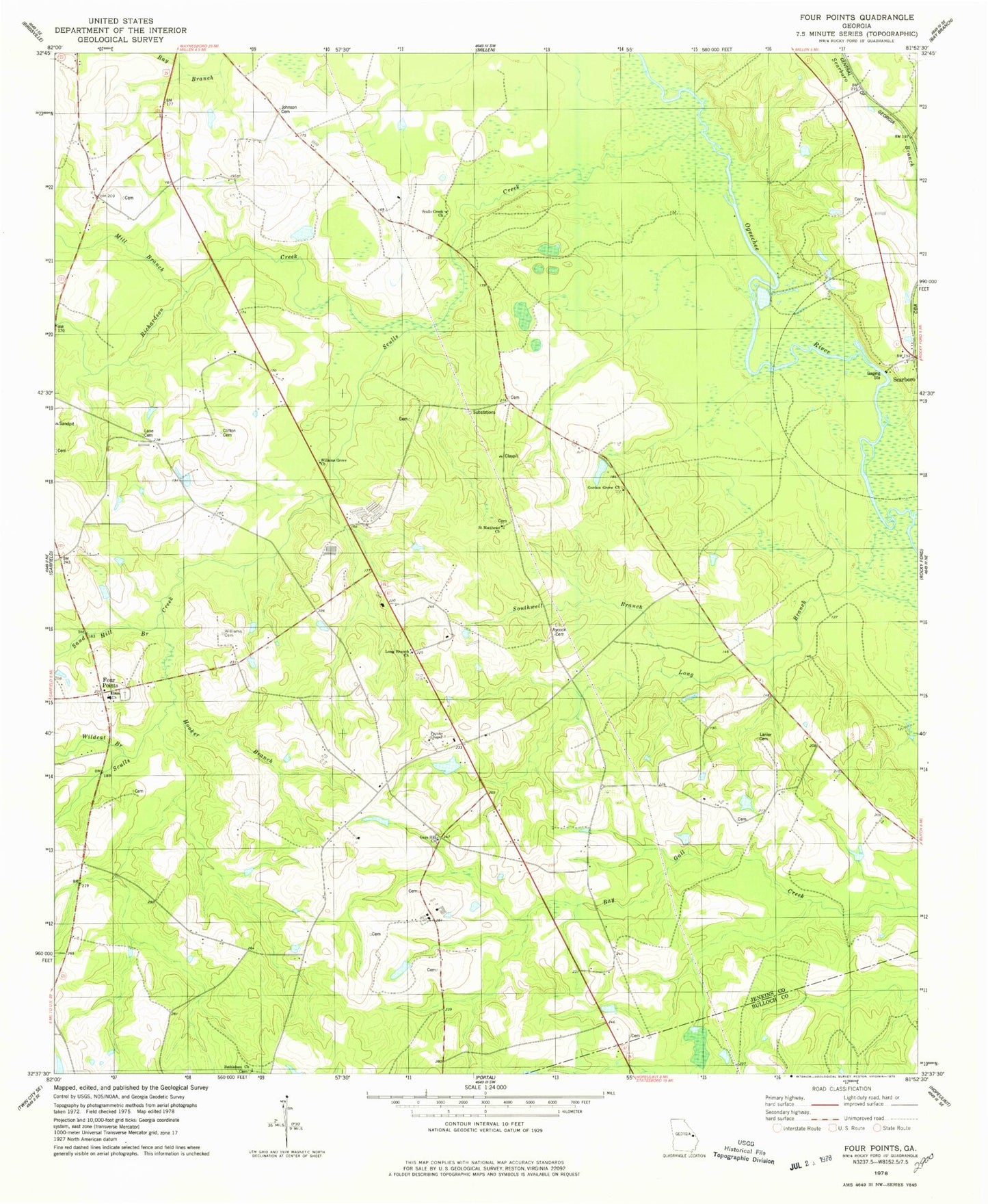
MyTopo
Classic USGS Four Points Georgia 7.5'x7.5' Topo Map
Couldn't load pickup availability
Historical USGS topographic quad map of Four Points in the state of Georgia. Map scale may vary for some years, but is generally around 1:24,000. Print size is approximately 24" x 27"
This quadrangle is in the following counties: Bulloch, Jenkins.
The map contains contour lines, roads, rivers, towns, and lakes. Printed on high-quality waterproof paper with UV fade-resistant inks, and shipped rolled.
Contains the following named places: Aycock Cemetery, Bethlehem Church, Clifton Cemetery, Elam Church, Four Points, Gays Hill Church, Gordon Grove Church, Gordons School, Hooker Branch, Lane Cemetery, Lanier Cemetery, Long Branch Church, Long Branch School, Milburne Lake, Milburne Lake Dam, Mill Branch, Mount Carmel Church, Newton Lake, Newton Lake Dam, Paynes Chapel, Paynes Chapel Cemetery, Richardson Creek, Rooty Branch School, Saint Matthews Church, Sand Hill Branch, Scarboro, Scarboro Branch, Sculls Creek, Sculls Creek Church, Southwell Branch, Wildcat Branch, Williams Cemetery, Williams Grove Church