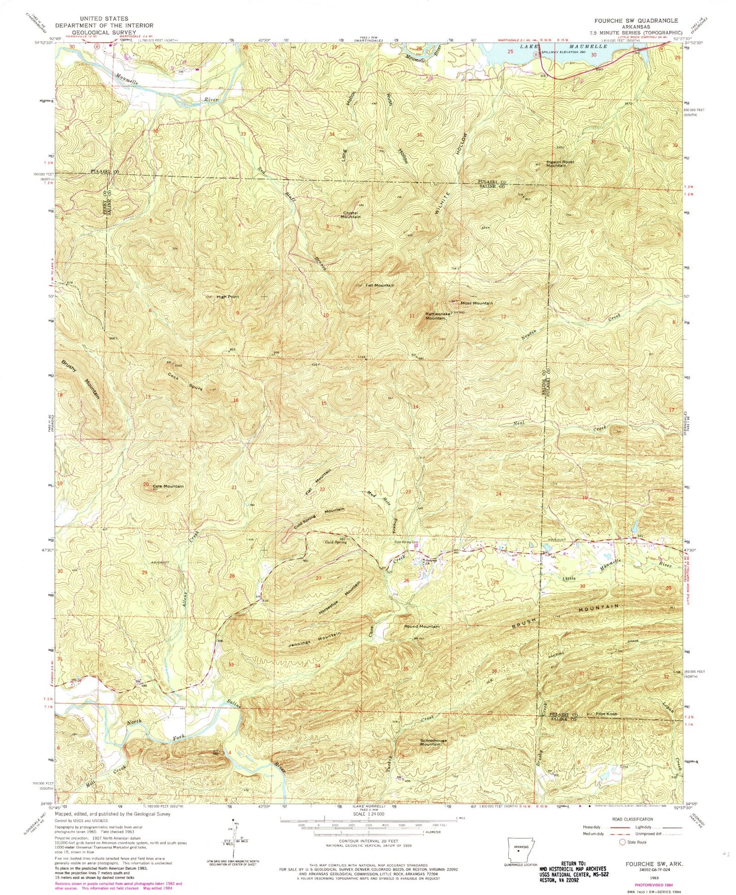
MyTopo
Classic USGS Fourche SW Arkansas 7.5'x7.5' Topo Map
Couldn't load pickup availability
Historical USGS topographic quad map of Fourche SW in the state of Arkansas. Map scale may vary for some years, but is generally around 1:24,000. Print size is approximately 24" x 27"
This quadrangle is in the following counties: Perry, Pulaski, Saline.
The map contains contour lines, roads, rivers, towns, and lakes. Printed on high-quality waterproof paper with UV fade-resistant inks, and shipped rolled.
Contains the following named places: Allens Creek, Bringle Creek, Brush Mountain, Cave Creek, Cock Spurs, Cold Spring, Cold Spring Cemetery, Cold Spring Mountain, Cold Springs, Cole Mountain, Crystal Mountain, Fall Mountain, Ferguson Ranch, Flat Mountain, High Point, Horseshoe Mountain, Jennings Mountain, Mill Creek, Moss Mountain, Mud Hole Branch, Patterson Branch, Pigeon Roost Mountain, Pilot Knob, Rattlesnake Mountain, Red Bluff Branch, Round Mountain, Rush Hollow, Schoolhouse Mountain, Smyrna Church, Vista Park, West Union School, Wilford Peak, Wilhite Branch, Wilhite Hollow