MyTopo
Classic USGS Fourche Arkansas 7.5'x7.5' Topo Map
Couldn't load pickup availability
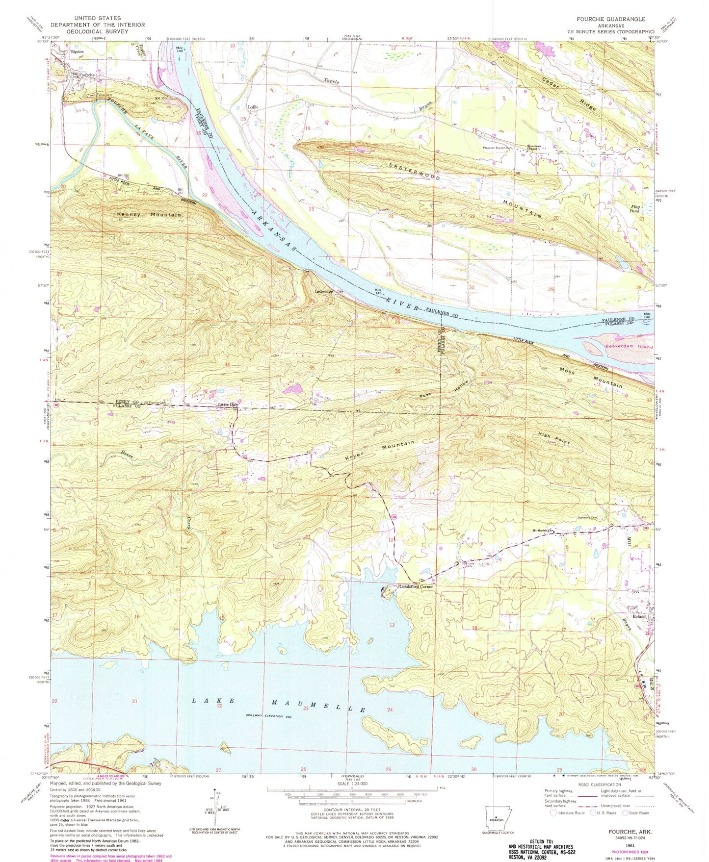
Historical USGS topographic quad map of Fourche in the state of Arkansas. Typical map scale is 1:24,000, but may vary for certain years, if available. Print size: 24" x 27"
This quadrangle is in the following counties: Faulkner, Perry, Pulaski.
The map contains contour lines, roads, rivers, towns, and lakes. Printed on high-quality waterproof paper with UV fade-resistant inks, and shipped rolled.
Contains the following named places: Easterwood Mountain, Faisst Cemetery, Fourche, Kennerly Cemetery, Kenney Mountain, Kryer Mountain, Little Italy, Moss Mountain, Mount Moriah Church, Pleasant Branch Cemetery, Rainey Cemetery, Reece Creek, Ross Hollow, Saint Francis Cemetery, Taylor Creek, Troutman Chapel, Ledwidge, Lundsford Corner, High Point, Lawson Ferry (historical), Providence Church (historical), Kenney (historical), Ledwidge School (historical), Township of Ledwidge (historical), Township of Benedict, Dead Horse Branch, Jolly Roger Landing, Open Pond (historical), Stillhouse Branch, Township of Wye, Lake Maumelle, Lollie School (historical), Providence (historical), Fourche LaFave River, Lollie, Tupelo Bayou, Twin Creek, Pleasant Branch Church (historical), Browns Lake Dam, Browns Lake, Wisley Lake Dam, Wisley Lake, Campbell Lake Dam, The Campbells Lake, Stevens Lake Dam, Stevens Lake, Roland Post Office, West Pulaski Fire Department Station 4, Town of Fourche, Roland Census Designated Place