
MyTopo
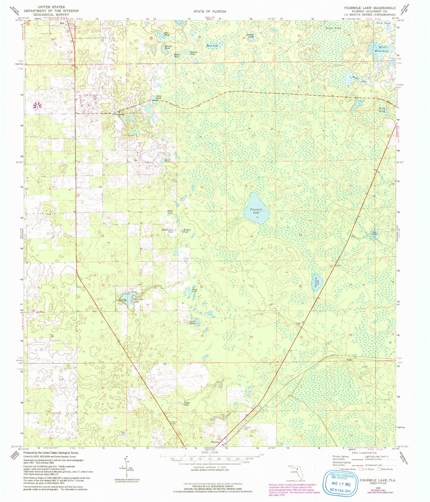
Classic USGS Fourmile Lake Florida 7.5'x7.5' Topo Map
Couldn't load pickup availability
Historical USGS topographic quad map of Fourmile Lake in the state of Florida. Map scale may vary for some years, but is generally around 1:24,000. Print size is approximately 24" x 27"
This quadrangle is in the following counties: Gilchrist.
The map contains contour lines, roads, rivers, towns, and lakes. Printed on high-quality waterproof paper with UV fade-resistant inks, and shipped rolled.
Contains the following named places: Bird Pond, Black Lake, Bonnet Pond, Bright Lake, Buttonwood Pond, Cannon Pond, Flying Harness Farms Airport, Fourmile Lake, Gator Pond, Gilchrist County, Gilchrist County Emergency Medical Services Medic 2, Gilchrist County Lookout Tower, Goose Pond, Grass Pond, Jennings Lake, Jennings Lake Church, Joppa Cemetery, Joppa Lake, Lee Lake, Mill Pond, Morgan Pond, Mutual, Negro Pond, Pleasant Hill Church, Sapp Lake, Saw Whet Farms Airport, Threemile Lake, Trenton Cemetery, Trenton Division, Tyler, Waccasassa Flats, Wash Pond, Watson Flight Strip, Weeks Lake, Weeks Waterhole, Yard Pond, ZIP Code: 32693


