MyTopo
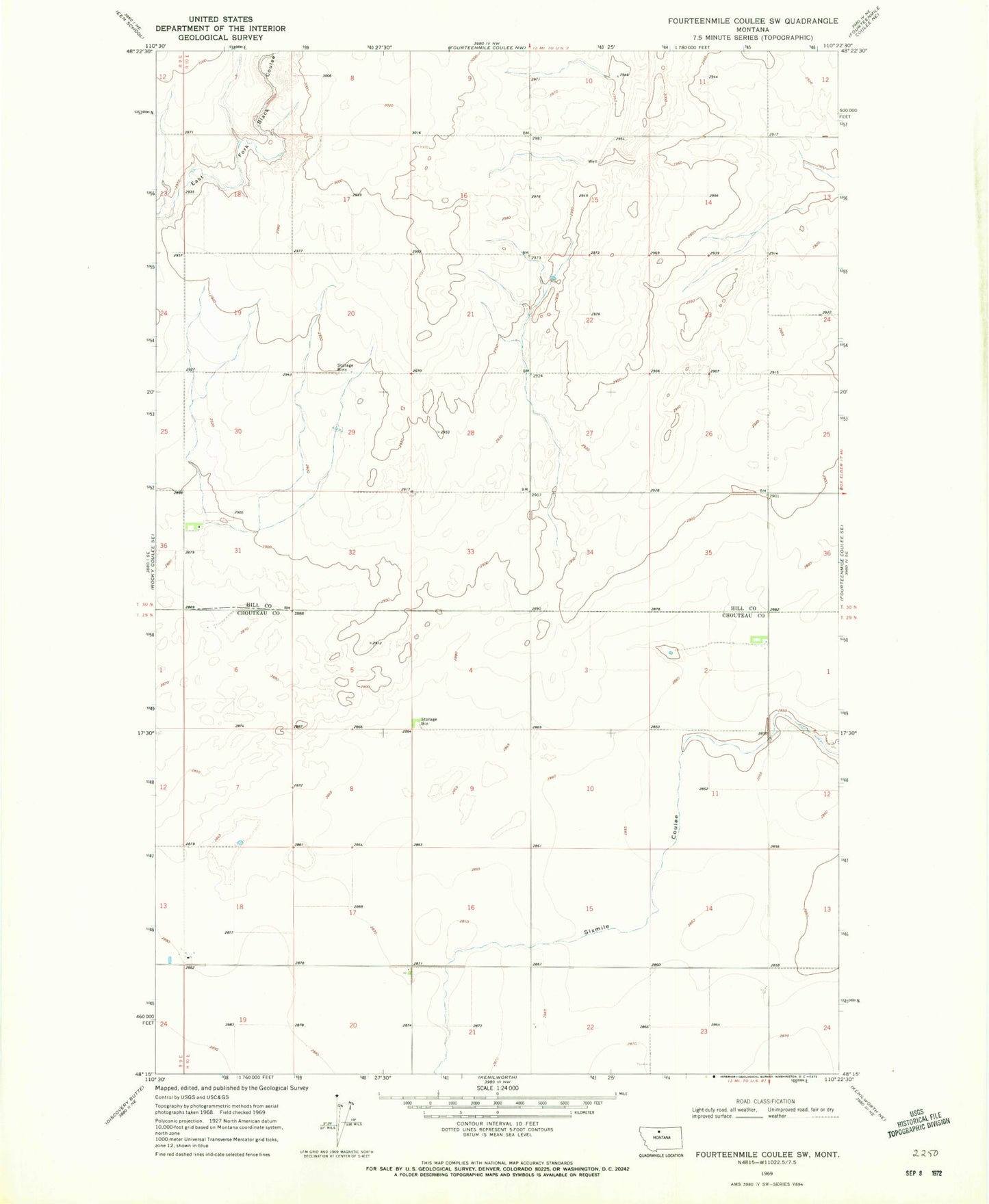
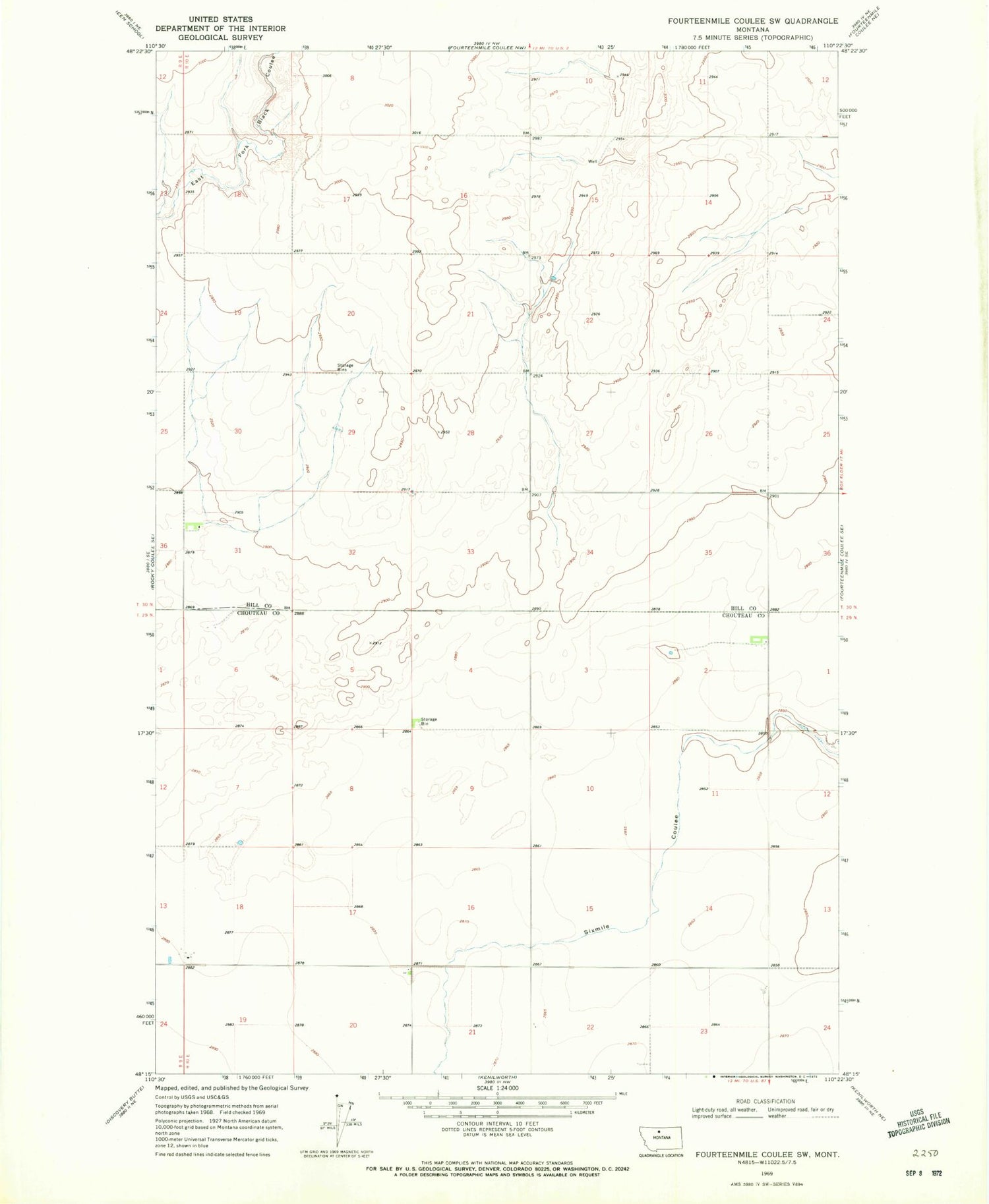
Classic USGS Fourteenmile Coulee SW Montana 7.5'x7.5' Topo Map
Couldn't load pickup availability
Historical USGS topographic quad map of Fourteenmile Coulee SW in the state of Montana. Map scale may vary for some years, but is generally around 1:24,000. Print size is approximately 24" x 27"
This quadrangle is in the following counties: Chouteau, Hill.
The map contains contour lines, roads, rivers, towns, and lakes. Printed on high-quality waterproof paper with UV fade-resistant inks, and shipped rolled.
Contains the following named places: 29N10E01CD__01 Well, 29N10E02AD__01 Well, 29N10E18CC__01 Well, 29N10E18CC__02 Well, 29N10E18CCDB01 Well, 29N10E20AA__01 Well, 29N10E22BC__01 Well, 29N10E22DD__01 Well, 29N10E23AA__01 Well, 29N10E23AADA01 Well, 30N10E29AB__01 Well, Prairie City Post Office, Prairie City School