MyTopo
Classic USGS Fowler Coulee NW Montana 7.5'x7.5' Topo Map
Regular price
$16.95
Regular price
Sale price
$16.95
Unit price
per
Couldn't load pickup availability
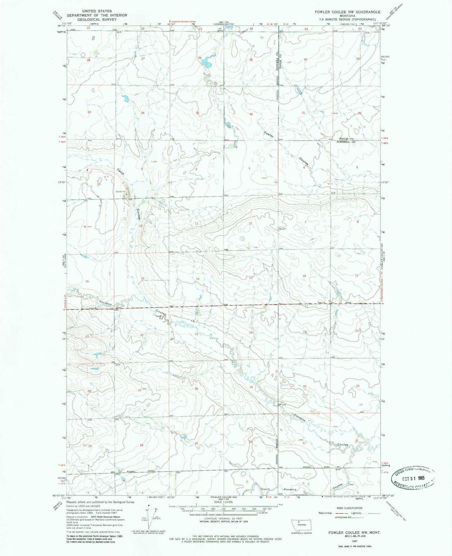
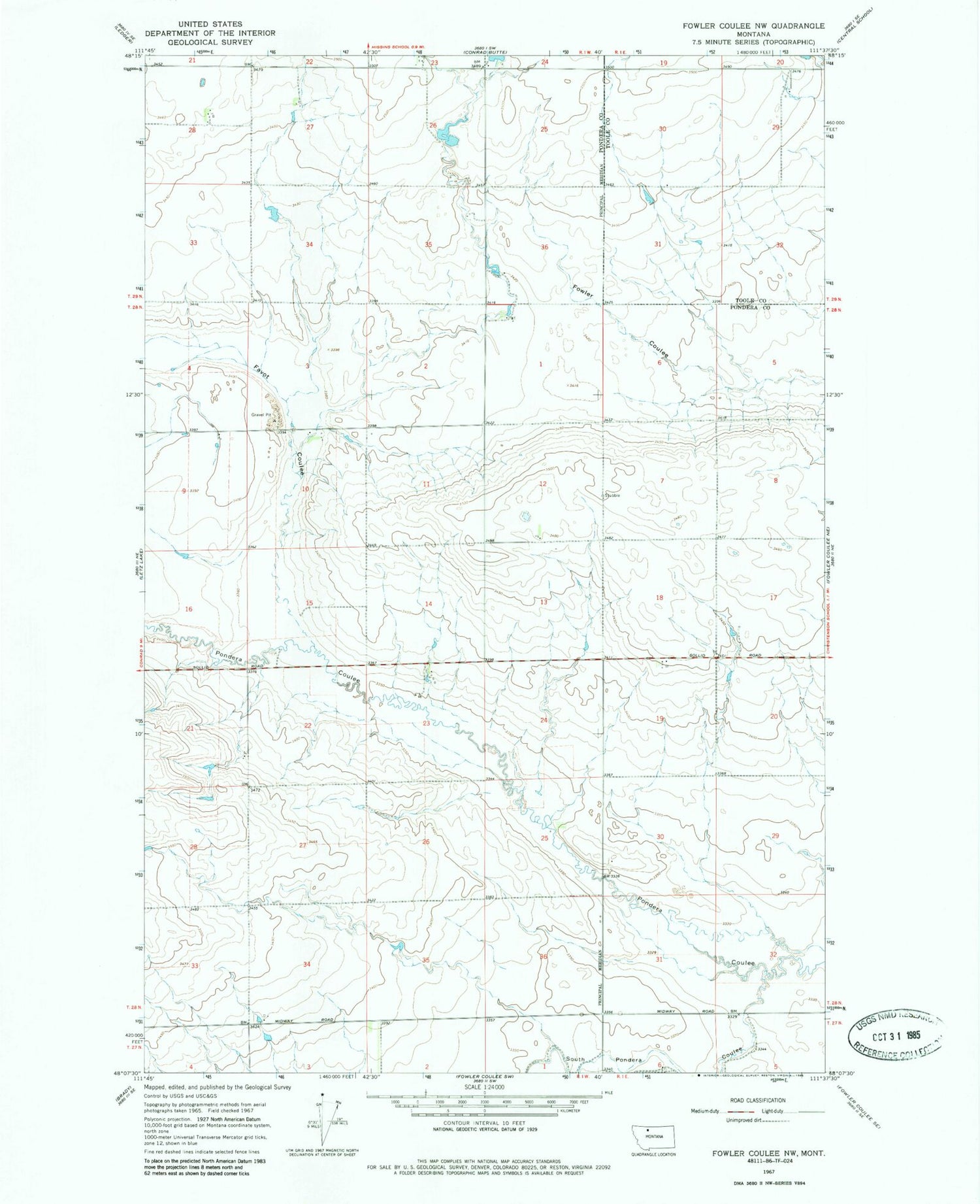
Historical USGS topographic quad map of Fowler Coulee NW in the state of Montana. Map scale may vary for some years, but is generally around 1:24,000. Print size is approximately 24" x 27"
This quadrangle is in the following counties: Pondera, Toole.
The map contains contour lines, roads, rivers, towns, and lakes. Printed on high-quality waterproof paper with UV fade-resistant inks, and shipped rolled.
Contains the following named places: 28N01W36ADBC01 Well, Berens Coulee, Bergstroms Farms Dam, Bergstroms Farms Number 2 Dam, Bird Coulee, Dato Dam, Favot Coulee, Freebury Coulee, Gibbons Coulee, Harold Phillips Dam, M Ratzburg Dam, Miller Coulee, South Pondera Coulee, Wilkcox Coulee