MyTopo
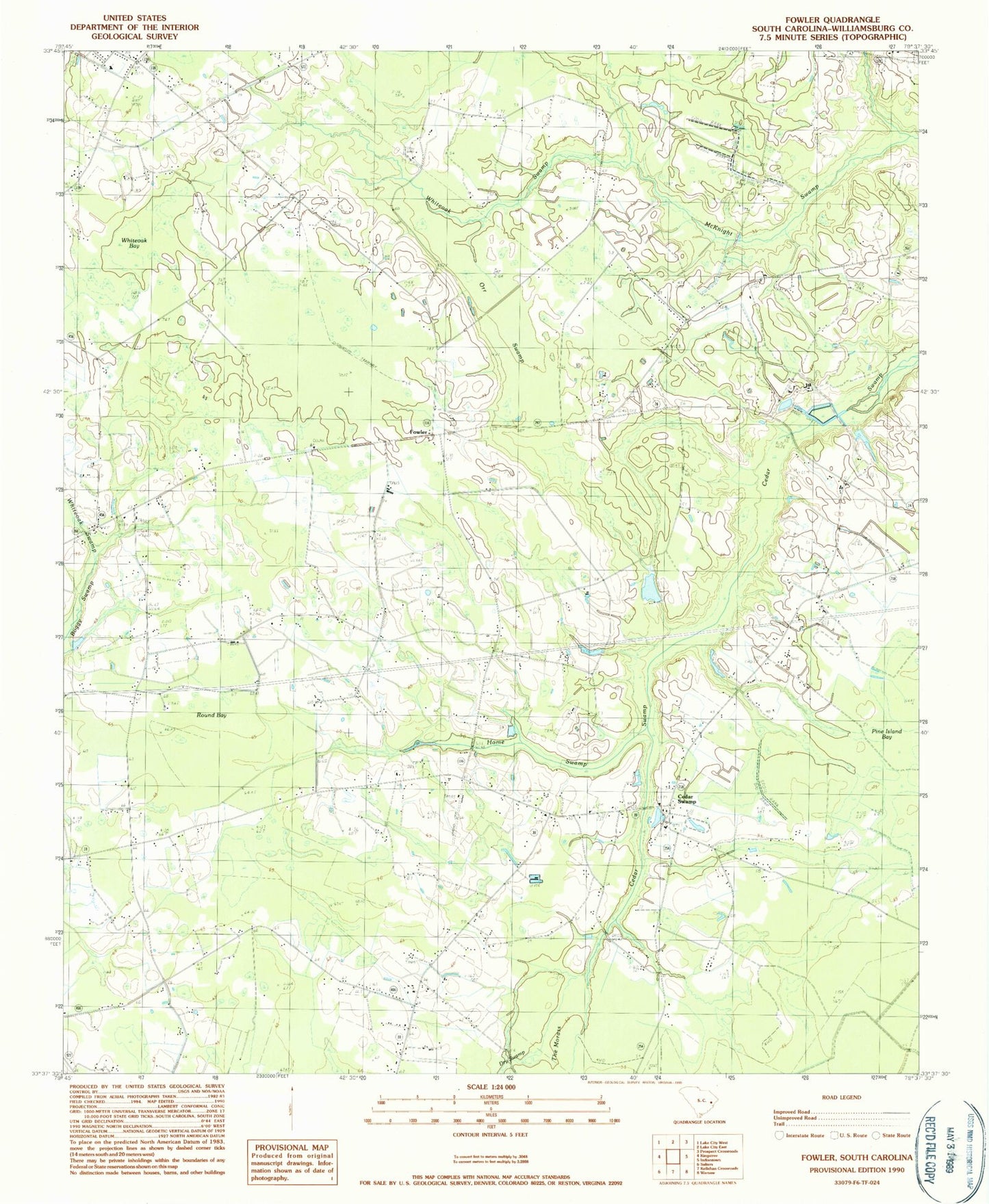
Classic USGS Fowler South Carolina 7.5'x7.5' Topo Map
Couldn't load pickup availability
Historical USGS topographic quad map of Fowler in the state of South Carolina. Map scale may vary for some years, but is generally around 1:24,000. Print size is approximately 24" x 27"
This quadrangle is in the following counties: Williamsburg.
The map contains contour lines, roads, rivers, towns, and lakes. Printed on high-quality waterproof paper with UV fade-resistant inks, and shipped rolled.
Contains the following named places: Beulah Church, Beulah School, Cedar Grove Church, Cedar Swamp, Cedar Swamp Baptist Church, Cedar Swamp Cemetery, Cedar Swamp Methodist Church, Cedar Swamp School, Cooper Fire Tower, Dry Swamp, Elijah Church, Fowler, Fowler School, Hickory Hill Church, Hickory Hill School, Home Swamp, Inglenook School, Jack McGill Pond, Kennedyville Church, King School, McCants Bay, Orr Swamp, Pine Island Bay, Round Bay, Saint James Church, Saint Luke Church, Saint Michael Church, Saint Michael School, Saint Paul Church, Saint Pauls Church, South Carolina Noname 45004 D-3094 Dam, Spring Branch School, Whiteoak Bay, Whiteoak Swamp, Williamsburg County Fire Department Station 3