MyTopo
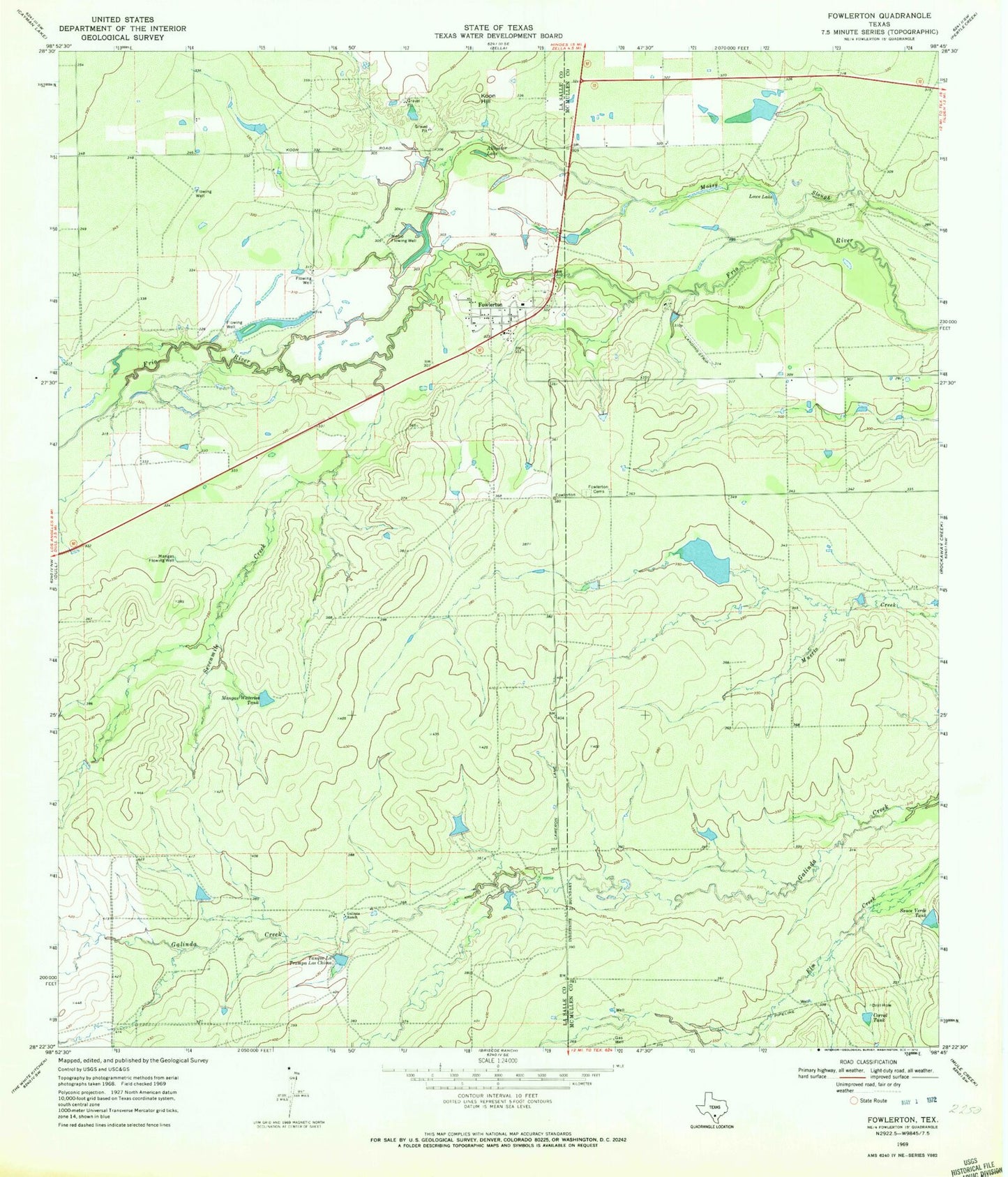
Classic USGS Fowlerton Texas 7.5'x7.5' Topo Map
Couldn't load pickup availability
Historical USGS topographic quad map of Fowlerton in the state of Texas. Map scale may vary for some years, but is generally around 1:24,000. Print size is approximately 24" x 27"
This quadrangle is in the following counties: La Salle, McMullen.
The map contains contour lines, roads, rivers, towns, and lakes. Printed on high-quality waterproof paper with UV fade-resistant inks, and shipped rolled.
Contains the following named places: Alligator Lake, Corral Tank, Fowlerton, Fowlerton Cemeteries, Fowlerton Census Designated Place, Fowlerton Post Office, Galinda Ranch, Koon Hill, Lowe Lake, Mangas Flowing Well, Mangas Waterlot Tank, Medio Flowing Well, Miller Dam, Miller Lake, Montgomery Lake, Montgomery Lake Dam, Morton Lake, Morton Lake Dam, Sauce Verde Tank, Sevenmile Creek, Tanque La Trampa Los Chivos, ZIP Code: 78021