MyTopo
Classic USGS Fowlerville Michigan 7.5'x7.5' Topo Map
Couldn't load pickup availability
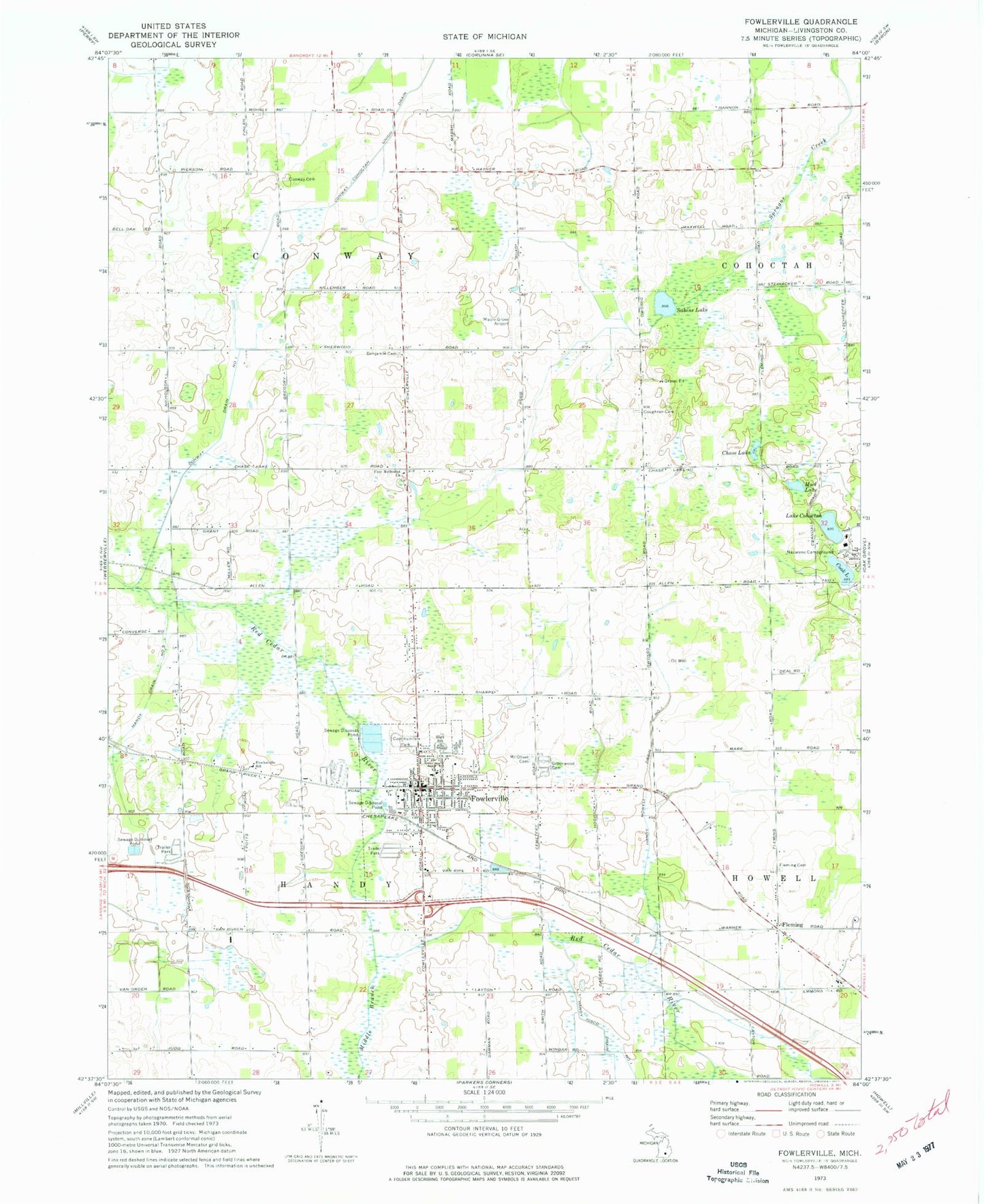
Historical USGS topographic quad map of Fowlerville in the state of Michigan. Map scale may vary for some years, but is generally around 1:24,000. Print size is approximately 24" x 27"
This quadrangle is in the following counties: Livingston.
The map contains contour lines, roads, rivers, towns, and lakes. Printed on high-quality waterproof paper with UV fade-resistant inks, and shipped rolled.
Contains the following named places: Alan's Mobile Home Park, Cedar River Estates Mobile Home Park, Chase Lake, Conway Benjamin Cemetery, Conway Drain Number 1, Conway Klein Cemetery, Cook Lake, Coughran Cemetery, First Baptist Church, First Church of the Nazarene, First United Methodist Church, Fleming, Fleming Post Office, Fowlerville, Fowlerville Area Fire Department, Fowlerville Christian School, Fowlerville Community Park, Fowlerville Fairgrounds, Fowlerville High School, Fowlerville Junior High School, Fowlerville Police Department, Fowlerville Post Office, Fowlerville Station, Fowlerville Village Hall, Free Methodist Church, Grand Shire Estates Mobile Home Park, Greenwood Cemetery, Handy Drain Number 5, Handy Howell Drain Number 1, Howell School District Number Five Schoolhouse Historical Marker, Kreeger Elementary School, Lake Cohoctah, Livingston Centre Historical Museum, Maple Grove Airport, McAuley-McPherson Family Care Center, Middle Branch Red Cedar River, Mount Olivet Cemetery, Mud Lake, Munn Middle School, Nazarene Campground, Sabine Lake, Saint Agnes Church, Saint John Lutheran Church, Smith Elementary School, Township of Conway, Township of Handy, United Brethren in Christ Church, Village of Fowlerville, West Howell Cemetery, ZIP Code: 48836