
MyTopo
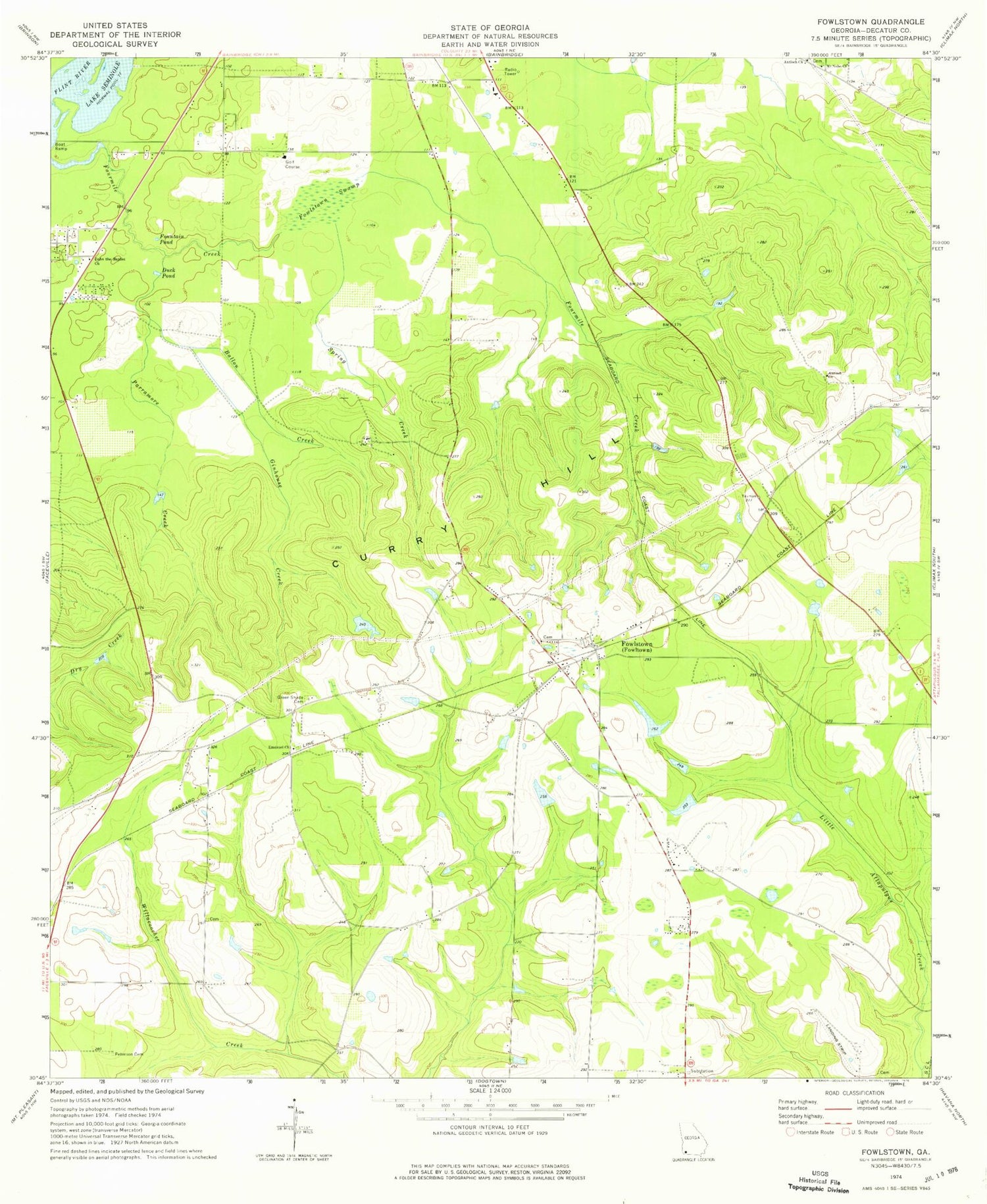
Classic USGS Fowlstown Georgia 7.5'x7.5' Topo Map
Couldn't load pickup availability
Historical USGS topographic quad map of Fowlstown in the state of Georgia. Map scale may vary for some years, but is generally around 1:24,000. Print size is approximately 24" x 27"
This quadrangle is in the following counties: Decatur.
The map contains contour lines, roads, rivers, towns, and lakes. Printed on high-quality waterproof paper with UV fade-resistant inks, and shipped rolled.
Contains the following named places: 97 South Volunteer Fire Department, Antioch Church, Ballou Creek, Christ Memorial Church, Davis Lake, Davis Lake Dam, Decatur County Fire Department and Rescue Station 245, Duck Pond, Emanuel Church, Emanuel Church Cemetery, Fountain Pond, Fourmile Creek, Fowlstown, Fowlstown Post Office, Fowlstown Swamp, Ginhouse Creek, Green Shade Cemetery, John the Baptist Church, Mount Nebo Church, Mount Nebo Church Cemetery, Parramore Creek, Peterson Cemetery, Rich Lake, Rich Lake Dam, Saint Joseph Church, Saint Paul Church, Spring Creek


