MyTopo
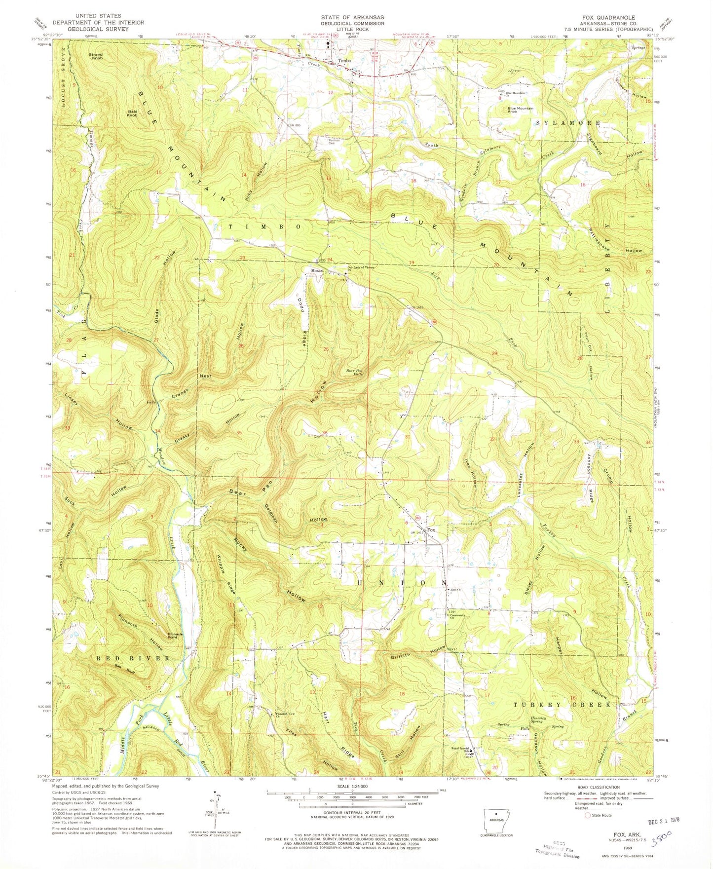
Classic USGS Fox Arkansas 7.5'x7.5' Topo Map
Couldn't load pickup availability
Historical USGS topographic quad map of Fox in the state of Arkansas. Map scale may vary for some years, but is generally around 1:24,000. Print size is approximately 24" x 27"
This quadrangle is in the following counties: Stone.
The map contains contour lines, roads, rivers, towns, and lakes. Printed on high-quality waterproof paper with UV fade-resistant inks, and shipped rolled.
Contains the following named places: Arlberg Arch, Bald Knob, Bear Pen Falls, Bear Pen Hollow, Bee Bluff, Blue Mountain Church, Blue Mountain Knob, Community Church, Cranes Nest Hollow, Crouch Lake, Crouch Lake Dam, Crump Hollow, Dodd Ridge, Fox, Fox Census Designated Place, Fox Fire Department Station 2, Fox Fire Department Station 3, Fox Fire Department Station 4, Fox Post Office, Gilmore Hollow, Glade Hollow, Goldman Hollow, Goodwin Branch, Grassy Hollow, Griffin Hollow, Harper Hollow, Hart Ridge, Hinesley Spring, Ives Hollow, Jimmys Creek, Johnson Ridge, KEMV-TV (Mountain View), Lancaster Hollow, Levi Hollow, Linsey Hollow, Meadow Creek, Mozart, Our Lady of Victory Church, Pinnacle Hollow, Pinnacle Point, Pleasant View Church, Pour Off Hollow, Ramsey Cemetery, Rattlesnake Hollow, Roby Hollow, Rocky Hollow, Rural Special Elementary School, Rural Special High School, Sibley Hollow, Signboard Hollow, Still Hollow, Strand Knob, Suck Hollow, Tick Creek, Timbo, Timbo Creek, Timbo Elementary School, Timbo Post Office, Township of Timbo, Township of Union, Whipple Ridge, Zion Baptist Church, ZIP Code: 72051