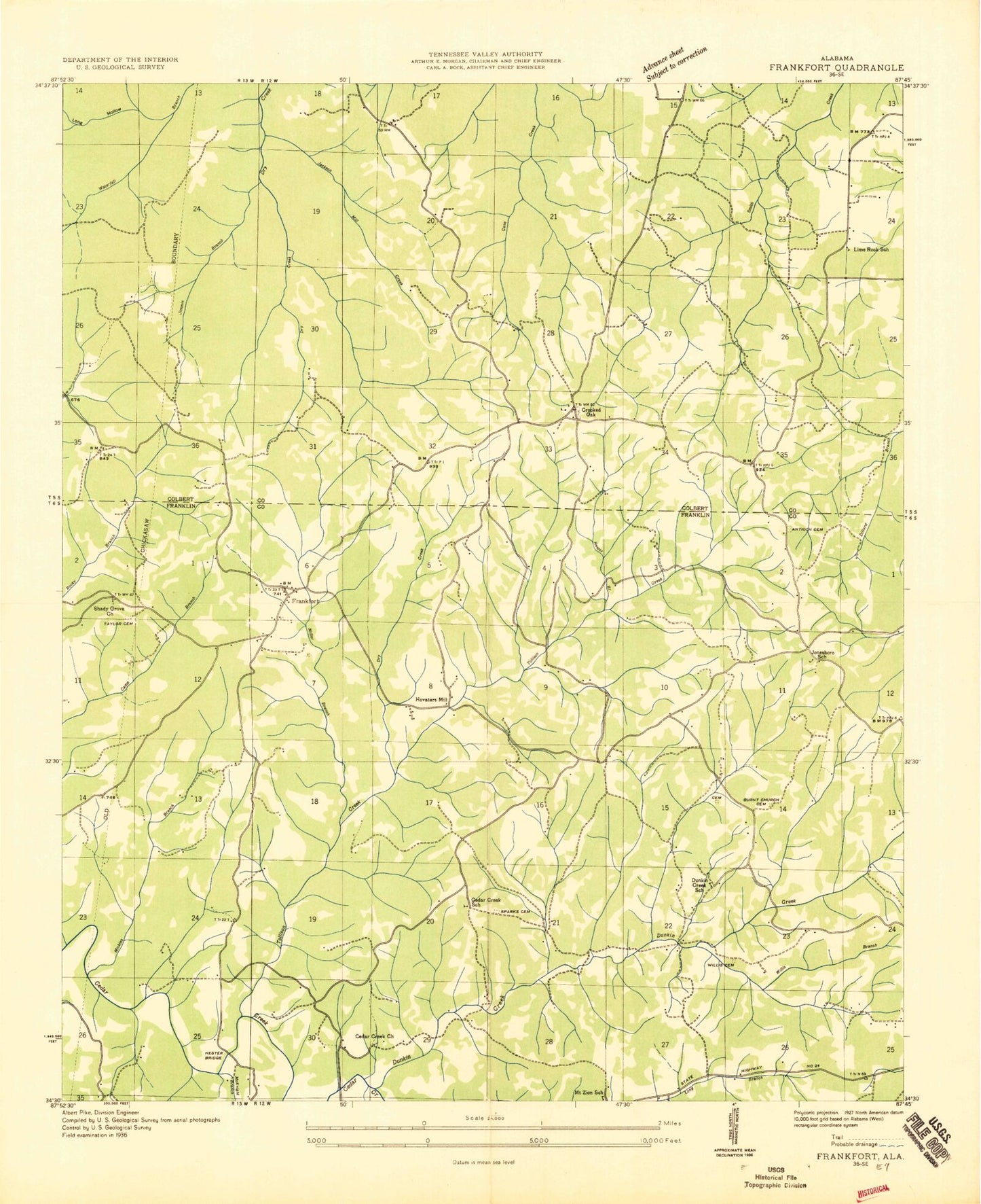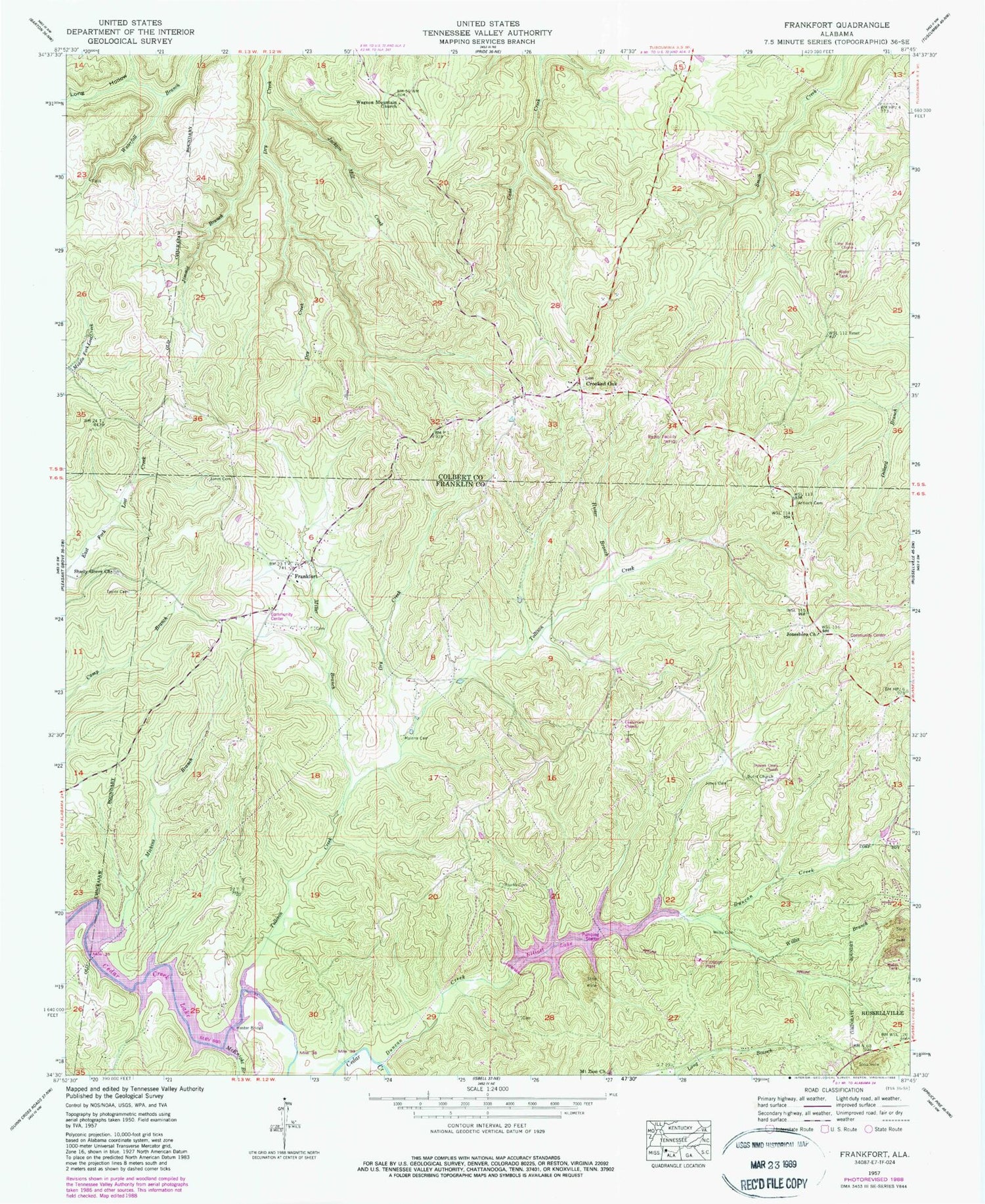

MyTopo
Classic USGS Frankfort Alabama 7.5'x7.5' Topo Map
Couldn't load pickup availability
Historical USGS topographic quad map of Frankfort in the state of Alabama. Typical map scale is 1:24,000, but may vary for certain years, if available. Print size: 24" x 27"
This quadrangle is in the following counties: Colbert, Franklin.
The map contains contour lines, roads, rivers, towns, and lakes. Printed on high-quality waterproof paper with UV fade-resistant inks, and shipped rolled.
Contains the following named places: Duncan Creek, Antioch Cemetery, Duncan Creek Cemetery, Cedar Creek Cumberland Presbyterian Church, Dry Creek, Dunkin Creek Church, Frankfort, Hester Branch, Hester Bridge, Jackson Mill Creek, Jimmie Branch, Jones Cemetery, Lime Rock School, Long Hollow, Malone Cemetery, McKnight Branch, Miller Branch, Sparks Cemetery, Taylor Cemetery, Tollison Creek, Wagnon Mountain Church, Willis Branch, Willis Cemetery, Elliott Lake Dam, Slosh Dam, Slosh Lake, Crooked Oak Missionary Baptist Church, Crooked Oak School (historical), Little Israel Christian Ranch, Waterfall Valley Conservation Club, Cedar Creek School (historical), Centerview Church, Old Frankfort Cemetery, Hester - James Cemetery, Jonesboro, Jonesboro Cemetery, Jonesboro Community Center, Jonesboro School (historical), Mount Zion School (historical), Shady Grove Cemetery, Frankfort Junior High School, Dunkin Creek School (historical), Hovaters Mill (historical), Jones Cemetery, Jonesboro Baptist Church, Mickins Branch, Mount Zion Church, Russellville Reservoir, Shady Grove Church of Christ, Charity Chapel Church, Limerock Church, Dunkin Creek Baptist Church, Crooked Oak, WFIQ-TV (Florence), WOWL-TV (Florence), WTUK-TV (Florence), Sand Lick (historical), Sand Lick Post Office (historical), Frankfort Volunteer Fire Department