MyTopo
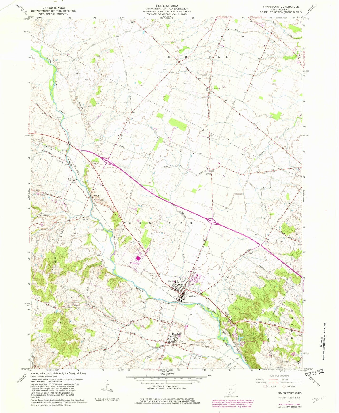
Classic USGS Frankfort Ohio 7.5'x7.5' Topo Map
Couldn't load pickup availability
Historical USGS topographic quad map of Frankfort in the state of Ohio. Map scale may vary for some years, but is generally around 1:24,000. Print size is approximately 24" x 27"
This quadrangle is in the following counties: Ross.
The map contains contour lines, roads, rivers, towns, and lakes. Printed on high-quality waterproof paper with UV fade-resistant inks, and shipped rolled.
Contains the following named places: Adena High School, Austin, Austin Chapel, Austin Post Office, Baptist Cemetery, Bethel School, Bowdle Farms, Clark Cemetery, Cline School, Concord Township Emergency Squad, Concord Township Fire Department, Corey Run, Dewey Creek, Dry Run, Egypt Church, Estel Chapel, Estell School, Fisher School, Fountain School, Frankfort, Frankfort Elementary School, Frankfort Post Office, Grassland Dairy, Greenland School, Greenlawn Cemetery, Herrod Creek, Lake Hill, Lake Hill Campground, Lake Hill Dam, Leffingwell School, Little Creek, Mallow Cemetery, Mallow School, McCortney Run, New Bethel Church, Noble School, Old Methodist Cemetery, Oldtown Run, Putnam Dairy Farm, Rowe Cemetery, Roxabell, Roxabell Post Office, Sanford School, Stader Cemetery, Township of Concord, Township of Deerfield, Village of Frankfort, Ware Cemetery, Wind Dreamer Farms, ZIP Codes: 43115, 45628