MyTopo
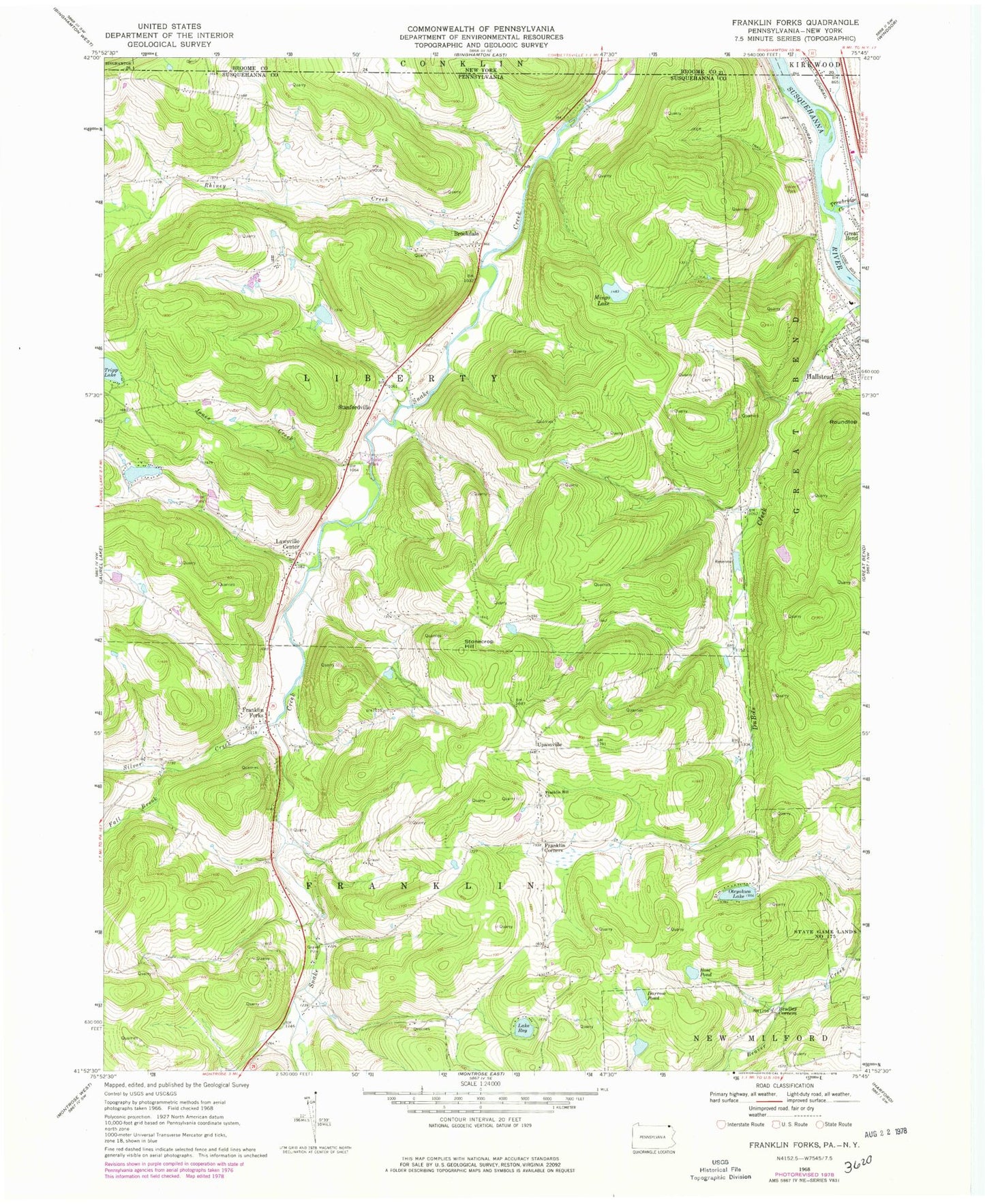
Classic USGS Franklin Forks Pennsylvania 7.5'x7.5' Topo Map
Couldn't load pickup availability
Historical USGS topographic quad map of Franklin Forks in the states of Pennsylvania, New York. Map scale may vary for some years, but is generally around 1:24,000. Print size is approximately 24" x 27"
This quadrangle is in the following counties: Broome, Susquehanna.
The map contains contour lines, roads, rivers, towns, and lakes. Printed on high-quality waterproof paper with UV fade-resistant inks, and shipped rolled.
Contains the following named places: Bel-Air Lake, Bel-Air Lake Dam, Blue Ridge Mobile Home Park, Bradley Corners, Brookdale, Darrow Pond, DuBois Creek Dam, DuBois Reservoir, Fall Brook, Fish School, Franklin Corners, Franklin Forks, Franklin Hill Church, Franklin Hill School, Jones Creek, Kirkwood Airpark, Lake Roy, Lawsville Center, Mingo Lake, Mingo Lake Dam, Oteyokwa Lake, Oteyokwa Lake Dam, Rhiney Creek, Rose Pond, Roundtop, Salt Springs, Salt Springs School, Salt Springs State Park, Silver Creek, Snake Creek Volunteer Fire Company, Snake Creek Volunteer Fire Company Station 2, Stanfordville, Stonecrop Hill, Township of Franklin, Township of Liberty, Tripp Lake, Trowbridge Creek, Upsonville, ZIP Code: 18822