MyTopo
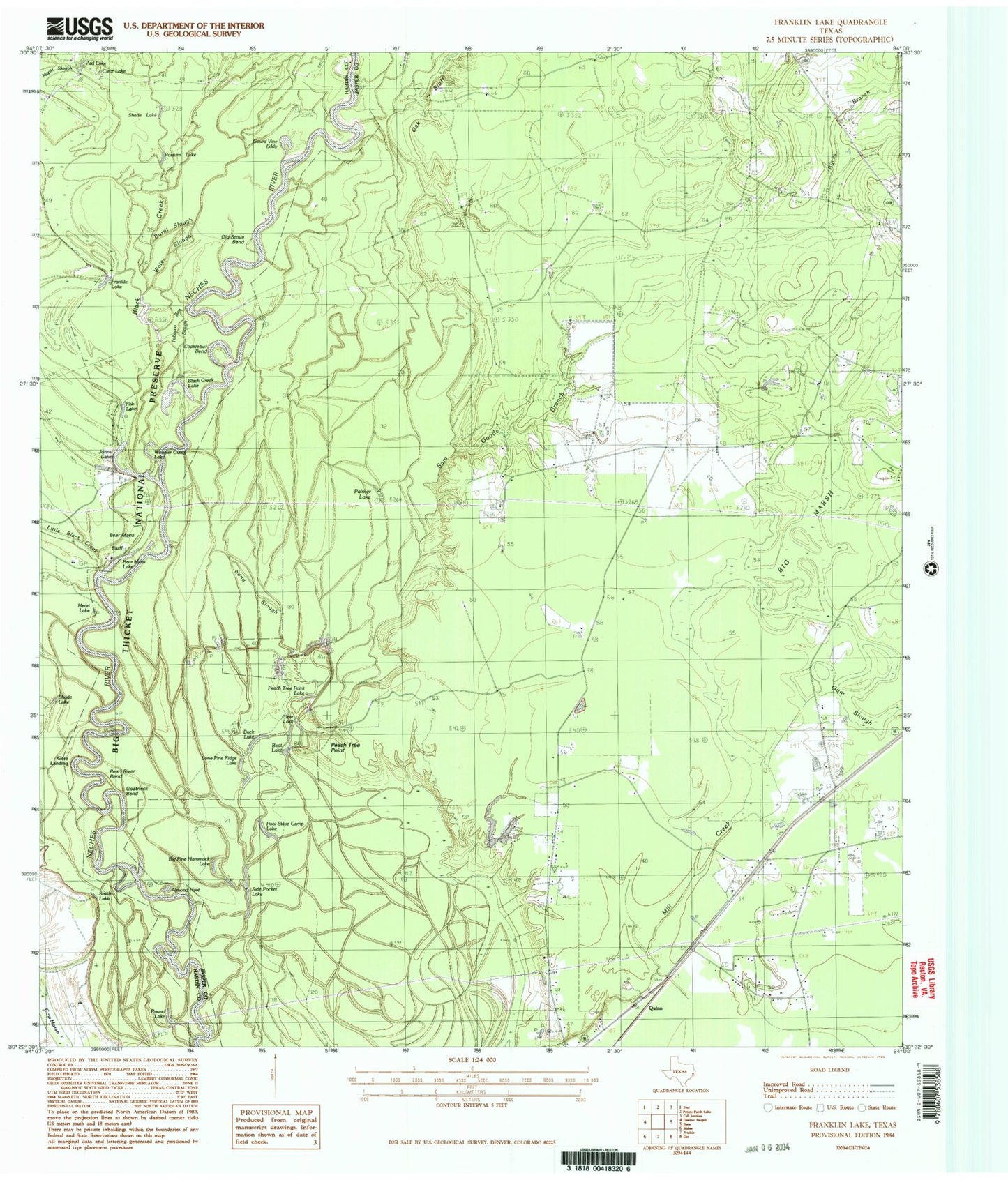
Classic USGS Franklin Lake Texas 7.5'x7.5' Topo Map
Couldn't load pickup availability
Historical USGS topographic quad map of Franklin Lake in the state of Texas. Map scale may vary for some years, but is generally around 1:24,000. Print size is approximately 24" x 27"
This quadrangle is in the following counties: Hardin, Jasper.
The map contains contour lines, roads, rivers, towns, and lakes. Printed on high-quality waterproof paper with UV fade-resistant inks, and shipped rolled.
Contains the following named places: Almond Hole, Antioch Church, Ard Lake, Bear Mans Bluff, Bear Mans Lake, Big Marsh, Big Pine Hammock Lake, Black Creek, Black Creek Lake, Boat Lake, Buck Lake, Bucks Branch, Burnt Slough, Clear Lake, Cocklebur Bend, Deep Slough, Fish Lake, Franklin Lake, Goatneck Bend, Gore Landing, Gourd Vine Eddy, Gum Slough, Heart Lake, Johns Lake, Little Black Creek, Lone Pine Ridge Lake, Oak Bluff, Old Stove Bend, Palmer Lake, Peach Tree Point, Peach Tree Point Lake, Pearl River Bend, Pool Stave Camp Lake, Possum Lake, Quinn, Round Lake, Sam Goode Branch, Sand Slough, Shade Lake, Side Pocket Lake, Smith Lake, South Mill Creek Church, Water Slough, Wheeler Cutoff Lake