MyTopo
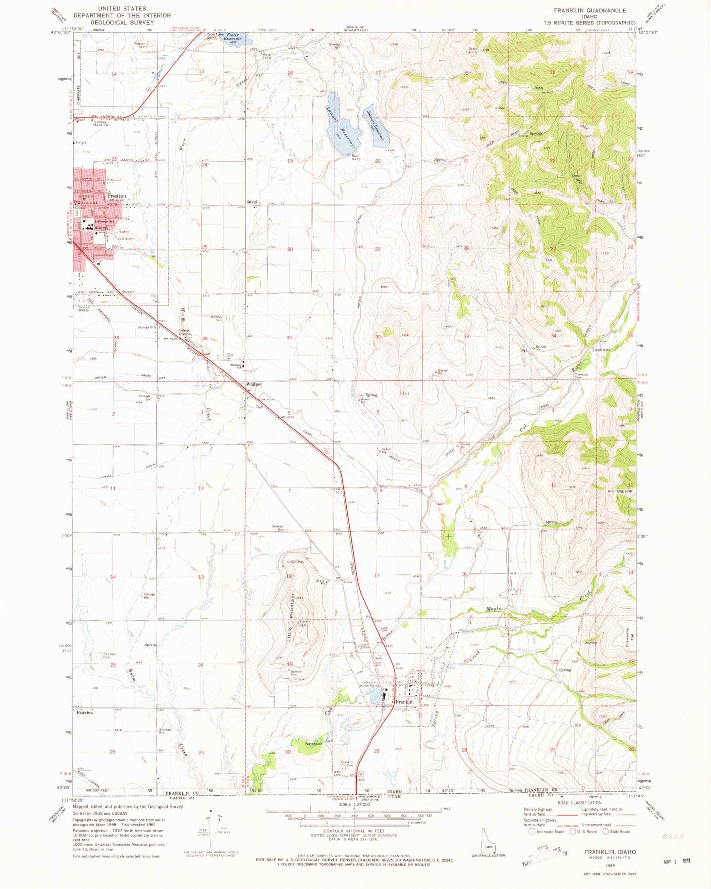
Classic USGS Franklin Idaho 7.5'x7.5' Topo Map
Couldn't load pickup availability
Historical USGS topographic quad map of Franklin in the state of Idaho. Map scale may vary for some years, but is generally around 1:24,000. Print size is approximately 24" x 27"
This quadrangle is in the following counties: Franklin.
The map contains contour lines, roads, rivers, towns, and lakes. Printed on high-quality waterproof paper with UV fade-resistant inks, and shipped rolled.
Contains the following named places: Big Hill, Central School, City of Franklin, Cub Canal, Deep Creek, Egypt, Fairview Cemetery, Foster Dam, Foster Reservoir Access Area, Franklin, Franklin Cemetery, Franklin County Medical Center, Franklin Post Office, Hinkley Dam, Jefferson Junior High School, Jefferson School, Johnson Dam, Johnson Reservoir, Lamont Dam, Lamont Reservoir, Le Fevre Dam, Little Mountain, Maple Creek, Middle Ditch, Nashville, Oakwood Elementary School, Pioneer Elementary School, Preston Cemetery, Preston High School, Van Orden Dam, Whitney, Whitney Cemetery, Whitney School, ZIP Code: 83237