


MyTopo
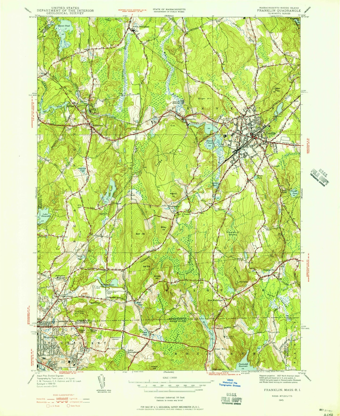
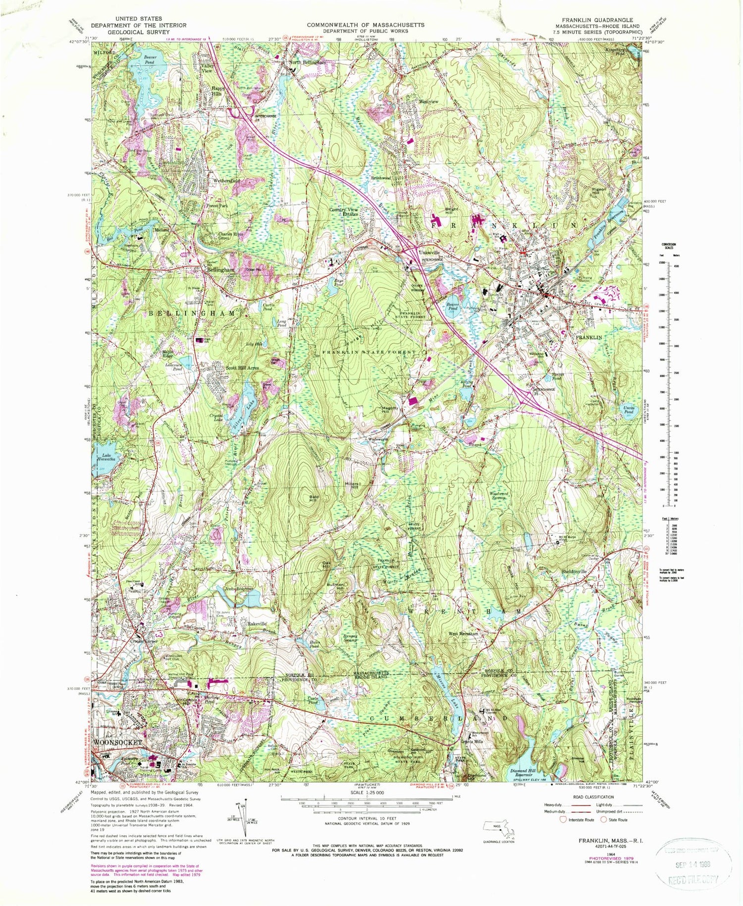
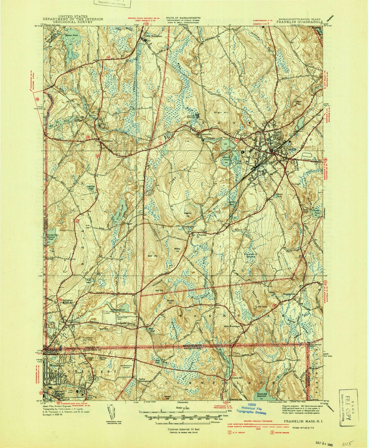
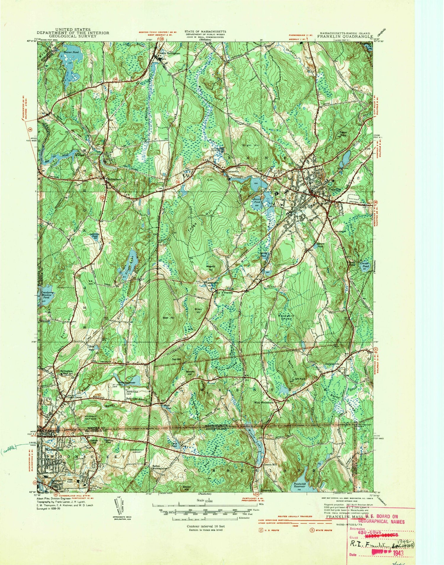
Classic USGS Franklin Massachusetts 7.5'x7.5' Topo Map
Couldn't load pickup availability
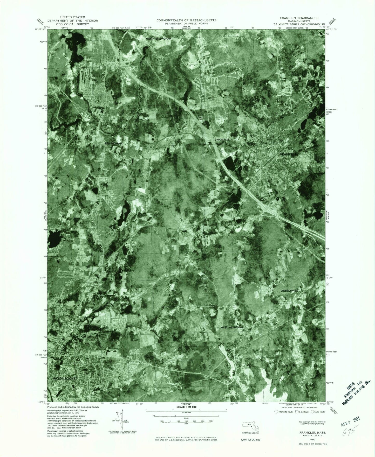
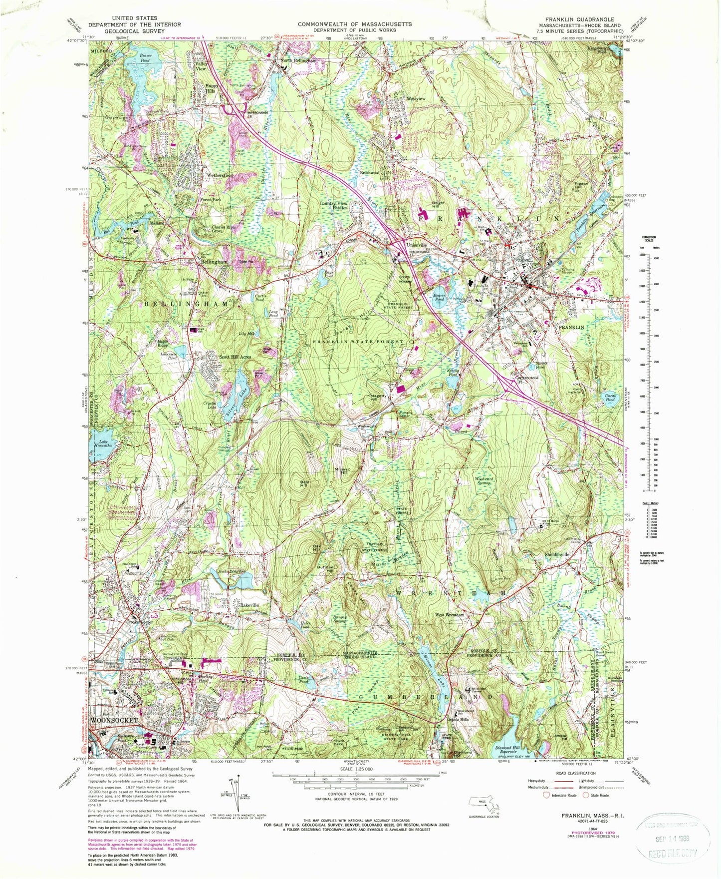
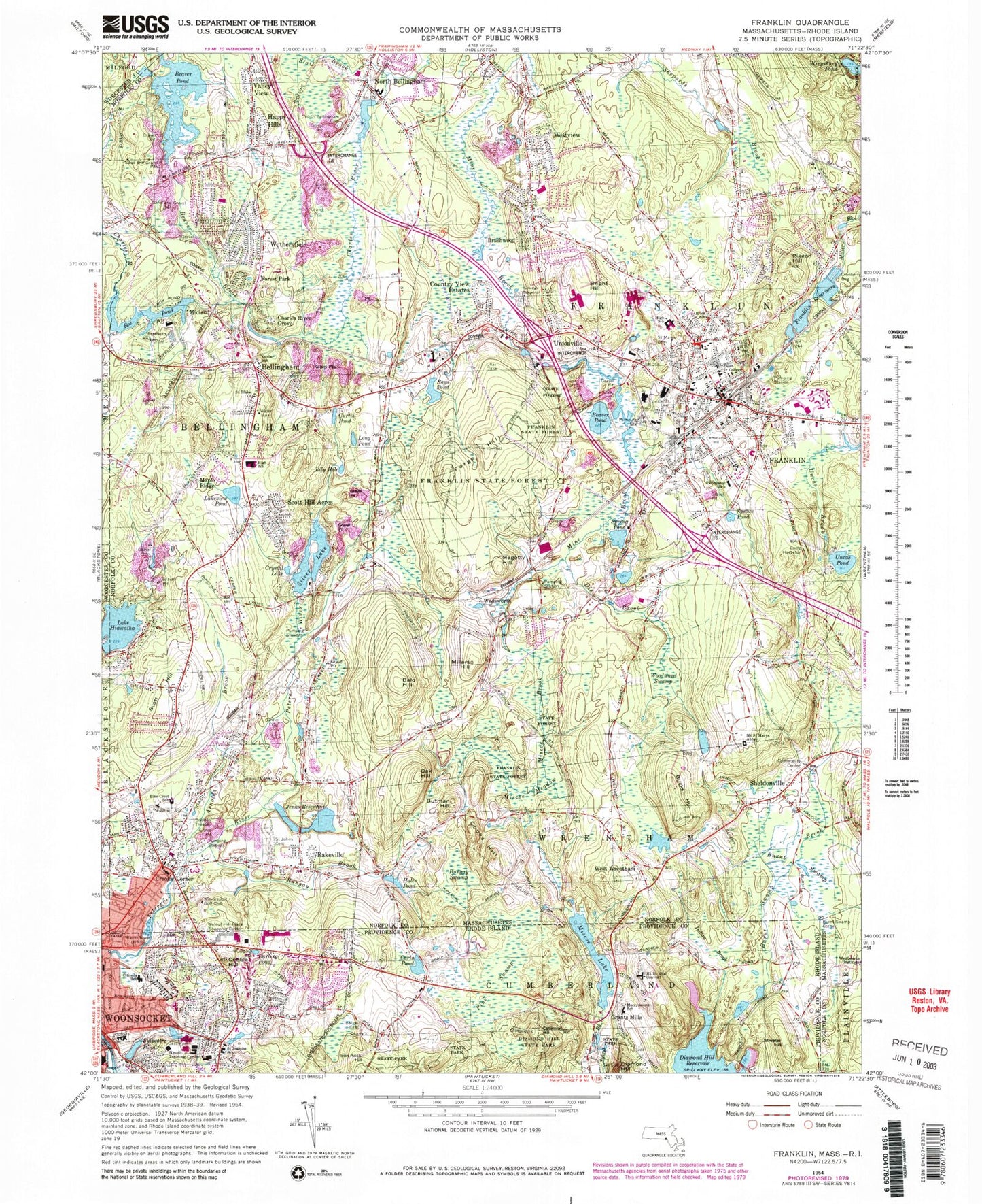
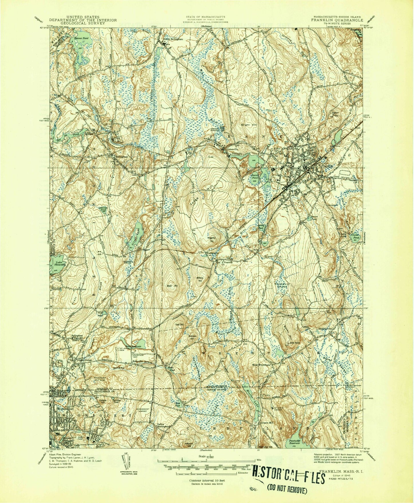
Historical USGS topographic quad map of Franklin in the states of Massachusetts, Rhode Island. Typical map scale is 1:24,000, but may vary for certain years, if available. Print size: 24" x 27"
This quadrangle is in the following counties: Norfolk, Providence, Worcester.
The map contains contour lines, roads, rivers, towns, and lakes. Printed on high-quality waterproof paper with UV fade-resistant inks, and shipped rolled.
Contains the following named places: Mount Saint Marys Abbey, Sheldonville Cemetery, Union Church, Winnesuket Golf Club, Wentworth Institute, Bellingham Center School, Bellingham Center Cemetery, South Elementary School, Scott Hill Acres High School, Scott Cemetery, Camp Hayaston, Brick School, Parmenter School, Saint Marys Cemetery, Franklin High School, Union Street Cemetery, Dean Junior College, Saint Blaise Church, North Bellingham Cemetery, Saint Jean - Baptiste Cemetery, Franklin Plaza, Indian Rock Shopping Center, Shoppers Fair, Lake Hiawatha Dam, Box Pond Dam, Maple Street Pond Dam, Maple Street Pond, Lake Hiawatha, Factory Pond, Arnolds Brook, Bald Hill, Beaver Brook, Beaver Pond, Beaver Pond, Bellingham, Box Pond, Bright Hill, Brushwood, Bucks Hill, Bungay Brook, Bungay Swamp, Burnt Swamp, Burnt Swamp Corner, Butman Hill, Charles River Grove, Cooks Hill, Country View Estates, Crooks Corner, Crystal Lake, Curtis Pond, Dix Brook, Forest Park, Forge Hill, Franklin, Franklin Reservoirs, Hales Pond, Happy Hills, Jenks Reservoir, Lakeview Pond, Lily Hole, Long Pond, Magotty Hill, Maple Ridge, Midland, Millers Hill, Miscoe Brook, Miscoe Meadow, North Bellingham, Oak Hill, Pigeon Hill, Rakeville, Rays Pond, Scott Hill, Scott Hill Acres, Sheldonville, Silver Lake, Spring Pond, Spruce Pond, Stall Brook, Uncas Pond, Unionville, Valley View, Wadsworth, Westview, West Wrentham, Wethersfield, Woodward Swamp, Miscoe Lake, Millerville, South Bellingham, Town of Bellingham, City of Franklin Town, Cress Brook, South Bellingham Post Office (historical), WGAO-FM (Franklin), Bellingham Memorial Junior-Senior High School, Bellingham Post Office, Bellingham Town Offices, Benjamins Landing, Christian Science Society, Clara Macy Elementary School, Davis Thayer School, Dean Junior College Longley Field, E Ross Anderson Library, First Universalist Society, Forge Industrial Park, Franklin Baptist Church, Franklin Federated Church, Franklin Plaza Shopping Center, Franklin Post Office, Franklin Public Library, Franklin United Methodist Church, Franklin Village Shopping Center, Grace Baptist Church, John F Kennedy Elementary School, Oak Street Elementary School, Remington Middles School, Saint Johns Episcopal Church, Shoppers Fair Shopping Center, Tri County Regional Vocational Technical School, Bellingham Bible Baptist Church, Burnt Swamp Cemetery, Center Cemetery, Dean Junior College Historic District, First Baptist Church, Oak Hill Cemetery, Wilcox Cemetery, Sheldonville Baptist Church, Union Cemetery, Allouette Plaza Shopping Center, Keough Administration Building, Memorial Junior-Senior High School, Primavera Junior-Senior High School, Keller-Sullivan School Library, Annie Sullivan Middle School, Bellingham Early Childhood Learning Center, Benjamin Franklin Classical Charter School, Forge Park-495 Station, Franklin ECDC School, Franklin-Dean College Station, Stall Brook School, Tri-County Regional Vocational Technical School Library, Bellingham Census Designated Place, Citizens Memorial School, Governor Aram J Pothier School, Franklin Fire Department Station 1 Headquarters, Bellingham Fire Department, Wrentham Fire Department Station 2, Franklin Fire Department Station 2, Franklin Police Department, Bellingham Police Department, Pine Swamp, Indian Brook, Diamond Hill, Sylvestre Pond, Cobble Hill, Darling Pond, Carls Pond, Catamint Hill, Pine Swamp, Burnt Swamp Brook, Streeter Hill, Burnt Swamp Corner, Grants Mills, Miscoe Lake, City of Woonsocket, Elder Ballou Meeting House Cemetery, Cass Park, Citizens Memorial School, Diamond Hill State Park, Elder Ballou Meetinghouse (historical), Good Shepherd Regional Middle School, Iron Rock Hill, Landmark Medical Center, Leo A Savoie School, Merrymount School, Resurrection Cemetery, Saint Josephs School, The Pavilion Shopping Center, Walnut Hill Plaza Shopping Center, Woonsocket Area Career and Technical School, Mount Saint Rita Convent, Woonsocket Fire Department, Walnut Hill Post Office, Cass Park Center Woonsocket Head Start, Mercymount Country Day School, New Pride School of Hillside, Viola M Berard School, Woonsocket High School, Woonsocket Fire Department Station 4, Jillson Burial Lot Cemetery, Whipple - Smith Cemetery, Mount Saint Marys Abbey, Sheldonville Cemetery, Union Church, Winnesuket Golf Club, Wentworth Institute, Bellingham Center School, Bellingham Center Cemetery, South Elementary School, Scott Hill Acres High School, Scott Cemetery, Camp Hayaston, Brick School, Parmenter School, Saint Marys Cemetery, Franklin High School, Union Street Cemetery, Dean Junior College, Saint Blaise Church, North Bellingham Cemetery, Saint Jean - Baptiste Cemetery, Franklin Plaza, Indian Rock Shopping Center, Shoppers Fair, Lake Hiawatha Dam, Box Pond Dam, Maple Street Pond Dam, Maple Street Pond, Lake Hiawatha, Factory Pond, Arnolds Brook, Bald Hill, Beaver Brook, Beaver Pond, Beaver Pond, Bellingham, Box Pond, Bright Hill, Brushwood, Bucks Hill, Bungay Brook, Bungay Swamp, Burnt Swamp, Burnt Swamp Corner, Butman Hill