
MyTopo
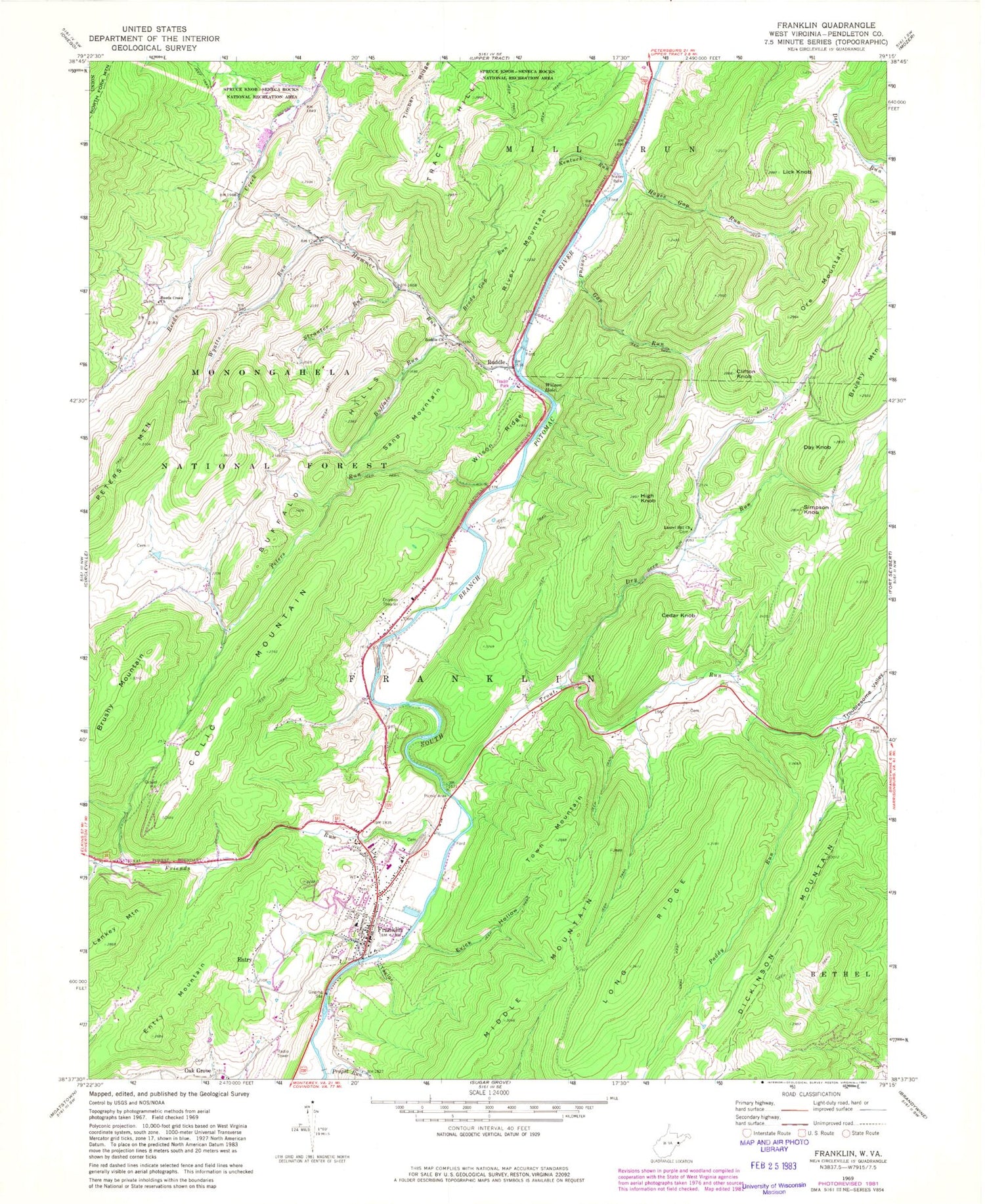
Classic USGS Franklin West Virginia 7.5'x7.5' Topo Map
Couldn't load pickup availability
Historical USGS topographic quad map of Franklin in the state of West Virginia. Map scale may vary for some years, but is generally around 1:24,000. Print size is approximately 24" x 27"
This quadrangle is in the following counties: Pendleton.
The map contains contour lines, roads, rivers, towns, and lakes. Printed on high-quality waterproof paper with UV fade-resistant inks, and shipped rolled.
Contains the following named places: Allen Eye Spring, Big Spring, Brady Gap Run, Brushy Mountain, Buffalo Hills, Buffalo Run, Cedar Knob, Clifton Knob, Colic Mountain, Conrad Gap Run, Day Knob, Dry Run, Entry, Entry Mountain, Evick Hollow, Franklin, Franklin Elementary School, Franklin Post Office, Franklin Volunteer Fire Department, Friends Run, Hammer Run, Hammer Spring, Hayes Gap Run, High Knob, Kentuck Run, Lankey Mountain, Laurel Hill Church, Lick Knob, Long Ridge, Middle Mountain, Oak Grove, Ore Mountain, Paddy Run, Pendleton County, Pendleton County Courthouse, Pendleton County Emergency Rescue Franklin, Pendleton County Middle / High School, Pendleton County Public Library, Pendleton County Sheriff's Office, Peters Run, Propst Run, Reeds Creek Church, Reeds Creek Spring, River Mountain, Ruddle, Ruddle Church, Sand Mountain, Simpson Knob, Smith Farm Spring, Strauter Run, Taylor Hollow, Timber Ridge, Town Mountain, Town of Franklin, Tract Hill, Troublesome Valley, Trout Run, West Virginia State Police Troop 3 - Franklin Detachment, Wilson Hole, Wilson Ridge, Wilson Spring, Wyatts Run, ZIP Code: 26807


