MyTopo
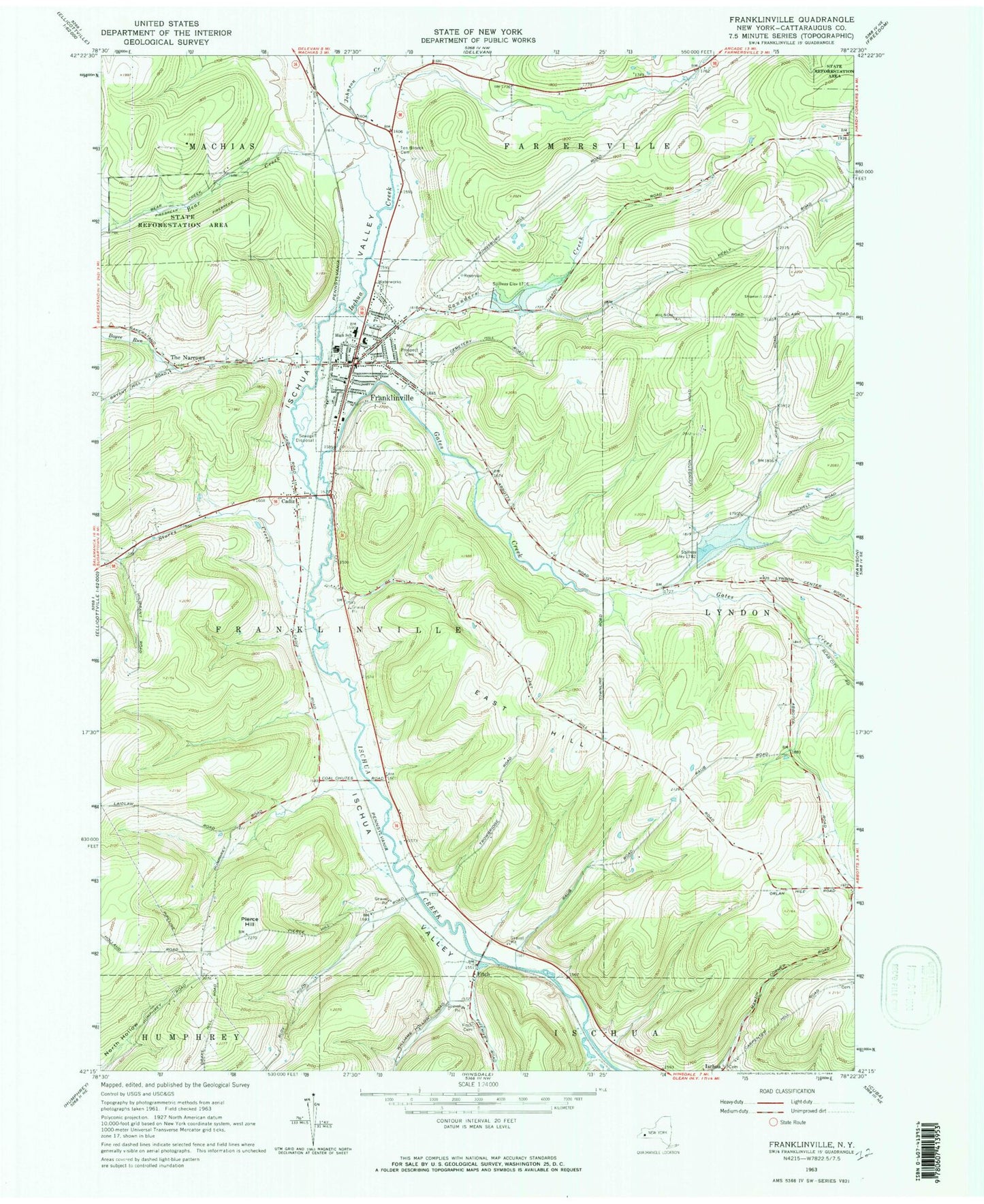
Classic USGS Franklinville New York 7.5'x7.5' Topo Map
Couldn't load pickup availability
Historical USGS topographic quad map of Franklinville in the state of New York. Map scale may vary for some years, but is generally around 1:24,000. Print size is approximately 24" x 27"
This quadrangle is in the following counties: Cattaraugus.
The map contains contour lines, roads, rivers, towns, and lakes. Printed on high-quality waterproof paper with UV fade-resistant inks, and shipped rolled.
Contains the following named places: Bear Creek, Blount Library, Boyce Run, Cadiz, Cadiz Cemetery, Christian and Missionary Alliance Church, East Hill, First Baptist Church, Fitch, Fitch Cemetery, Franklinville, Franklinville Elementary School, Franklinville Fire Department, Franklinville Free Methodist Church, Franklinville Junior - Senior High School, Franklinville Post Office, Gates Creek, Ischua Cemetery, Ischua Valley, Ischua Valley Country Club, Ishua Valley Estates Mobile Home Park, Johnson Creek, Mount Prospect Cemetery, Pierce Hill, Presbyterian Church, Saint Philomena Roman Catholic Church, Saunders Creek, Storrs Creek, Ten Broeck Cemetery, The Narrows, Town of Franklinville, Triple R Campground, Village of Franklinville, Woodhill Estates Mobile Home Park, ZIP Code: 14737