MyTopo
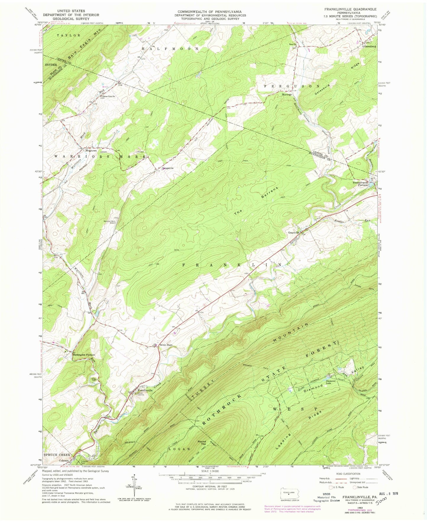
Classic USGS Franklinville Pennsylvania 7.5'x7.5' Topo Map
Couldn't load pickup availability
Historical USGS topographic quad map of Franklinville in the state of Pennsylvania. Typical map scale is 1:24,000, but may vary for certain years, if available. Print size: 24" x 27"
This quadrangle is in the following counties: Blair, Centre, Huntingdon.
The map contains contour lines, roads, rivers, towns, and lakes. Printed on high-quality waterproof paper with UV fade-resistant inks, and shipped rolled.
Contains the following named places: Beaver Branch, Brewer Path, Center Line Church, Colerain, Colerain Trail, Diamond Lake, Dungarvin, Fowler Run, Franklinville, Frogtown, Gatesburg, Marengo, Pennsylvania Furnace, Pine Hill Trail, Ross Church, Summit Trail, The Barrens, Tussey Trail, Warriors Mark Run, Wheeler Trail, Halfmoon Creek, Round Top, Russell Farms Airport (historical), Warriors Mark Run, Graysville, Grazier Mill, Dry Run, Blick School (historical), Double Spring, Huntingdon Furnace, Seven Stars, Colerain Picnic Area, Pine Hill Picnic Area, Township of Franklin, Graysville Cemetery, Seven Stars Cemetery, Franklinville Cemetery, Spittler Cemetery, Funk Cemetery, Warriors Mark Volunteer Fire Company Station 22, Center Line Lutheran Cemetery, Ross Cemetery, Spittler Cemetery