MyTopo
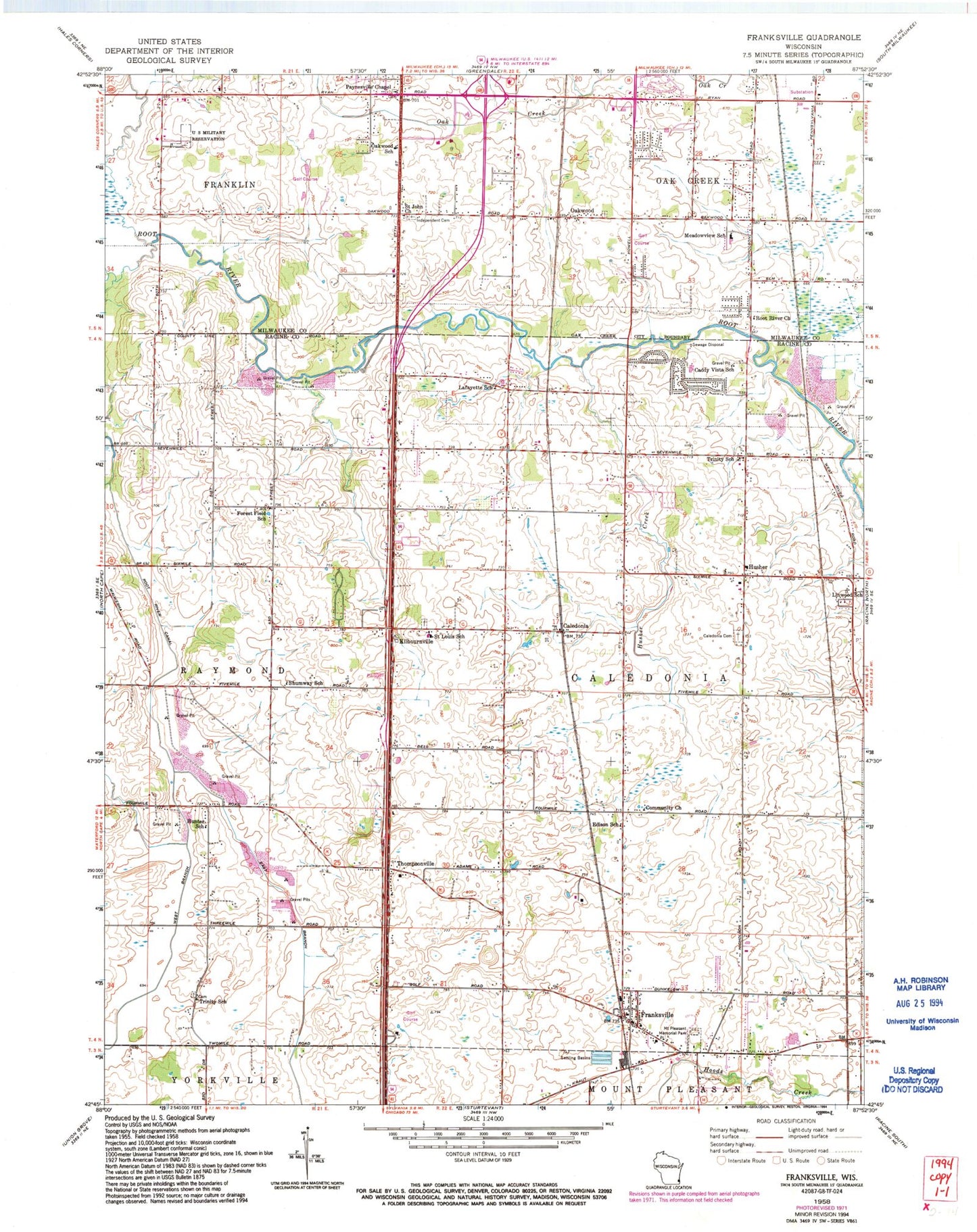
Classic USGS Franksville Wisconsin 7.5'x7.5' Topo Map
Couldn't load pickup availability
Historical USGS topographic quad map of Franksville in the state of Wisconsin. Typical map scale is 1:24,000, but may vary for certain years, if available. Print size: 24" x 27"
This quadrangle is in the following counties: Milwaukee, Racine.
The map contains contour lines, roads, rivers, towns, and lakes. Printed on high-quality waterproof paper with UV fade-resistant inks, and shipped rolled.
Contains the following named places: Caddy Vista Elementary School, Caledonia, Caledonia Memorial Park, Community Church, Edison School, Forest Field School, Franksville, Hunter School, Husher, Independent Cemetery, Kilbournville, Lafayette School, Linwood School, Meadowview Elementary School, Caledonia-Mount Pleasant Park, Oakwood, Oakwood School, Paynesville Chapel, Root River Canal, Root River Church, Ryan Creek, Saint John Church, Discovery Stage Preschool and Child Care, Shumway School, Thompsonville, Trinity School, Trinity Lutheran School, Husher Creek, WZXA-FM (Sturtevant), Caledonia Town Hall, Caledonia Wildlife Area, Gifford Elementary School, Green Ridge Park, South Hills Country Club, Oakbrook Shopping Center, Oakwood Golf Course, Shepard Hills Elementary School, Franklin Business Park, Franklin Industrial Park, Oak Hills Golf Course, Southbranch Industrial Park, Village of Caledonia, Out On A Limb Acres, Caledonia Fire Department Station 1, Caledonia Mt Pleasant Fire Station 10, Franklin Fire Department Station 2, Country View Christian Academy, Parkway Christian Academy, Oak Creek Police Department, Caledonia Police Department, Gorney Park Pond, Franksville Post Office, Caledonia Post Office