MyTopo
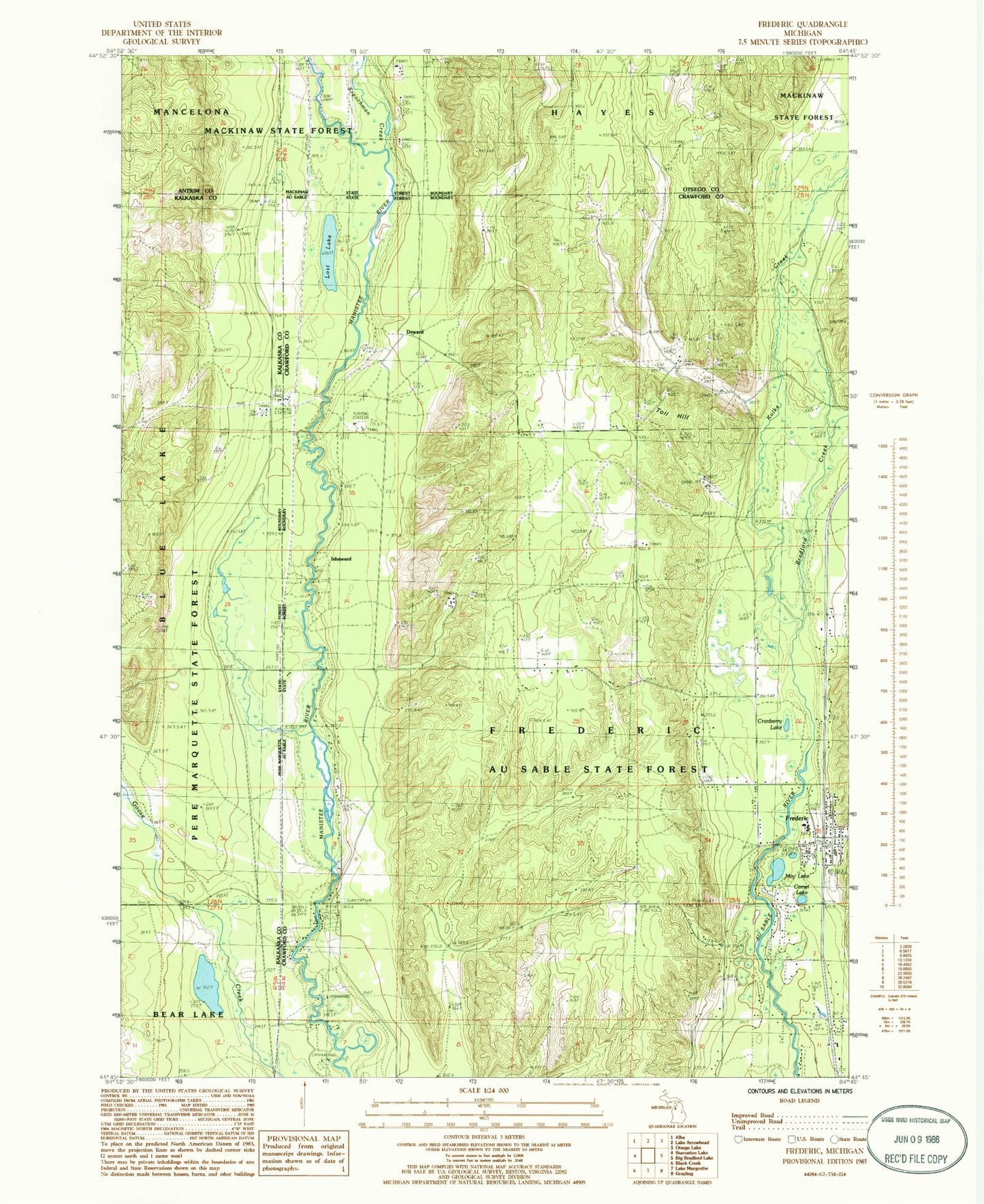
Classic USGS Frederic Michigan 7.5'x7.5' Topo Map
Couldn't load pickup availability
Historical USGS topographic quad map of Frederic in the state of Michigan. Typical map scale is 1:24,000, but may vary for certain years, if available. Print size: 24" x 27"
This quadrangle is in the following counties: Antrim, Crawford, Kalkaska, Otsego.
The map contains contour lines, roads, rivers, towns, and lakes. Printed on high-quality waterproof paper with UV fade-resistant inks, and shipped rolled.
Contains the following named places: Bradford Creek, Cranberry Lake, Frederic, Frenchman Creek, Kolke Creek, Lost Lake, May Lake, Toll Hill, Deward, Ishaward, Au Sable State Forest, Cameron Bridge, Deward Lookout Tower, Red Bridge, Township of Frederic, Camel Lake, Goose Creek State Forest Campground and Trail Camp, Leary Park, Frederic Station, Frederic Post Office, Happi Days Campground and Diner, Frederic Township Volunteer Fire Department, Frederic Community Library, First Baptist Church, Frederic Elementary School, Deward Station (historical), Deward Post Office (historical), Shrine Cemetery, Oakwood Cemetery, Frederic Township Volunteer Fire Department Ambulance Garage