MyTopo
Classic USGS Fredonia Arizona 7.5'x7.5' Topo Map
Couldn't load pickup availability
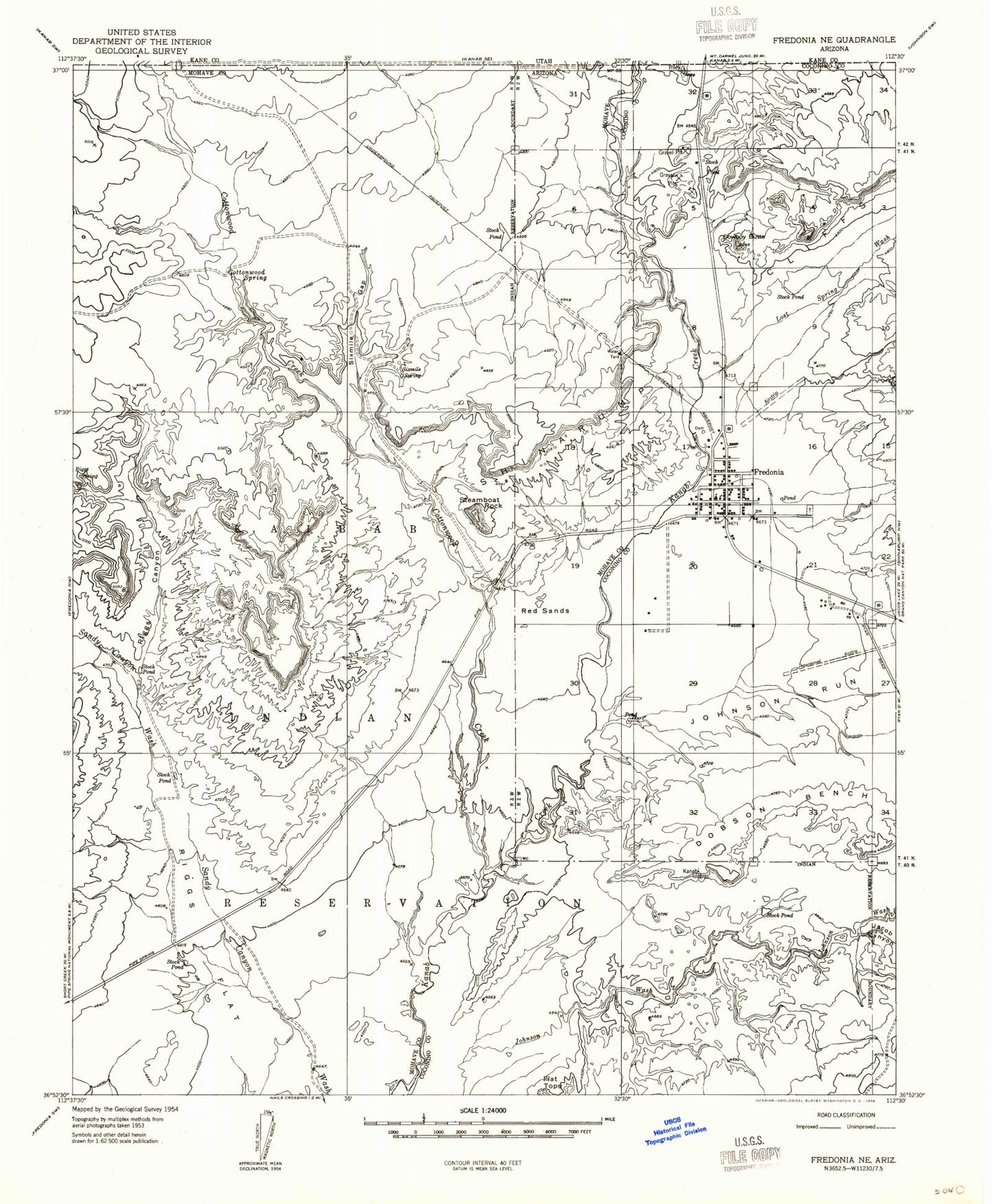
Historical USGS topographic quad map of Fredonia in the state of Arizona. Map scale may vary for some years, but is generally around 1:24,000. Print size is approximately 24" x 27"
This quadrangle is in the following counties: Coconino, Mohave.
The map contains contour lines, roads, rivers, towns, and lakes. Printed on high-quality waterproof paper with UV fade-resistant inks, and shipped rolled.
Contains the following named places: Arizona Inspection Station, Aulson Canyon, Cottonwood Creek, Cottonwood Spring, Cowboy Butte, Dobson Bench, Fredonia, Fredonia Cemetery, Fredonia Dam, Fredonia Elementary School, Fredonia Fire Department, Fredonia High School, Fredonia Marshal's Office, Fredonia Municipal Court, Fredonia Post Office, Fredonia Public Library, Jacob Canyon, Johnson Run, Lost Spring Wash, Red Sands, Riggs Canyon, Riggs Flat, Sixmile Gap, Sixmile Spring, Sixmile Village, Town of Fredonia