MyTopo
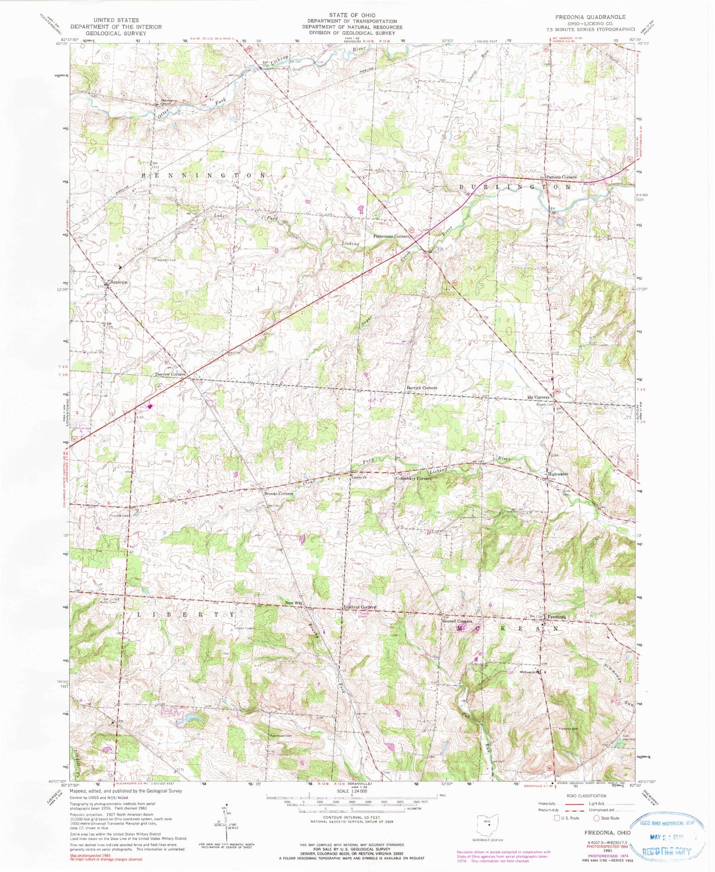
Classic USGS Fredonia Ohio 7.5'x7.5' Topo Map
Couldn't load pickup availability
Historical USGS topographic quad map of Fredonia in the state of Ohio. Map scale may vary for some years, but is generally around 1:24,000. Print size is approximately 24" x 27"
This quadrangle is in the following counties: Licking.
The map contains contour lines, roads, rivers, towns, and lakes. Printed on high-quality waterproof paper with UV fade-resistant inks, and shipped rolled.
Contains the following named places: Appleton, Appleton Cemetery, Barrick Corners, Bennington Chapel, Bennington Chapel Cemetery, Bowers Cemetery, Brooks Corners, Brushy Fork School, Center School, Clark Cemetery, Cokesbury Corners, Curtis School, Decrow Corners, Devinney School, Edelblut Corners, Fairview School, Fredonia, Fredonia Cemetery, Fredonia Post Office, Gosnell Corners, Greenbush School, Hancock Cemetery, Hancock School, High Water Post Office, Highwater, Highwater Orchard, Highwater United Church of Christ, Hillcrest Airport, Jones School, Lafayette School, Liberty Cemetery, Liberty Church, McKean School, Moorehead Cemetery, Morgan School, New Way, New-way Post Office, Northridge High School, Old Fredonia Cemetery, Patterson Cemetery, Pattersons Corners, Pattons Corners, Pleasantville School, Reynolds Creek, Runaway School, Six Corners, Sugar Creek, Township of Bennington, Township of Burlington, Township of Liberty, Township of McKean, Union School, Wright School